News & announcements
Saving your
history
Early accounts
Maps
Nearby towns
People
Churches
Schools
Municipal
Organizations
Businesses
The mines
Transportation
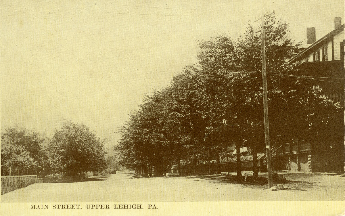
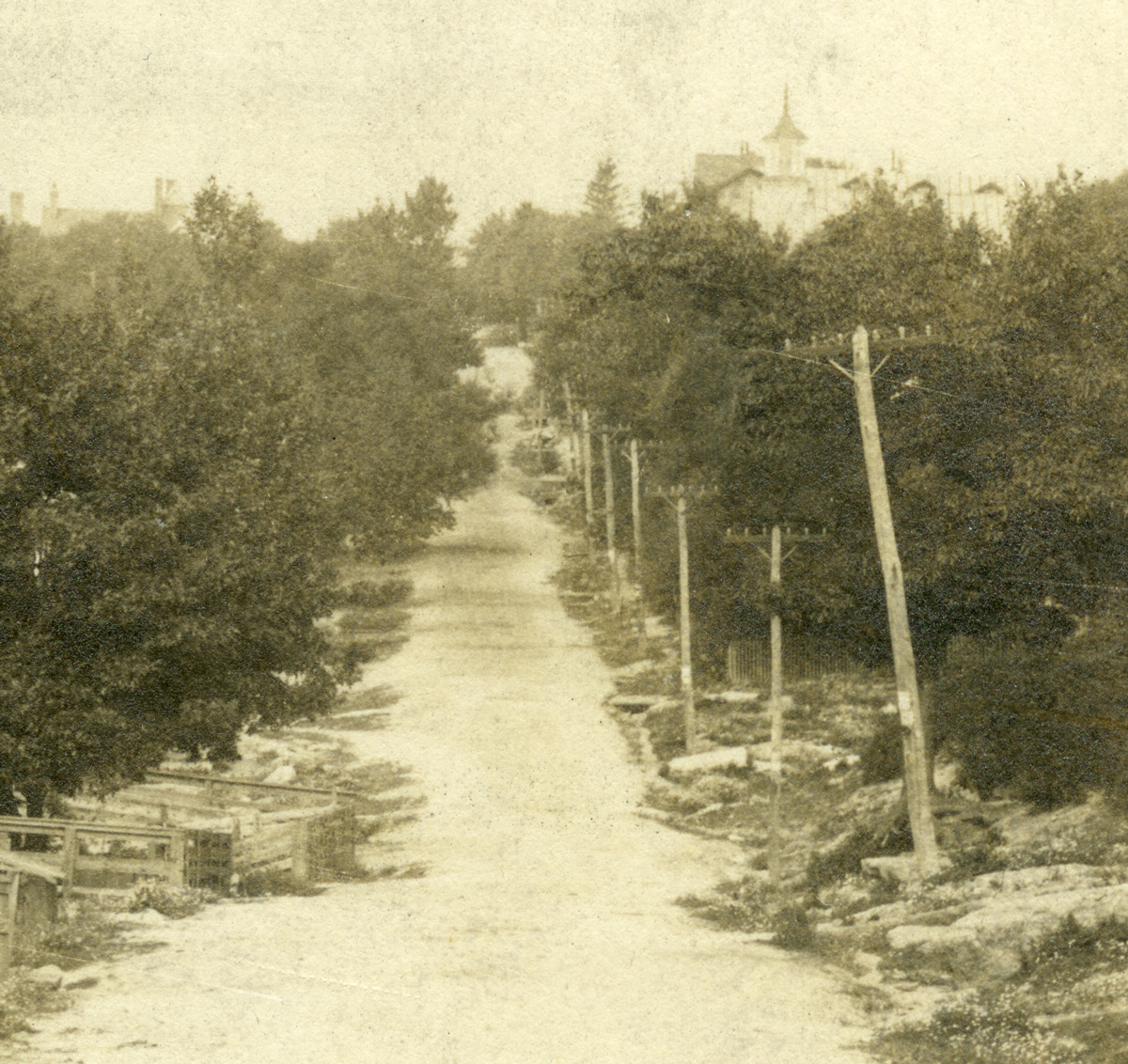
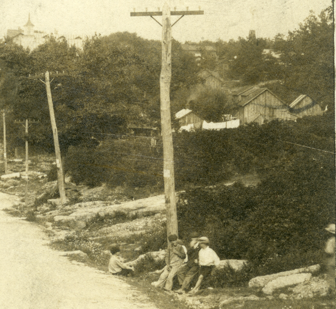
Streets
Buildings
Entertainment
Celebrations
Sports
Ethnic groups
Nearby towns - Upper Lehigh
What's on this page:
- Images from previous century
- Upper Lehigh breaker and coal strippings
- Churches in Upper Lehigh
- Upper Lehigh school in Foster Township
- Some sports news 1933-1934 and a dance ad 1934
- 1873 map of the area and a hand-drawn 1940s-1950s street map from Charlie Stumpf
- George Dreisbach articles on Upper Lehigh and the North
Basin
- Upper Lehigh schools
- Upper Lehigh Honor Roll
- Baseball - Includes Upper Lehigh info and photos
- Upper Lehigh in Munsell's history of 1880
- Upper Lehigh in Bradsby's history of 1893
 This is an
early 20th century view of Upper Lehigh. The
mansions of the mine owners and bosses were located at this end. The
photographer was standing on Main Street, looking westward from in
front of the company store. Doctor Neale's home would have been on the
photographer's left, not shown in the photo. Thank you to Ed Sharp for
the notes on his annotated copy of this view.
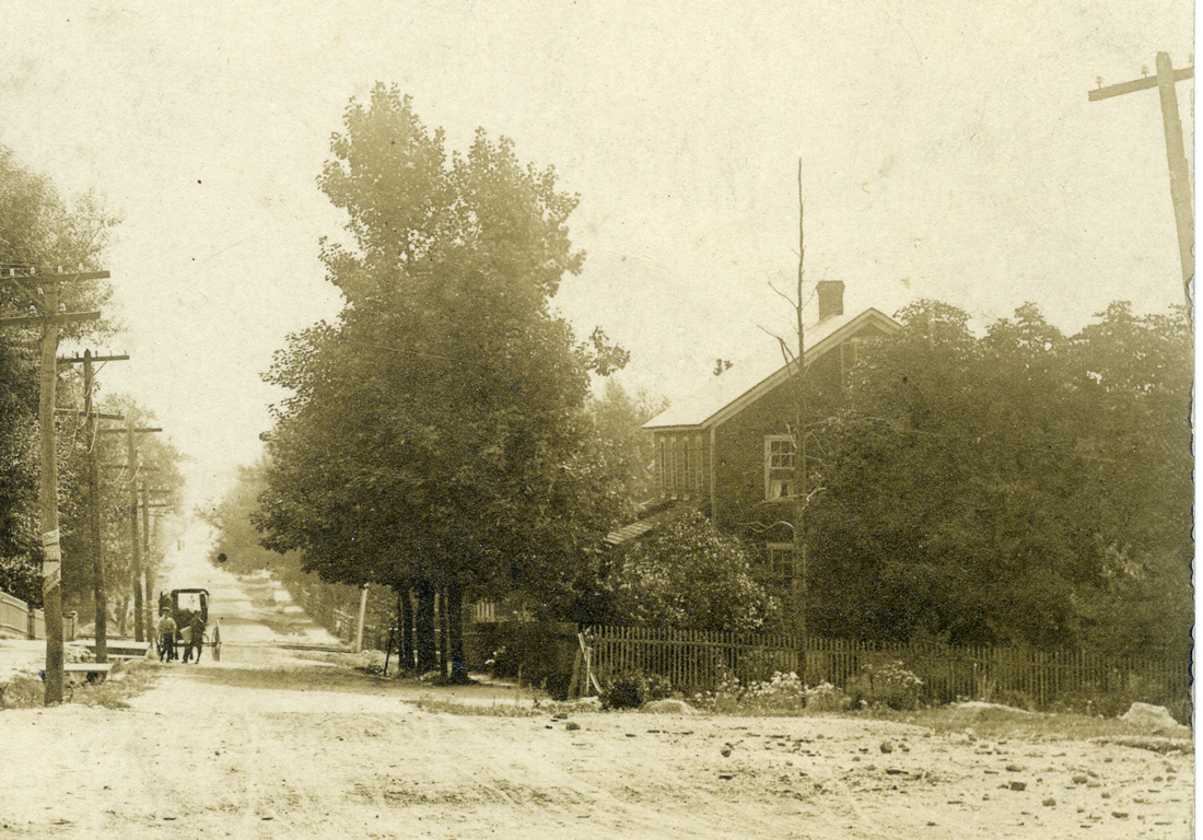
This is an
early 20th century view of Upper Lehigh. The
mansions of the mine owners and bosses were located at this end. The
photographer was standing on Main Street, looking westward from in
front of the company store. Doctor Neale's home would have been on the
photographer's left, not shown in the photo. Thank you to Ed Sharp for
the notes on his annotated copy of this view.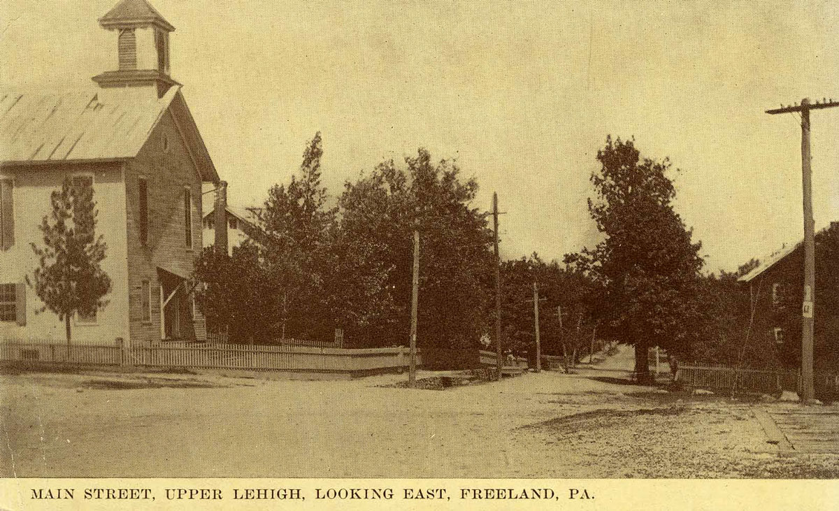 Another
view of Upper Lehigh from the same period. The
photographer is standing on the same spot or close to the same spot
from which the previous view was photographed, but now facing east. The
Presbyterian Church is on the left, and if you were standing on this
spot, the coal breaker would be off to your right. Thanks again to Ed
Sharp for the notes on his annotated copy of this view.
Another
view of Upper Lehigh from the same period. The
photographer is standing on the same spot or close to the same spot
from which the previous view was photographed, but now facing east. The
Presbyterian Church is on the left, and if you were standing on this
spot, the coal breaker would be off to your right. Thanks again to Ed
Sharp for the notes on his annotated copy of this view.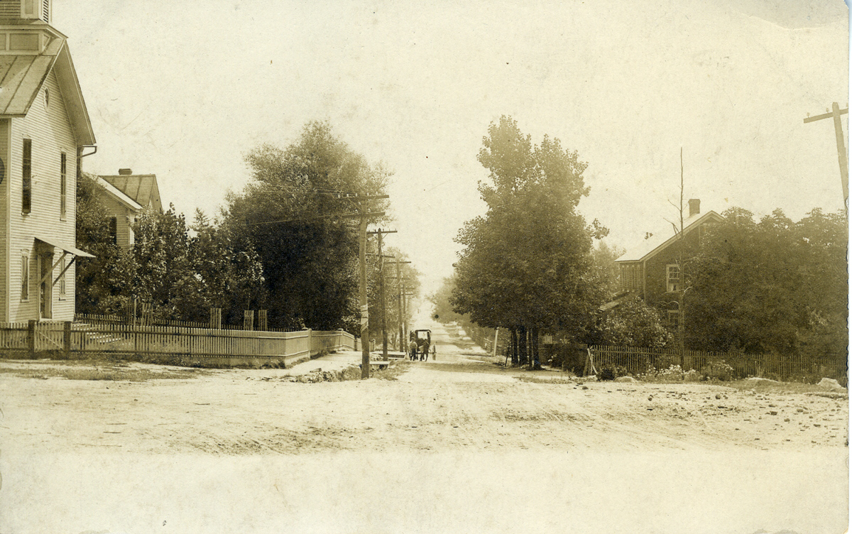
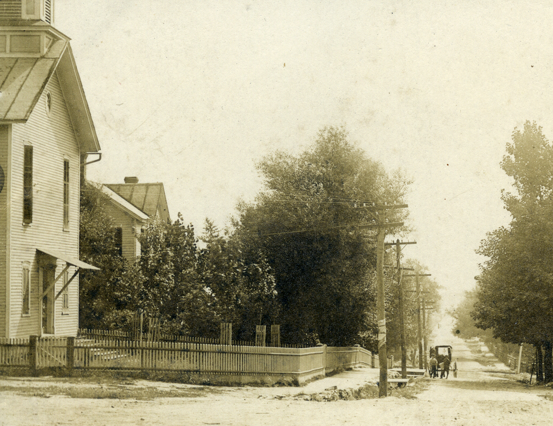
 This similar view of the same area
gives a clear view with the Presbyterian Church on the left and a
horse-drawn wagon stopped nearby. The street is unpaved. A bit further
past this view was where the workers' homes began. Two additional crops
provide close-ups.
This similar view of the same area
gives a clear view with the Presbyterian Church on the left and a
horse-drawn wagon stopped nearby. The street is unpaved. A bit further
past this view was where the workers' homes began. Two additional crops
provide close-ups.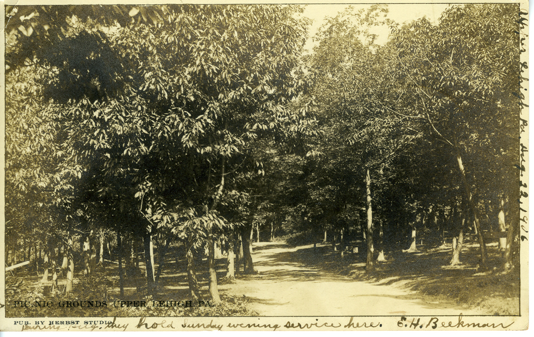
 This postcard is labeled Picnic Grounds,
Upper Lehigh, Pa.,
postmarked 1906.
The postcard was published by Herbst Studio. Can anyone tell us where
this area was located? The note on the right edge was written on August
22, 1906 -- just a few weeks before Freeland's Pearl Jubilee. Postcards
from this period did not provice space on the back for a message -- the
back was strictly reserved for the mailing address.
This postcard is labeled Picnic Grounds,
Upper Lehigh, Pa.,
postmarked 1906.
The postcard was published by Herbst Studio. Can anyone tell us where
this area was located? The note on the right edge was written on August
22, 1906 -- just a few weeks before Freeland's Pearl Jubilee. Postcards
from this period did not provice space on the back for a message -- the
back was strictly reserved for the mailing address.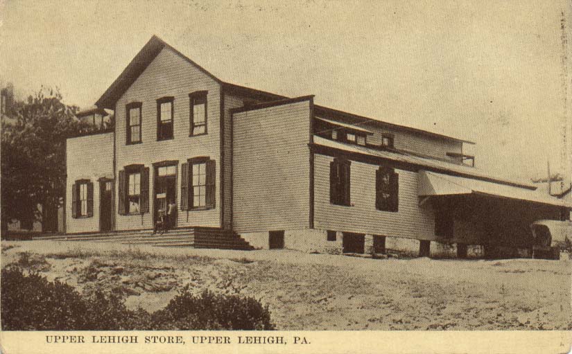 Here's a
view of the Upper Lehigh company store. This building was
later acquired by Mr. Boyko and became the Boyko Dance Hall, site of
many wedding parties and other celebrations. The building later burned
down and only a few traces can be seen today.
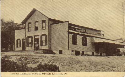
Here's a
view of the Upper Lehigh company store. This building was
later acquired by Mr. Boyko and became the Boyko Dance Hall, site of
many wedding parties and other celebrations. The building later burned
down and only a few traces can be seen today.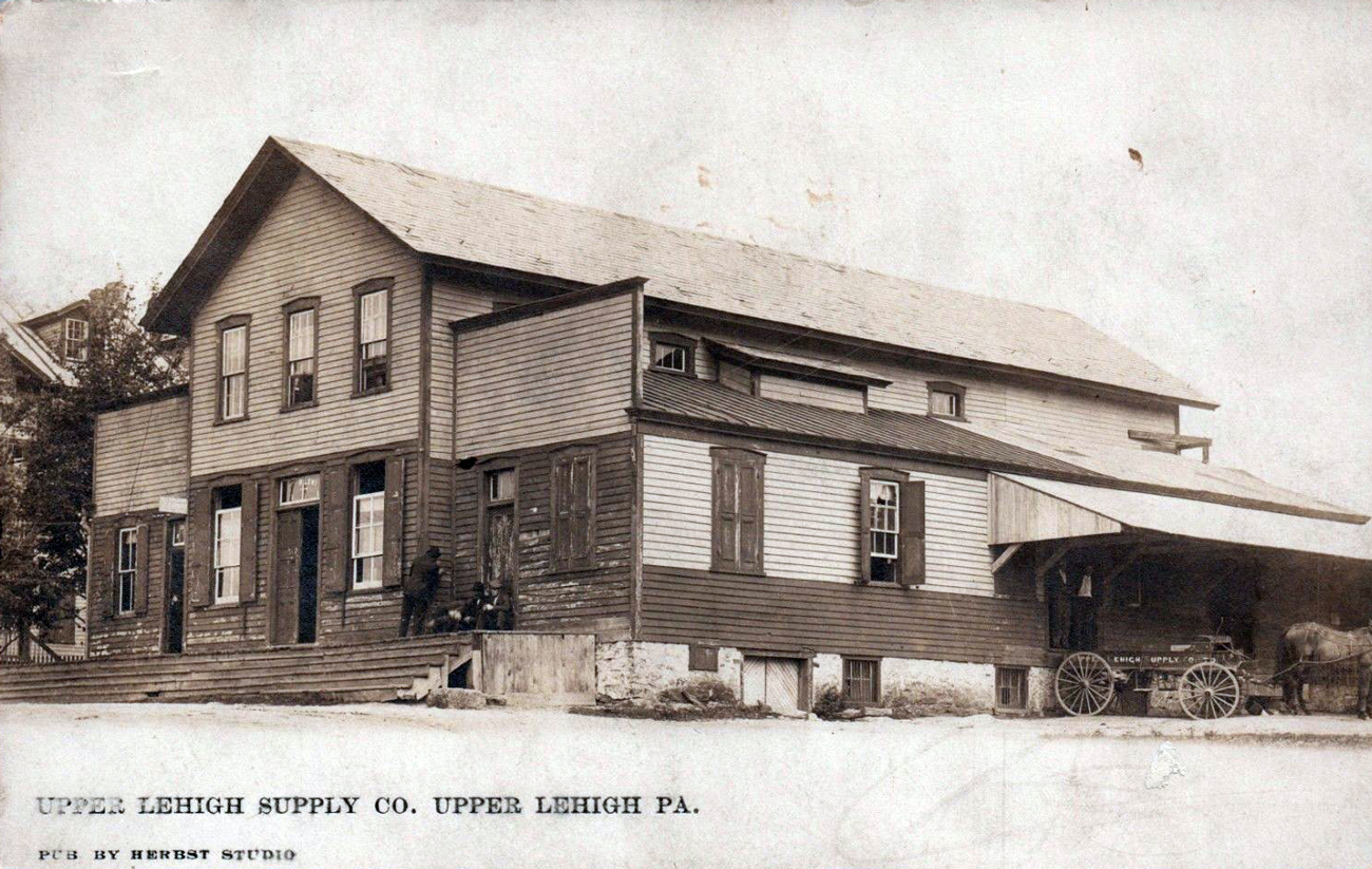 Another,
later view of the same store. The building has weathered
considerably
since the previous view. Along the side, a horse is hitched to a wagon
that has "Upper Lehigh Supply Co." painted on it. In this view there
are a couple of men standing in the loading doorway, and a few more
hanging out on the porch.
Another,
later view of the same store. The building has weathered
considerably
since the previous view. Along the side, a horse is hitched to a wagon
that has "Upper Lehigh Supply Co." painted on it. In this view there
are a couple of men standing in the loading doorway, and a few more
hanging out on the porch.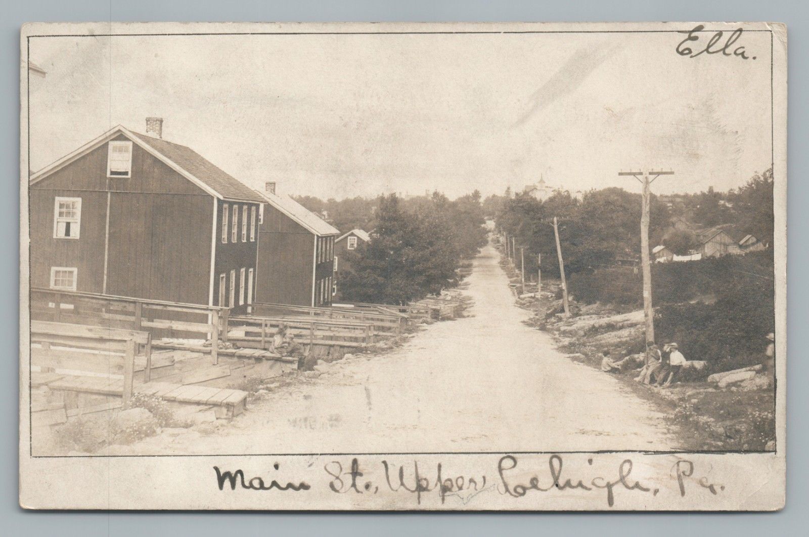
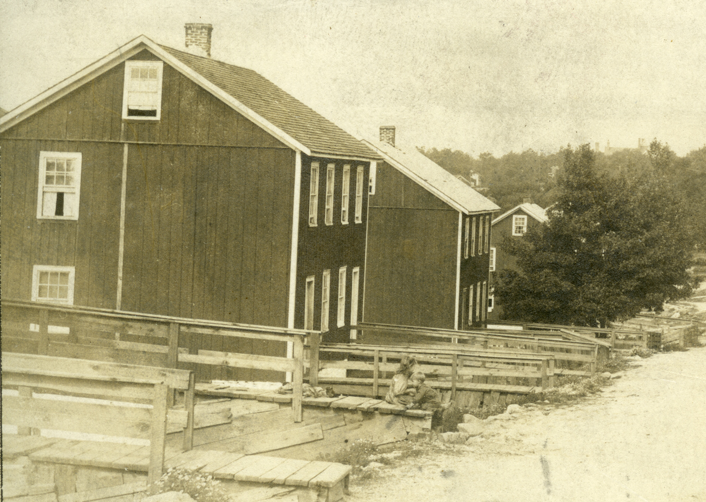
 This postcard of Upper Lehigh is
postmarked
1906, the same year that Freeland celebrated its Pearl Jubilee.
It's a good view of some of the company houses at the time, and
looking down (up?) the road toward the wealthier end of town you can
see the top of the Presbyterian Church on the right. I don't know, but
it looks to me as though these houses are new, and those wooden
walkways are surely temporary until better ones can be made. Below are
five
cropped details from this photograph. Left to right: two children
playing on a wooden walkway, with a dog dozing nearby; how the street
looked; 4 boys, and more houses on nearby streets; closer view of other
company houses; the Presbyterian church seen in the distance, with
another 1 or 2 tall buildings.
This postcard of Upper Lehigh is
postmarked
1906, the same year that Freeland celebrated its Pearl Jubilee.
It's a good view of some of the company houses at the time, and
looking down (up?) the road toward the wealthier end of town you can
see the top of the Presbyterian Church on the right. I don't know, but
it looks to me as though these houses are new, and those wooden
walkways are surely temporary until better ones can be made. Below are
five
cropped details from this photograph. Left to right: two children
playing on a wooden walkway, with a dog dozing nearby; how the street
looked; 4 boys, and more houses on nearby streets; closer view of other
company houses; the Presbyterian church seen in the distance, with
another 1 or 2 tall buildings. At least one of those boys looks to be barefoot. My dad told us that he and his siblings would take their shoes off after school or church and play barefoot to save wear and tear on the shoes. He remembered stepping on a snake while barefoot, and the feeling of the snake partly winding around his ankle before taking off (he or the snake or both of them in different directions, I imagine). Brrr!
The original postcard is in sepia tone, and the colorized version shown above was done by Mike Korb.

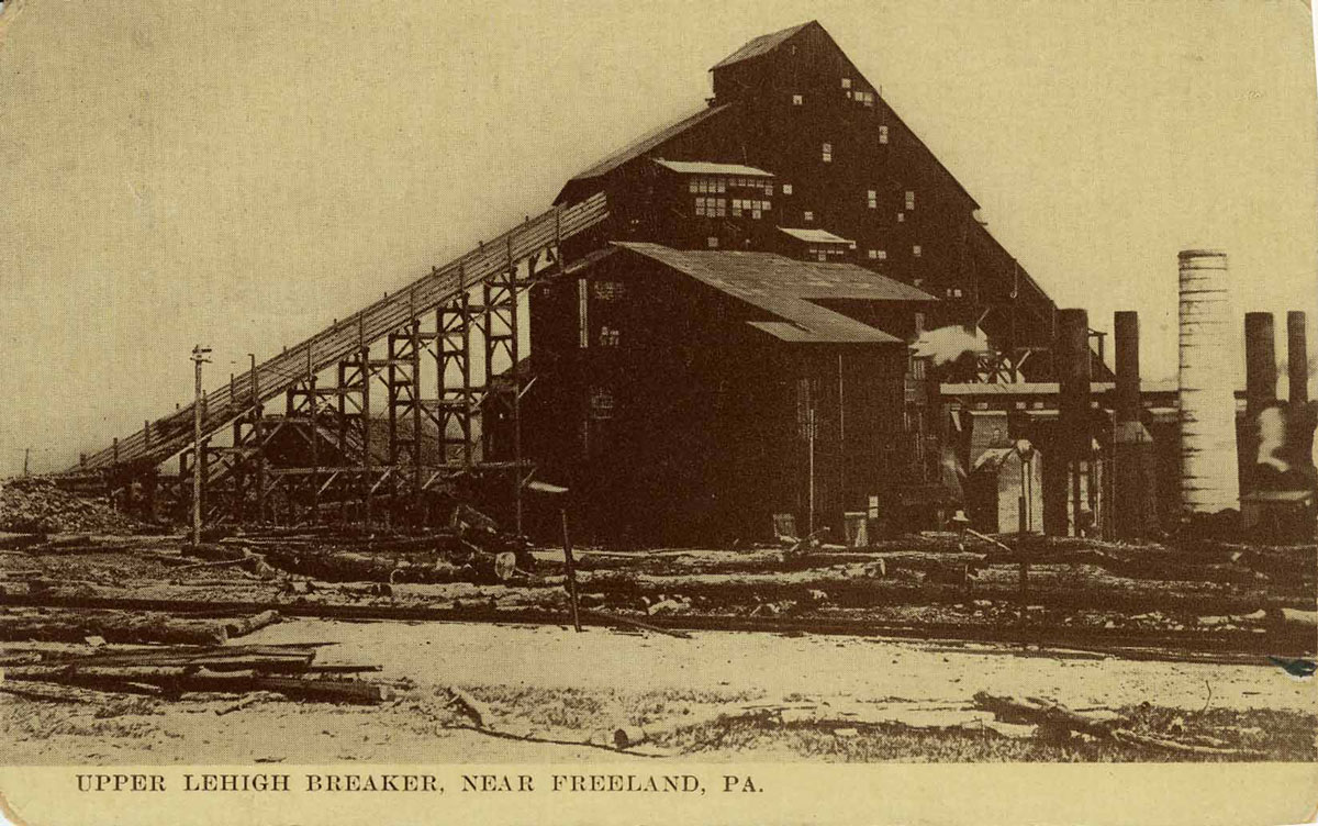
 Here is the
Upper Lehigh Coal Company breaker. As early as 1873, the date of
the
map shown below, it was supported by a machine shop, a mine reservoir,
and a railroad track complex that would enable coal to be shipped. Note
that the map shows slopes no. 1 and 2 mined by this breaker.
Here is the
Upper Lehigh Coal Company breaker. As early as 1873, the date of
the
map shown below, it was supported by a machine shop, a mine reservoir,
and a railroad track complex that would enable coal to be shipped. Note
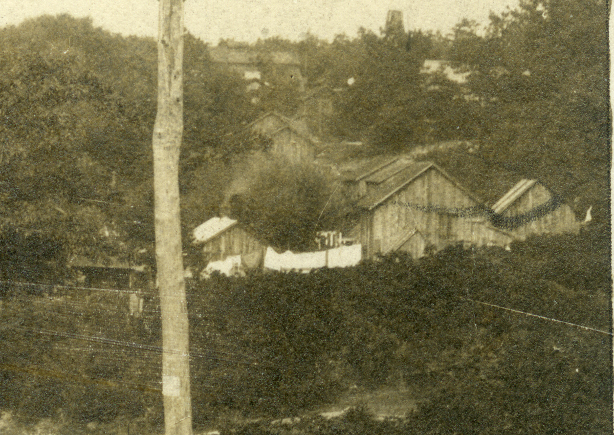
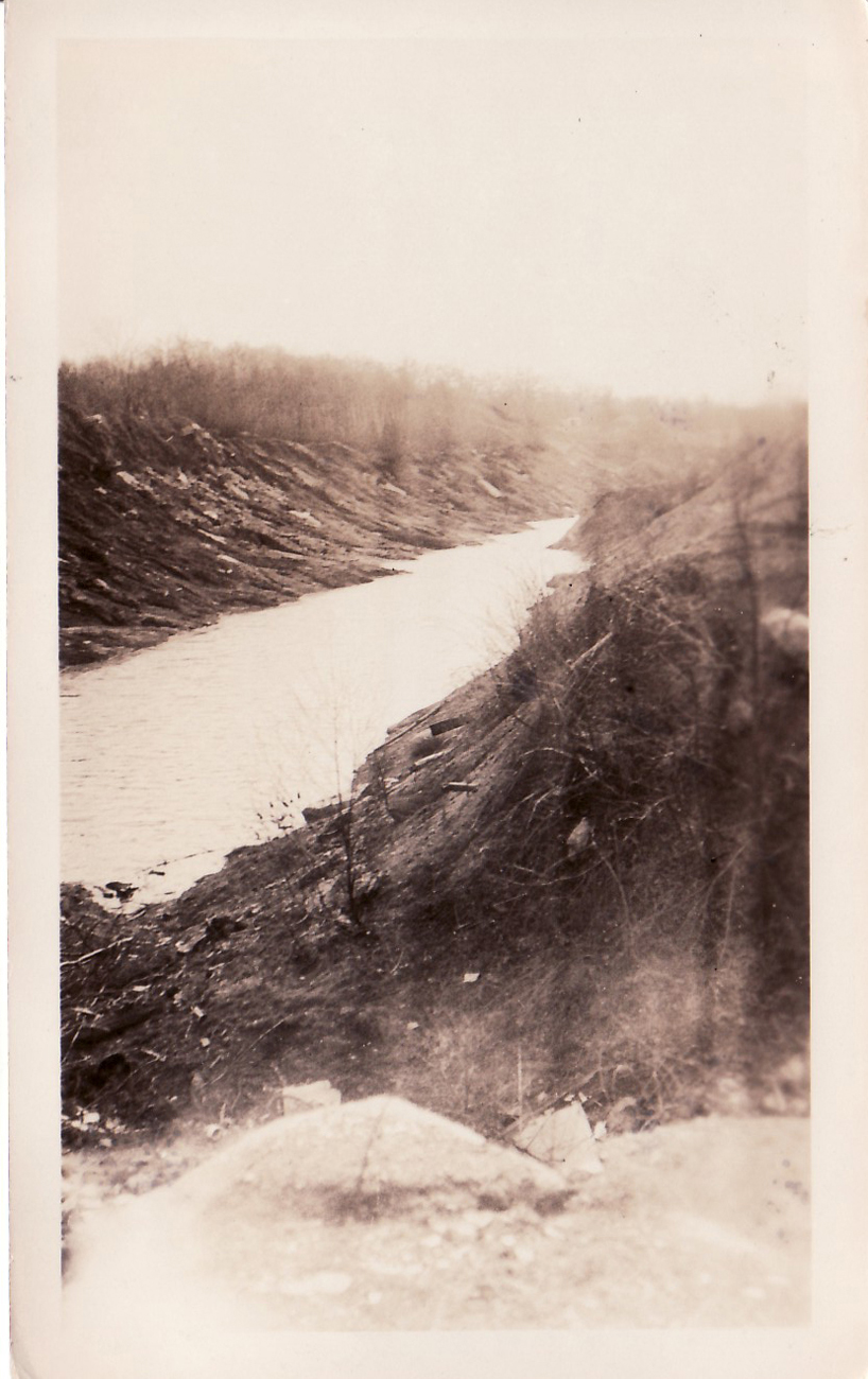
that the map shows slopes no. 1 and 2 mined by this breaker. This photo of one of the Upper Lehigh coal strippings comes to us courtesy of the Freeland Historical Society. Strippings like this are a familiar sight to anyone who grew up in the area.
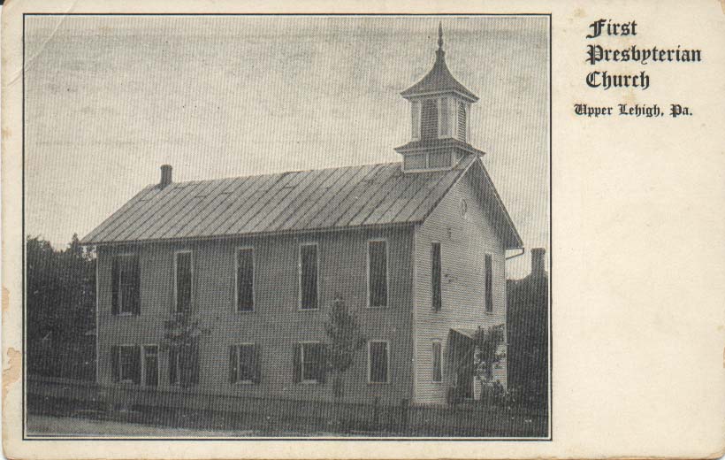 This
photo postcard shows the Upper Lehigh Presbyterian church. It's
a
great view showing the building in very good condition, nicely fenced
and landscaped, with some parishioners standing near the front door.
This church was attended by the mine owners and bosses. There was also
a Welsh Baptist church in town. The miners from other ethnic groups
traveled to Freeland, usually on foot, to attend other churches.
This
photo postcard shows the Upper Lehigh Presbyterian church. It's
a
great view showing the building in very good condition, nicely fenced
and landscaped, with some parishioners standing near the front door.
This church was attended by the mine owners and bosses. There was also
a Welsh Baptist church in town. The miners from other ethnic groups
traveled to Freeland, usually on foot, to attend other churches. I don't have a photo of the Welsh Baptist Church, but Charlie Stumpf wrote in part IV of his "The Saga of Upper Lehigh" in his Reflections series: A most unique feature of the Baptist Church was an outdoor pit which was used for baptismal ceremonies. It was about 8' x 5' wide and 5' deep. A set of steps led from the top to the bottom of the pit, whose sides were lined with slate slab about 1-1/2" thick. When the church was razed, the pit was filled in.
Elsewhere in his notes there is this: The frame building originally used as a Baptist Church in Upper Lehigh was moved to Hazleton in 1899. I haven't followed up on that yet but if I find more information I'll add it here.
 From Nadine
Heckler: "My aunt Esther is 91. She says that when
she started going to the UL school it only had 2 rooms and that the
building that was across the street (where the honor roll eventually
went) was where the 7th and 8th graders went. Then they added the 3rd
room / addition to the UL school and that's when the other building was
used for just activities. The activities building was eventually torn
down due to its condition. My Aunt Gwenie, who is 88, says the
foundation of that building is still there and that's where they put
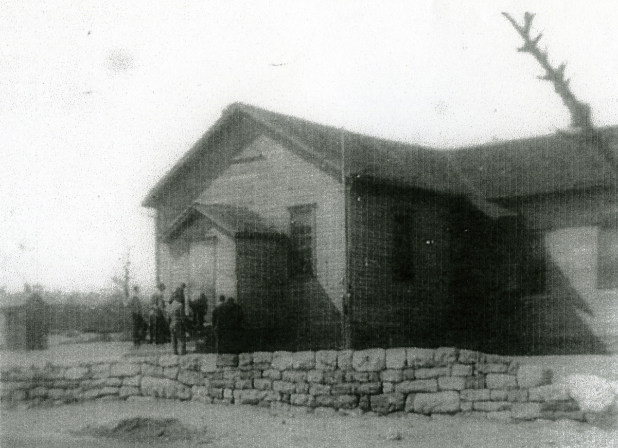
the honor roll." Here is the photocopied photo of the Upper Lehigh
school that Nadine sent.
From Nadine
Heckler: "My aunt Esther is 91. She says that when
she started going to the UL school it only had 2 rooms and that the
building that was across the street (where the honor roll eventually
went) was where the 7th and 8th graders went. Then they added the 3rd
room / addition to the UL school and that's when the other building was
used for just activities. The activities building was eventually torn
down due to its condition. My Aunt Gwenie, who is 88, says the
foundation of that building is still there and that's where they put
the honor roll." Here is the photocopied photo of the Upper Lehigh
school that Nadine sent.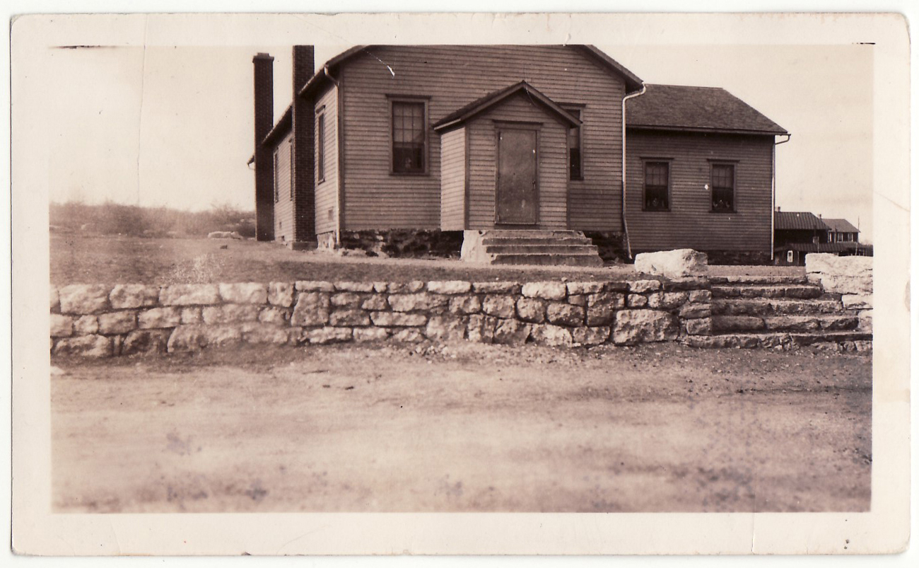 This is another
photo of the same Upper Lehigh school, courtesy of the Freeland
Historical Society. This one was in Foster Township, and there was also
another
school at the end of town in Butler Township. I don't know if this is
correct, but my dad told us that at one point the boundary between the
townships went through their house on Main Street. When the line was
redrawn, a couple of his siblings had to change schools.
This is another
photo of the same Upper Lehigh school, courtesy of the Freeland
Historical Society. This one was in Foster Township, and there was also
another
school at the end of town in Butler Township. I don't know if this is
correct, but my dad told us that at one point the boundary between the
townships went through their house on Main Street. When the line was
redrawn, a couple of his siblings had to change schools.There are more photos and information on the Upper Lehigh schools page.

 In 1934
the Upper Lehigh A. C. played the White Haven Blue Mountain
Leaguers and the Rock Glen All-Stars. In 1933 the Upper Lehigh Ramblers
baseball team played teams including the Weatherly Independents, The
Oakdale team, and the Freeland Pirates. Clippings from Charlie Stumpf.
In 1934
the Upper Lehigh A. C. played the White Haven Blue Mountain
Leaguers and the Rock Glen All-Stars. In 1933 the Upper Lehigh Ramblers
baseball team played teams including the Weatherly Independents, The
Oakdale team, and the Freeland Pirates. Clippings from Charlie Stumpf.More information and photos of Upper Lehigh teams can be found on the Baseball page.

An ad for a dance at Upper Lehigh Hall in 1934. As mentioned earlier, the old company store eventually became Upper Lehigh Hall, and in the 1950s it was owned by Mr. Boyko and known locally as Boyko's Hall. I remember as a child attending several wedding receptions there, including my aunt Helen and uncle Charlie Gross's reception (I was their flower girl in 1954). I don't know who owned the building in 1934 when this dance was being advertised, but it sounded like fun. Ad from Charlie Stumpf.
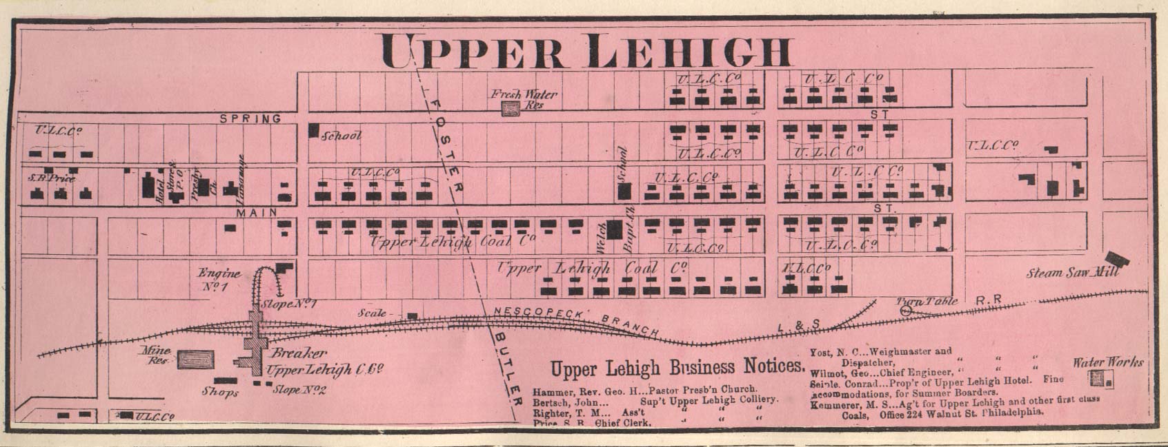 Here's the
map of Upper Lehigh that appears in D. G. Beers' Atlas of Luzerne
County, Pennsylvania (1873). It's a wonderfully detailed view of
a
carefully laid out company town, complete with hotel, store, two
churches, two schools, steam saw mill, reservoirs, water works, and of
course the coal breaker. Note the train tracks. The map is accompanied
by business listings and shows the Foster/Butler townships border
dividing the town. Note that the Upper Lehigh Coal Company owns all of
the homes except for those at the west end of town. This was true up
until the late 1920s when the homes were offered for sale.
Here's the
map of Upper Lehigh that appears in D. G. Beers' Atlas of Luzerne
County, Pennsylvania (1873). It's a wonderfully detailed view of
a
carefully laid out company town, complete with hotel, store, two
churches, two schools, steam saw mill, reservoirs, water works, and of
course the coal breaker. Note the train tracks. The map is accompanied
by business listings and shows the Foster/Butler townships border
dividing the town. Note that the Upper Lehigh Coal Company owns all of
the homes except for those at the west end of town. This was true up
until the late 1920s when the homes were offered for sale.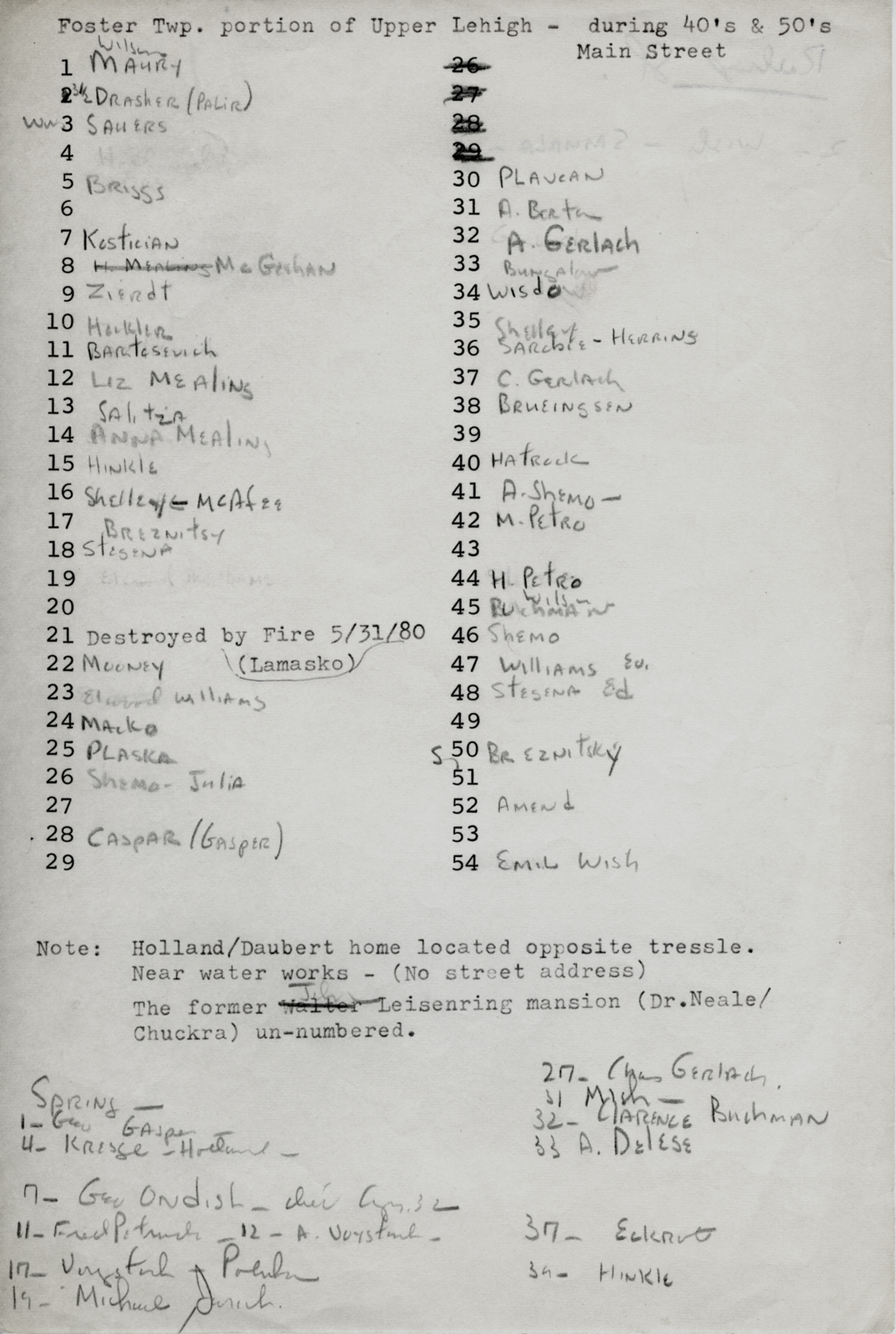
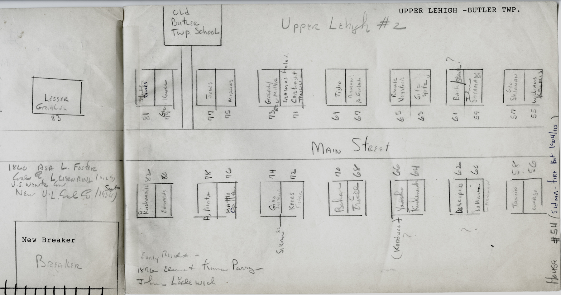
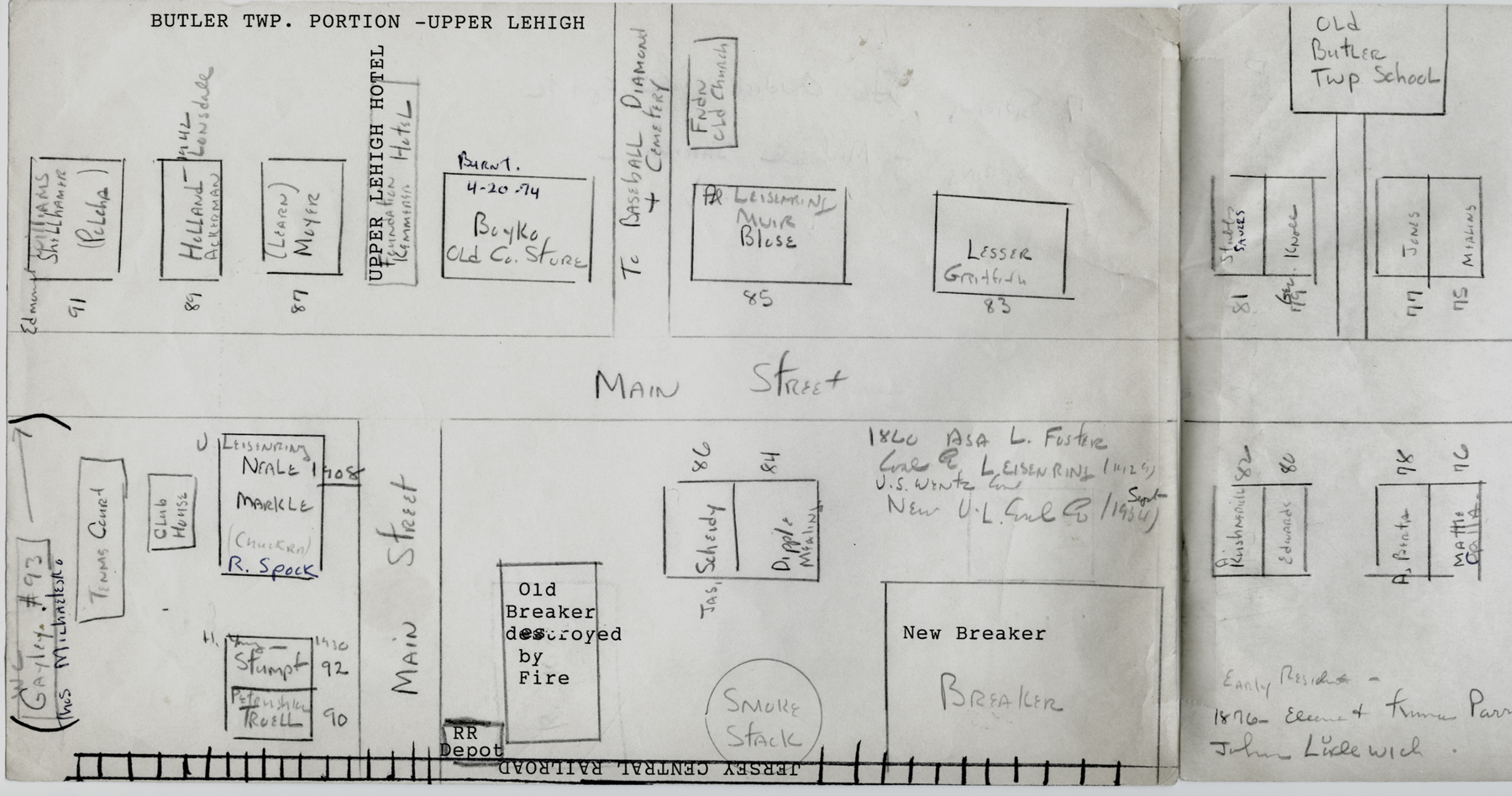
 And here is something more
recent and more personal: a couple of street maps/lists of Upper Lehigh
drawn
and annotated by Charlie Stumpf.
And here is something more
recent and more personal: a couple of street maps/lists of Upper Lehigh
drawn
and annotated by Charlie Stumpf. At left he listed some of the residents of the Foster Twp. section of Upper Lehigh in the 1940s-1950s as Charlie remembered them.
Below is his annotated map listing some residents of the Butler Twp. section.
Reminiscences of Upper Lehigh history by George Dreisbach, published in the Plain Speaker on October 3, 1957, contributed here by Ed Merrick.
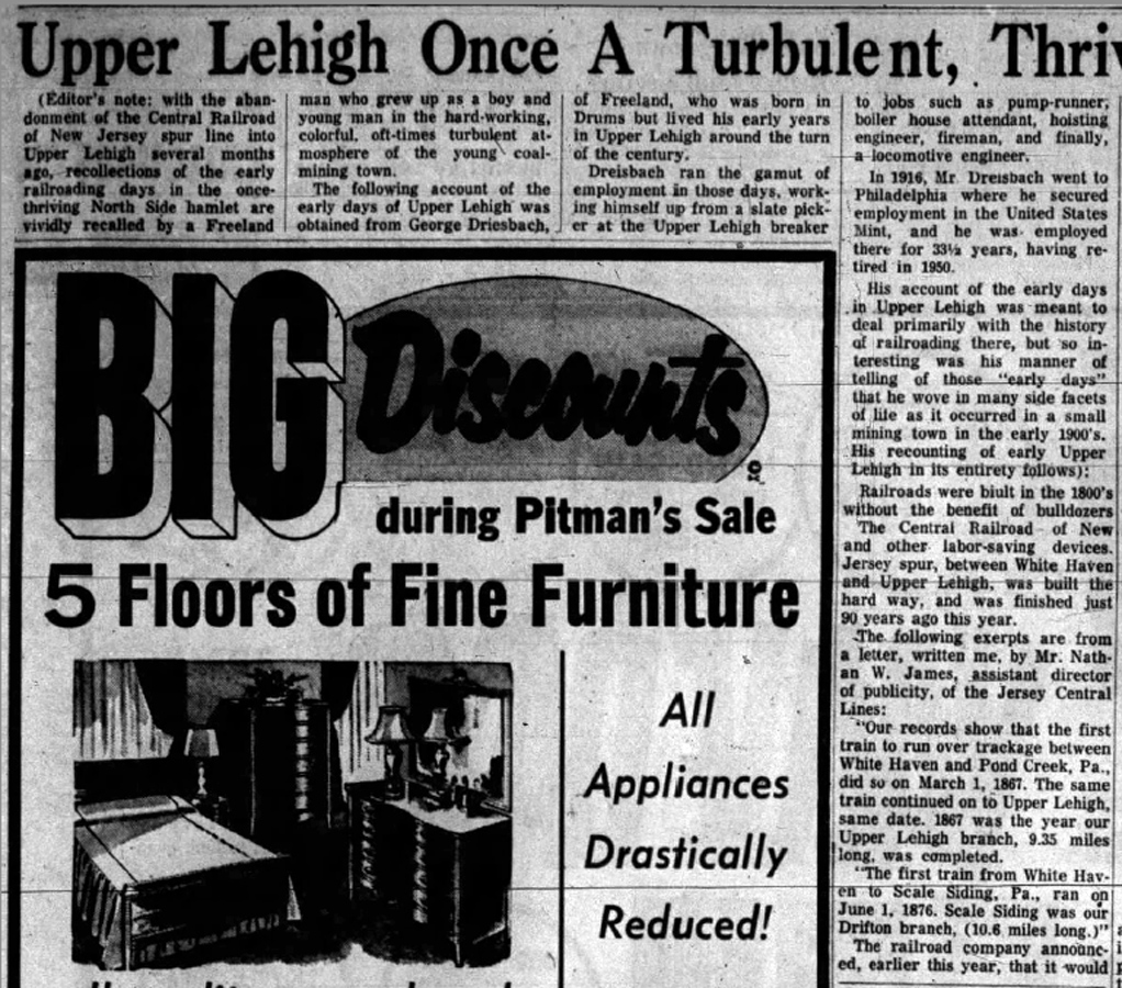
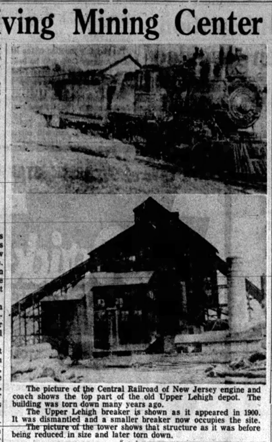
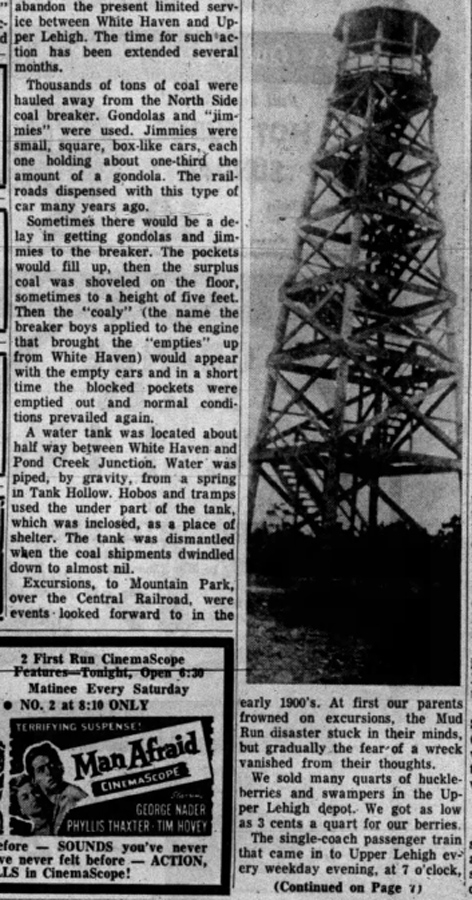
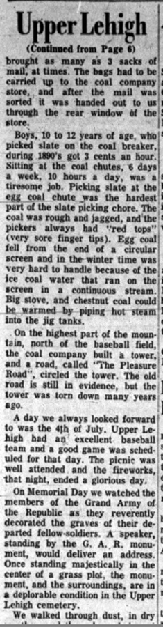
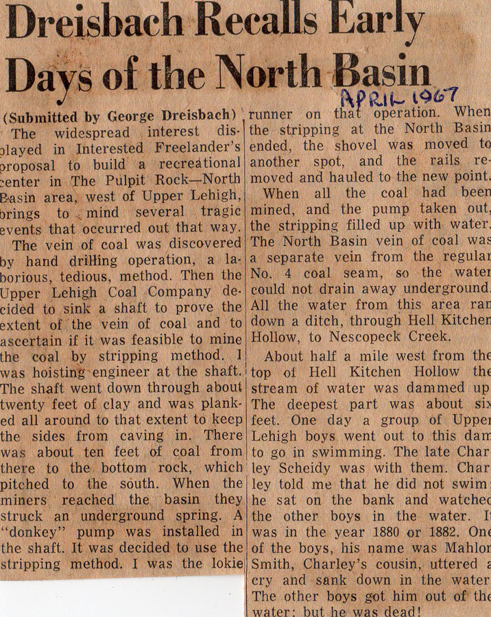
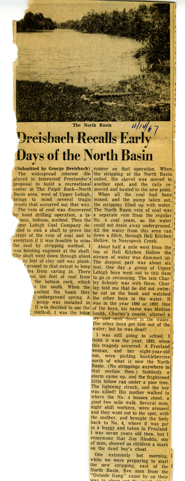
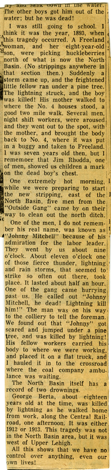 This
article about the North Basin by George
Dreisbach was published in 1967. At the end of the article
George Dreisbach mentions
deaths by lightning strike and includes that of George Berta, which
happened in Upper Lehigh, not at the North Basin. George Berta was my
grandmother's brother. The story passed down through our family was
that
it happened near home and that my grandmother was watching for him to
come home and actually saw the lightning strike hit
him as he was walking along the tracks. Tragedy was never far away for
those miners and their families. Original article courtesy of the
Standard Speaker, and Ed Merrick has
kindly
sent me another copy of the beginning of the article to replace what
was torn away from the first column of the copy I had (center image).
This
article about the North Basin by George
Dreisbach was published in 1967. At the end of the article
George Dreisbach mentions
deaths by lightning strike and includes that of George Berta, which
happened in Upper Lehigh, not at the North Basin. George Berta was my
grandmother's brother. The story passed down through our family was
that
it happened near home and that my grandmother was watching for him to
come home and actually saw the lightning strike hit
him as he was walking along the tracks. Tragedy was never far away for
those miners and their families. Original article courtesy of the
Standard Speaker, and Ed Merrick has
kindly
sent me another copy of the beginning of the article to replace what
was torn away from the first column of the copy I had (center image).