News & announcements
Saving your history
Early accounts
Maps
Nearby towns
People
Churches
Schools
Municipal
Organizations
Businesses
The mines
Transportation
Streets
Buildings
Entertainment
Celebrations
Sports
Ethnic groups
Freeland, then and now - Street views, running east-west
What's on this page:
- Gallery of old postcards and modern photographs showing matching street views for streets running east/west
- Gallery of old postcards and modern photographs showing matching street views for streets running north/south
- Gallery of old postcards and modern photographs showing matching views for churches and
other buildings.
MAPPING
THE PRESENT ONTO THE PAST
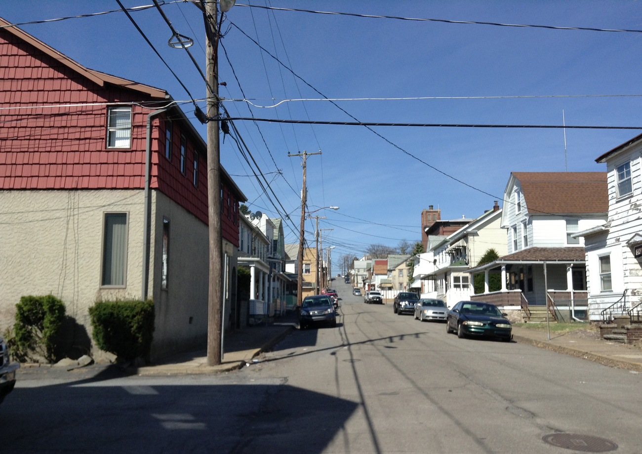
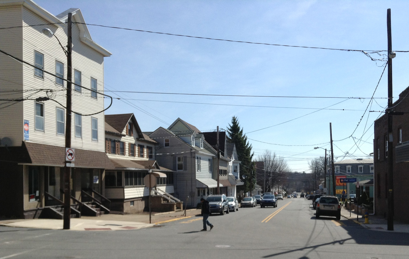
Here are more of Charlie Gallagher's photographs
of views previously documented in postcards.
He
walked around Freeland recently, looking for the spots where a number
of these old postcard views of Freeland streets were photographed from.
Once he felt that he was in the right spots, he made new photographs of
the same general views, 100+ years. Most of the old postcards are
mine, and a few of the older views were provided courtesy of John
Zubach.

View at left: This view shows Walnut Street, looking west toward Centre Street from a block or two east of it (from Washington or Pine Streets?). The building at right in the foreground looks like a storefront, but I only have this low resolution digital photo and so I can't see enough detail to be able to tell. You can see the steeple of the borough building in the back right area of the photo.
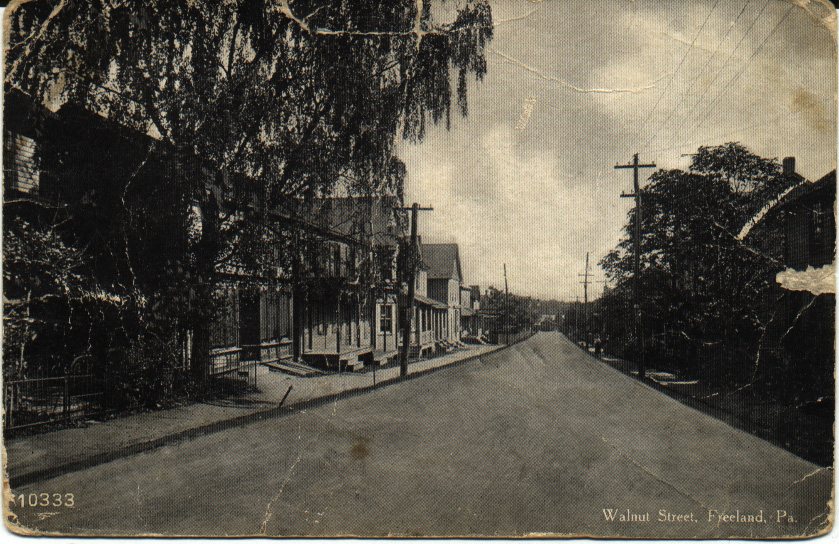
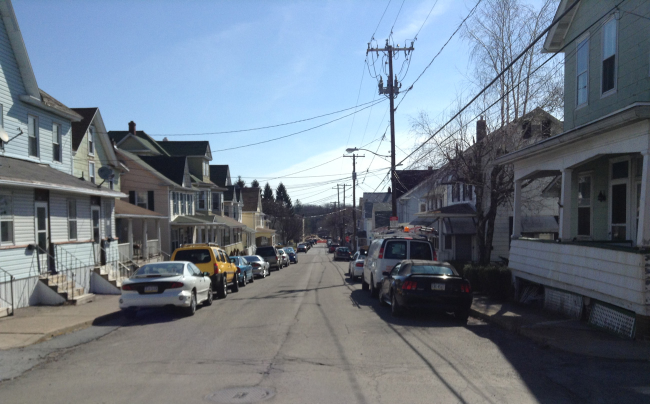
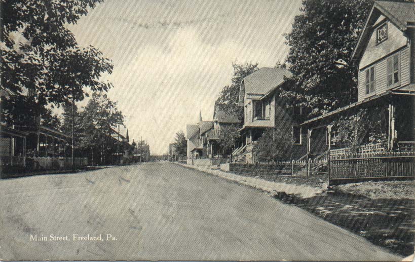
View at left: Here we're looking east on Walnut Street toward Birkbeck Street, which you can see at the end of the street. The buildings on this street are mostly homes, as is the case today. There were some nice, large trees along this street. The second building from the left edge of the picture looks like a storefront of some kind, and has wooden doors in the sidewalk in front that would lead to the basement.
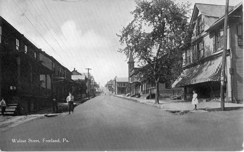
View at left: Walnut Street at Washington, looking west toward Centre Street. You can see the steeple of the Borough Building and the uphill rise of Walnut Street west of Centre. That's Henry George's grocery store in the right foreground, shaded by a large striped awning to protect people and produce from the heat of the sun. I wonder how long that tree lasted before it was taken down?
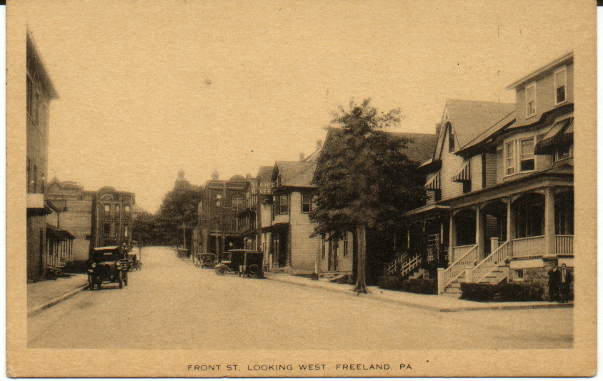
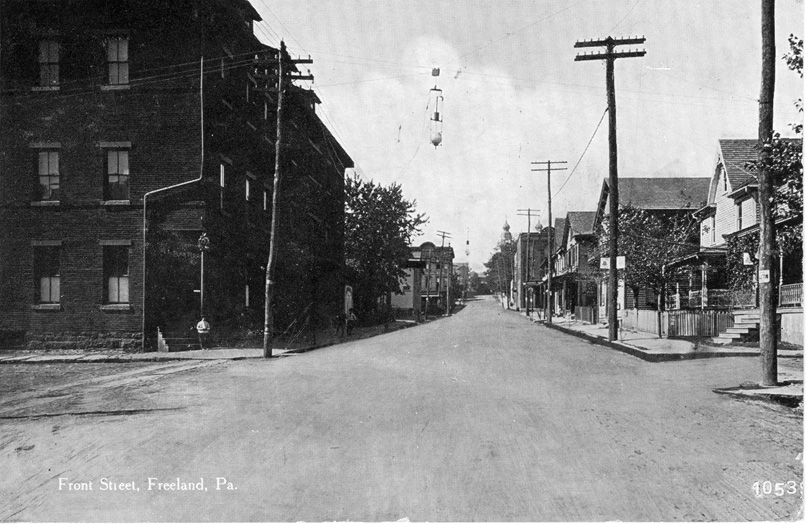

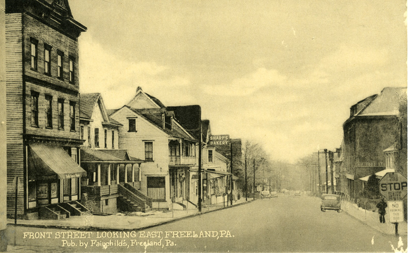
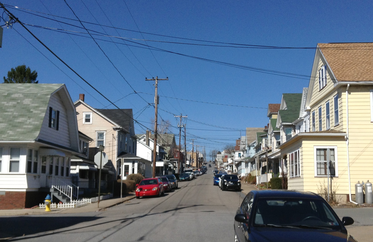
View at left: Two older views of Front Street, looking west toward Centre Street. The first one is a great image, looking toward the intersection of Centre and Front Streets from about a half block east of the intersection, on Front Street. On the right you can see the sign for Sharp's Bakery. At the intersection across Centre Street you can see De Pierro's on the left (where the bank is now) and Oswald's general store on the right. The twin steeples of St. Mary's Church are visible in the background on the right. There were some nice-sized trees along the street, too. In the center image, I'm assuming that the large building at left foreground is Krell's Hall, earlier the site of one of our opera houses, and later the site of the A&P grocery store that burned down in the 1970s. You can see the steeples of St. Mary's Church in the back right area of the photo. Note the streetlight hanging over the middle of the street.
View at left: Here's another Front Street view from a couple of decades later, standing at the intersection of Front and Centre Streets and looking east toward the Public Park instead of west toward Ridge Street. There are several recognizable buildings in this photo. This is from a wonderful series of postcards produced by Fairchild's.

View at left: This shows some beautiful homes with fenced lawns and yards, and quite a few trees along the street. The church steeple visible at right in the background is the original St. Luke's Lutheran Church, a wooden building that was later replaced by stone construction. I can't tell what's at the far end of the street -- trees? The Public Park is behind the person who photographed this view.
See also the related page of views for north/south streets.
See also the related page of views of churches and other buildings.