
News & announcements
Saving your history
Early accounts
Maps
Nearby towns
People
Churches
Schools
Municipal
Organizations
Businesses
The mines
Transportation
Streets
Buildings
Entertainment
Celebrations
Sports
Ethnic groups
Freeland, then and now - Street views, running north-south
What's on this page:
- Gallery of old postcards and modern photographs showing
matching street views for streets running north/south
- Gallery of old postcards and modern photographs showing matching street views for streets running east/west
- Gallery of old postcards and modern photographs showing matching views for churches and
other buildings
MAPPING
THE PRESENT ONTO THE PAST
These pages are the brainchild of Charlie
Gallagher.
He
walked around Freeland recently, looking for the spots where a number
of these old postcard views of Freeland streets were photographed from.
Once he felt that he was in the right spots, he made new photographs of
the same general views, 100+ years. Most of the old postcards are
mine, and a few of the older views were provided courtesy of John
Zubach.
Although there will be some obvious differences between the
old and new views, you might be surprised to see how many of the
buildings from the older views are still with us!
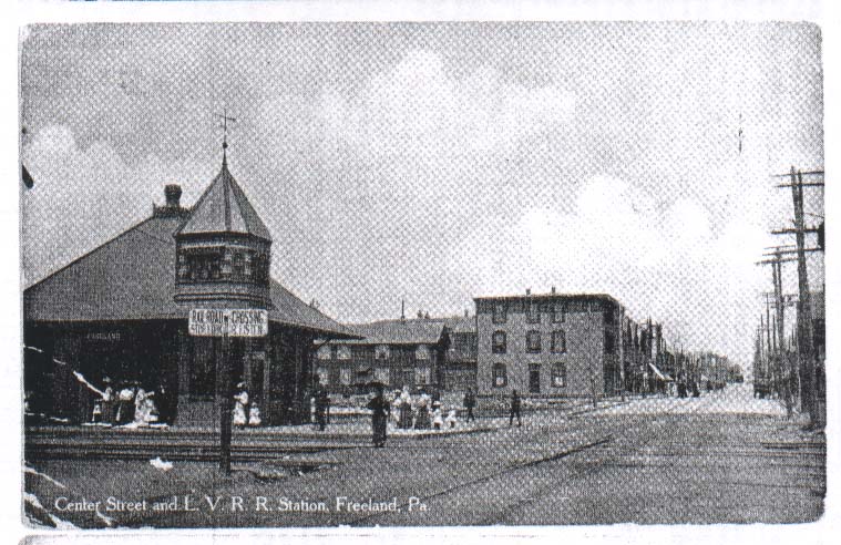
View at left: In addition to the railroad, Freeland enjoyed regular trolley service. In 1894, work was begun by the Lehigh Traction Company on a trolley line between Freeland and Harleigh, The trolley ran until 1932, and the last of the tracks were pulled up in the mid-1960s as part of a repaving project, as reported in the Freeland Penny Saver. The tracks ran right up the middle of Centre Street. This postcard, looking north from below the train station, shows the intersection of the railroad and trolley tracks on Centre Street below Carbon.
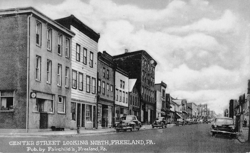
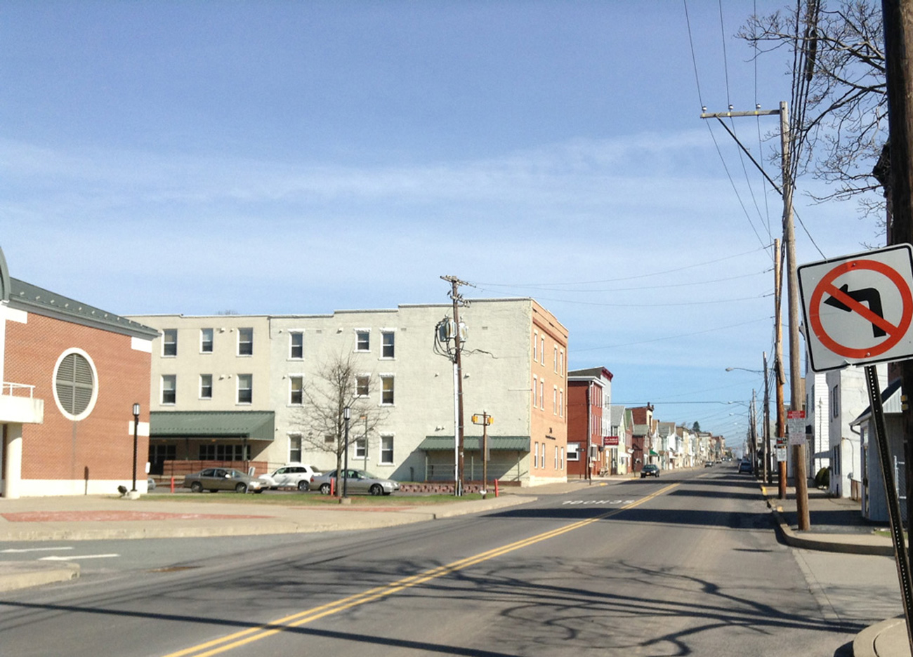
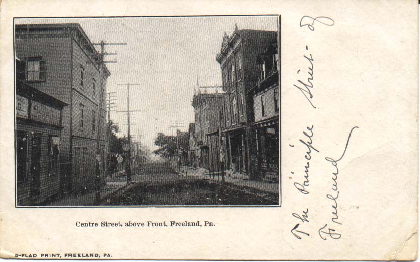
View at left: Centre Street, looking north from Carbon Street. There's the Machella and Resuto bar in the left foreground, a familiar site to me because it was across the street from our apartment when I was a kid living above my grandfather's auto supply store. This is another postcard in the Fairchild's series.
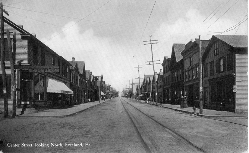
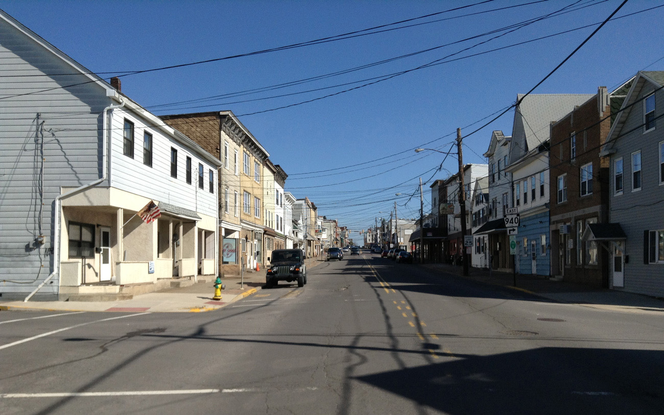
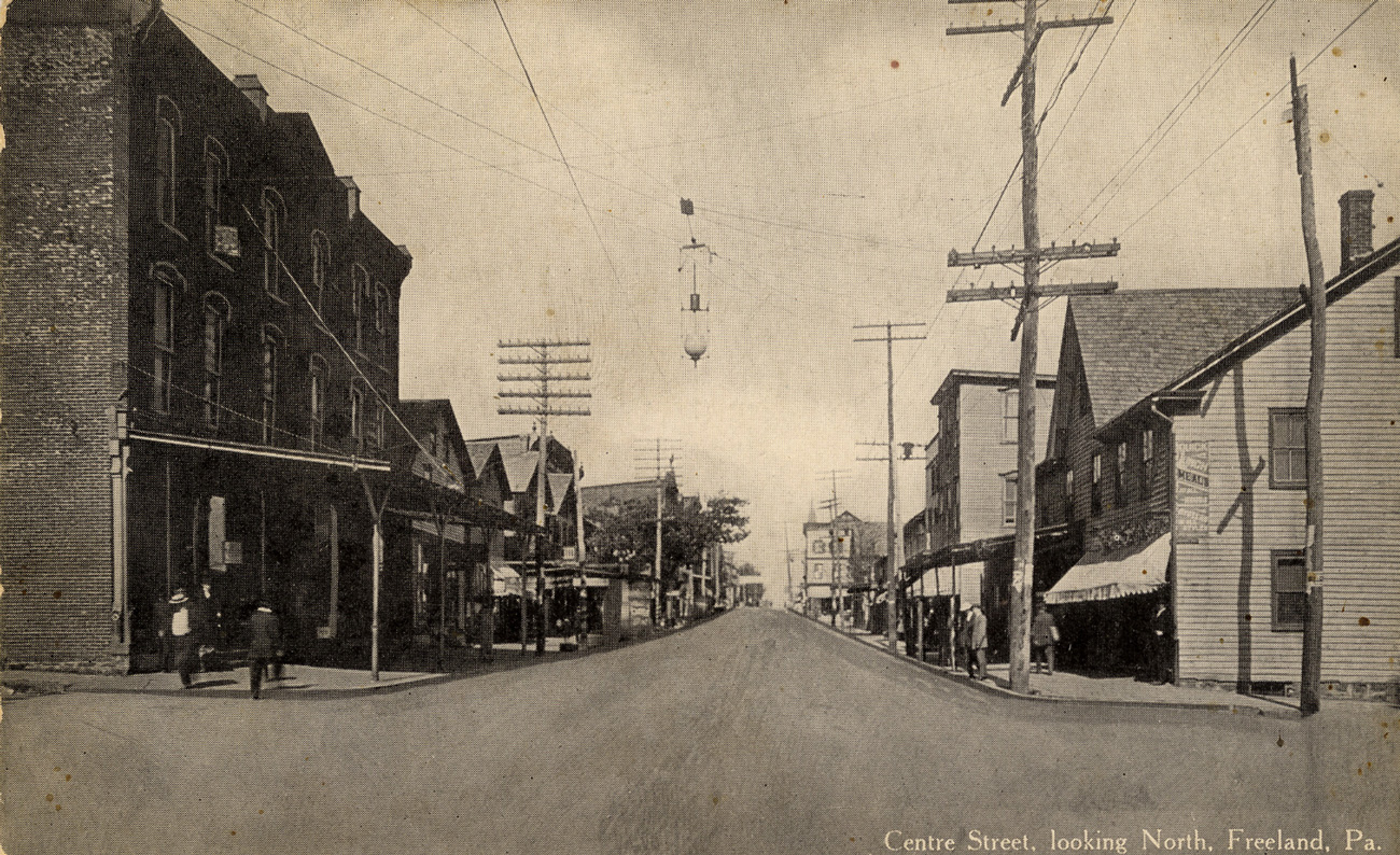
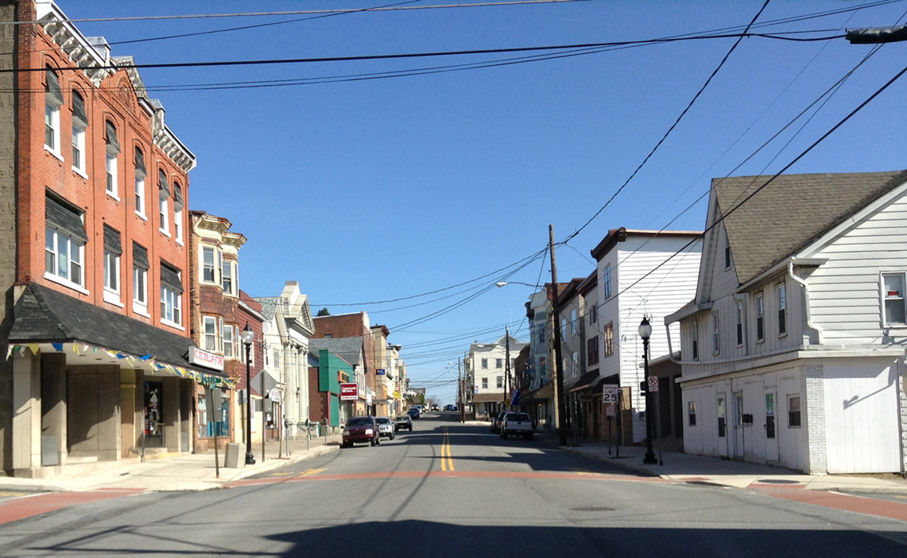
View at left: Centre Street, looking north from Luzerne Street. Telephone poles were sort of rough and ready, not as smoothly mass produced as they are today. Note the trolley tracks going up Centre Street. No trees until you get up to the Central Hotel on the left between Main and Front Streets, barely visible here.
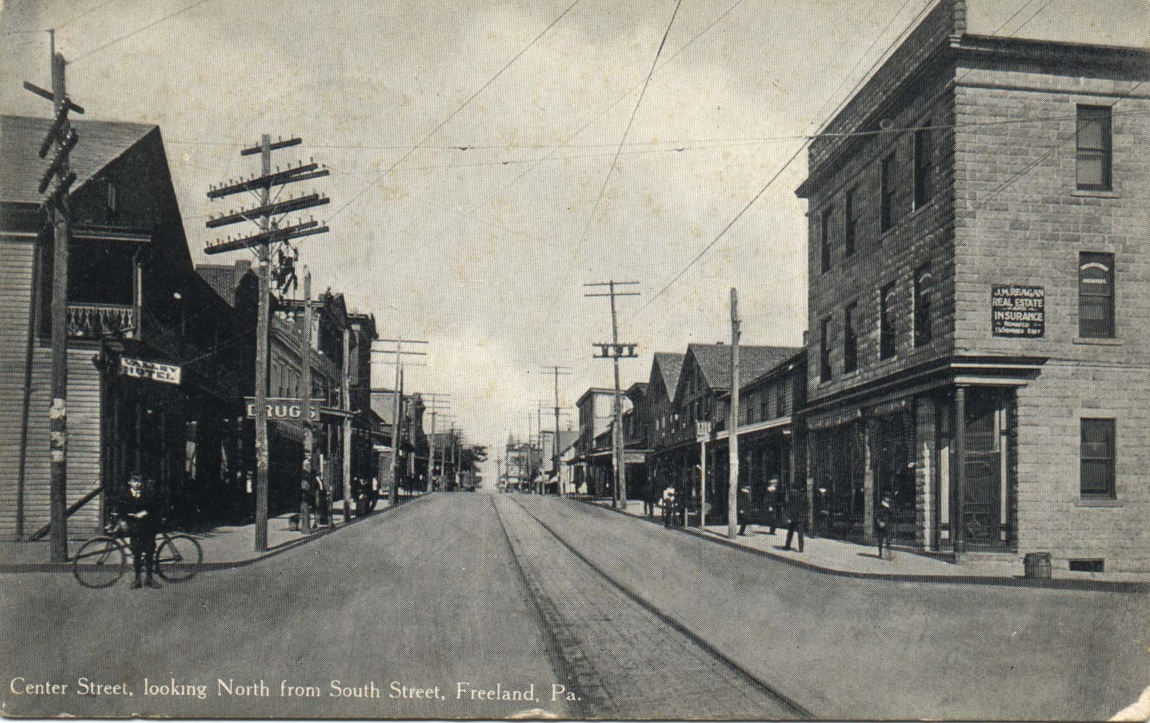
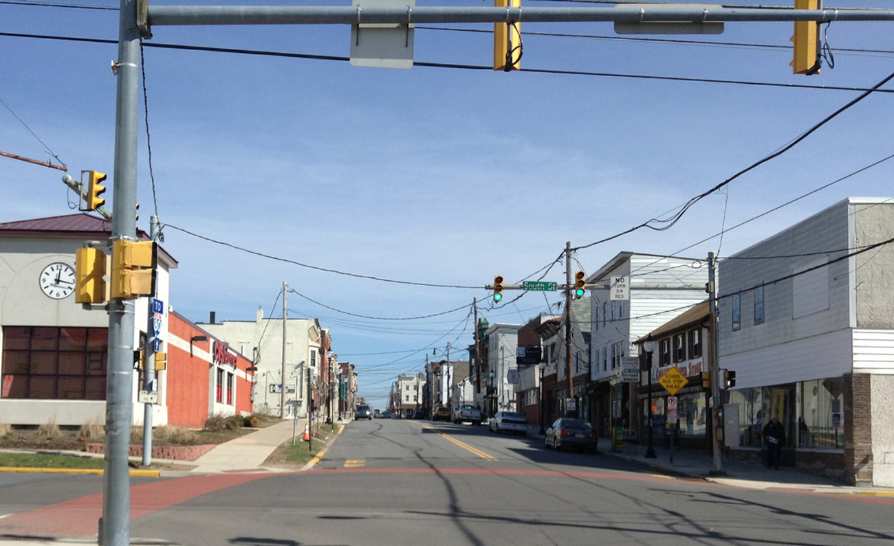
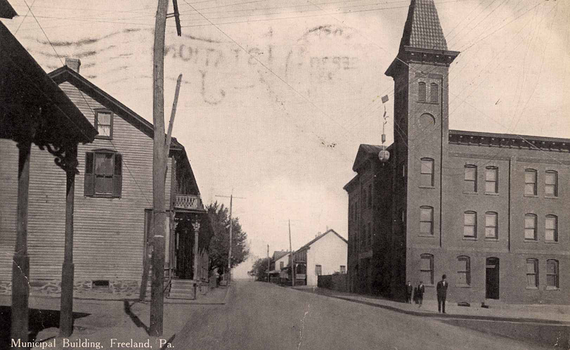
View at left: Centre Street, looking north from South Street. This is a great picture, especially in light of the recent new contruction on this site. In thie photo, on the left in the foreground is the Valley Hotel (with a balcony), and next to it a drug store. On the right in the foreground, real estate and insurance offices. On the right, all the way in the background, you can see what looks like a church steeple. It's the borough building, which at this time still had a steeple. See the photo on my "Municipal Matters" page.
Views at left and center: Centre and Main Streets, looking north. That's the Birkbeck Block in the left foreground -- a large building which housed William Birkbeck's hardware and plumbing business, and later a succession of other businesses. Several early models of automobiles are on the street in the center image, and it's a little hard to see but it's possible that there's a horse-drawn carriage parked on the left behind the car that's in the foreground.
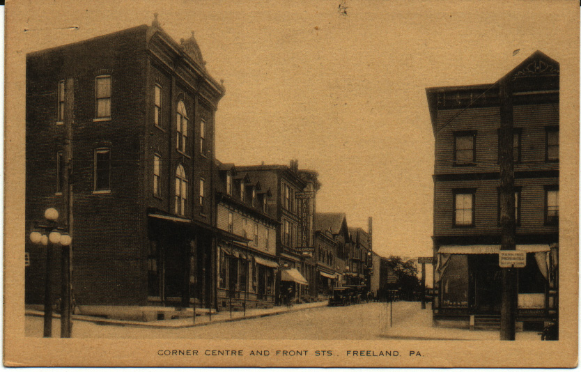
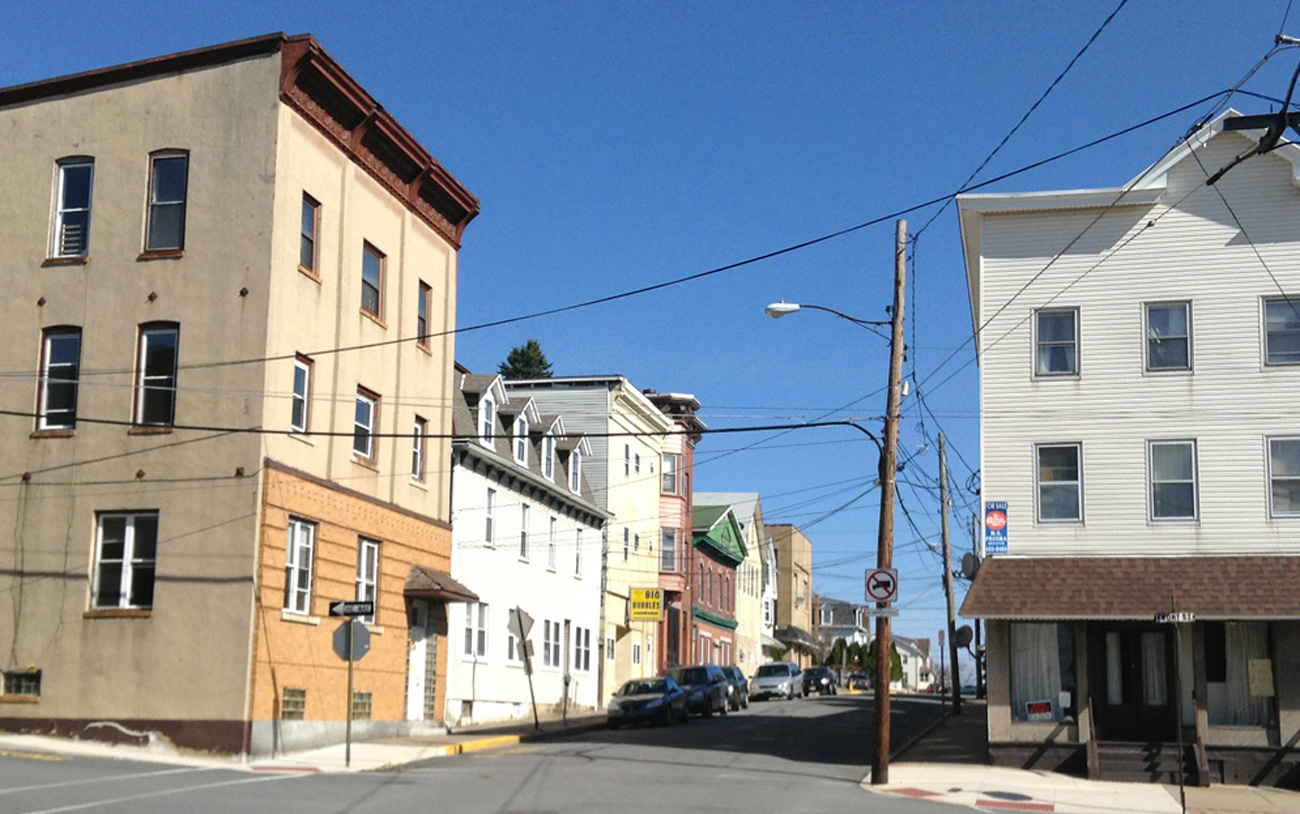
View at left: Centre and Front Streets, looking north. On the right you see William A. Bachman's optometrist office; he also dealt in watches and clocks at the same location. On the left, on the corner, is Amandus Oswald's general store. Two other signs are legible on the west side of the street: "Home-made Candies - Fairchild's - Ice Cream" and "Light Heat Power". Many of these buildings are still standing and still identifiable.

View at left: Centre and Walnut Streets, looking north. On the right is the Borough Building. On the left, the building with the wood siding on the corner, is Lloyd's millinery store, where ladies could purchase hats. Later it would be the Nagle family home. This is a great view of the Borough Building before the steeple was removed. I've got to check my notes to see what that porch is in the left foreground. If you know, I'd love to hear about it.
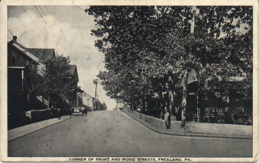
View at left: This postcard shows the view from the intersection of Front and Ridge Streets, looking north toward Walnut Street. This was a quiet residential area at the time of the photo, even more so than it is today, and although you can't see it here, the Bethel Baptist Church is at the end of the block ahead on the right.
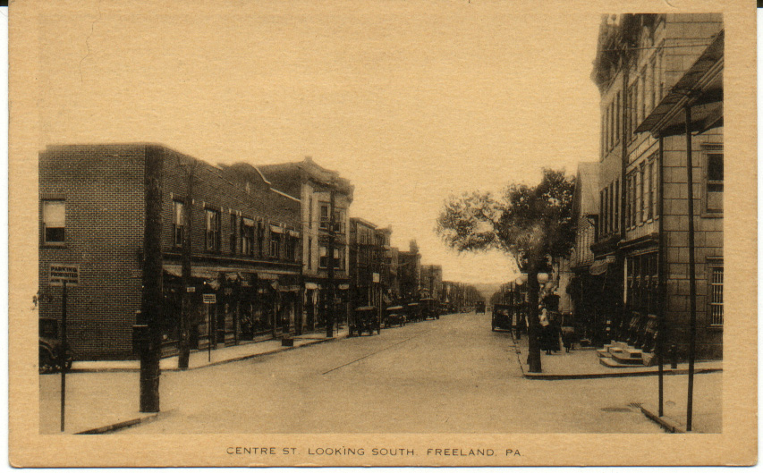
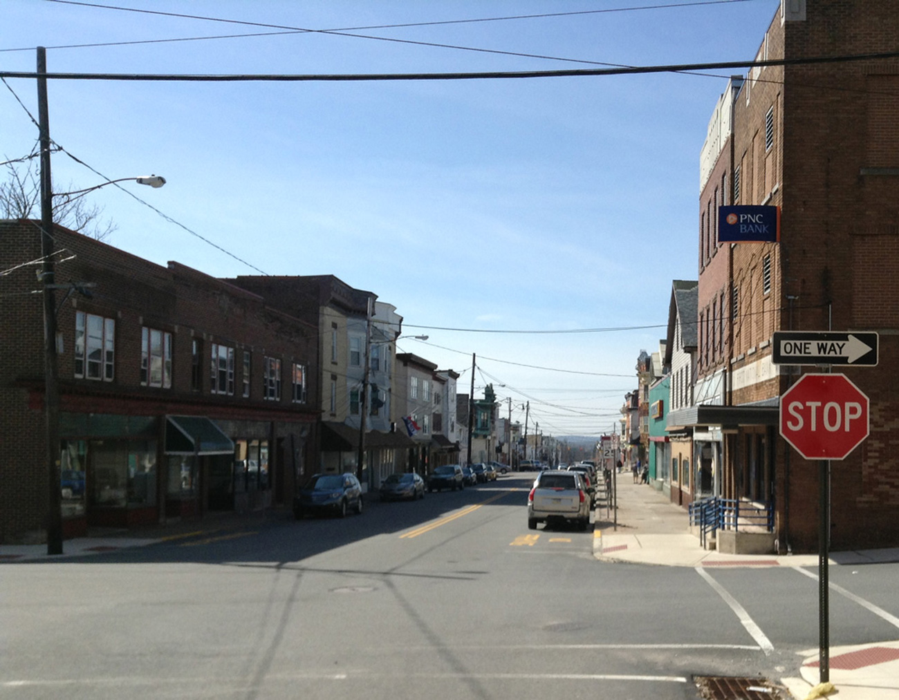
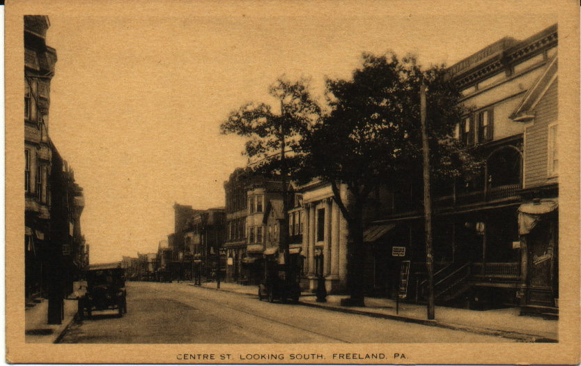
LOOKING SOUTHWARD FROM CENTRE AND FRONT STREETS:
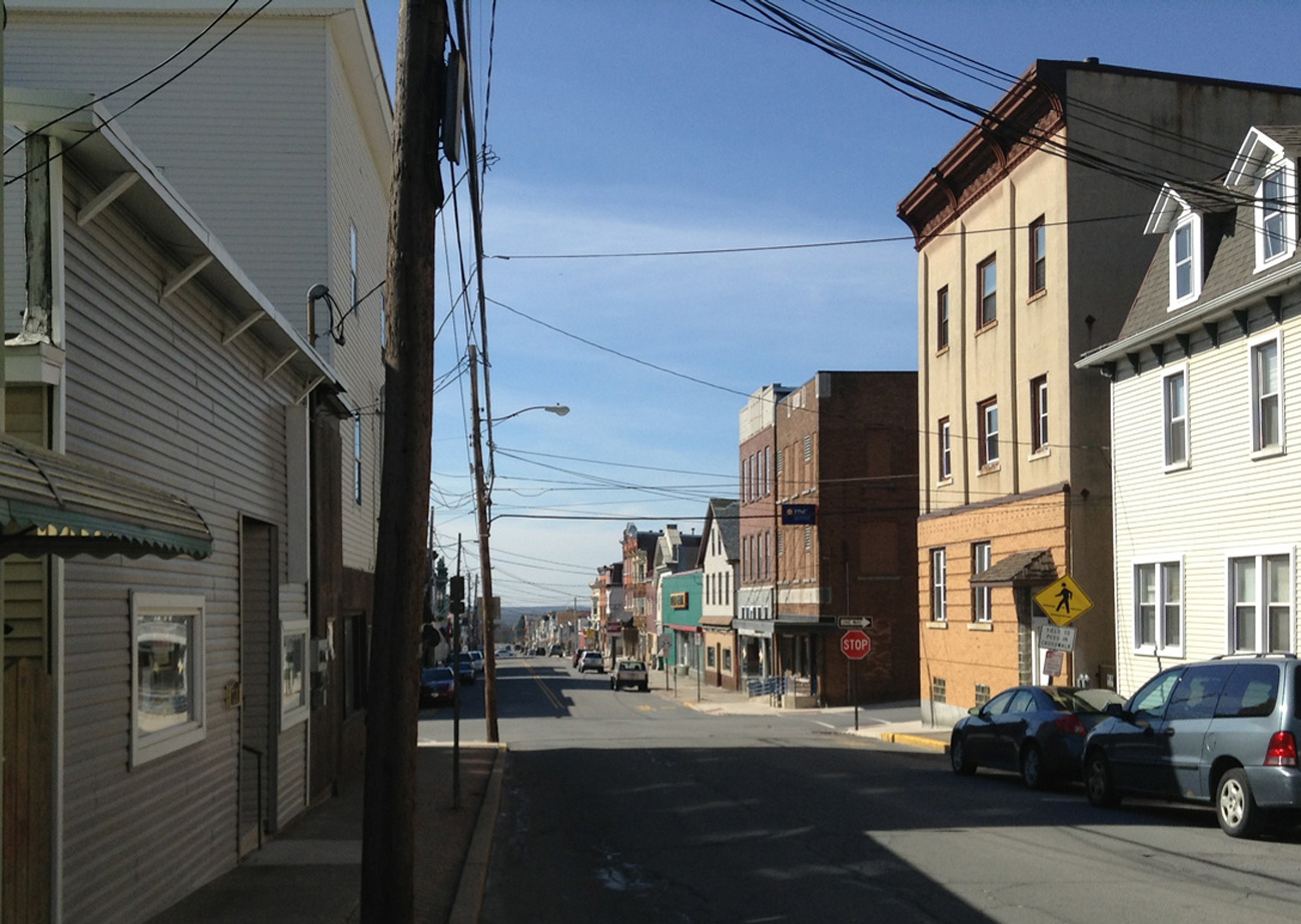
View at left: Looking south from just above Centre and Front Streets. At the left of the picture, in the foreground, is the print shop where the Semi-Weekly Progress newspaper was printed. Across the street you can see Amandus Oswald's general store on the corner, with its.covered entryway. There are several trees visible on the next block, including the one or two in front of the Central Hotel.
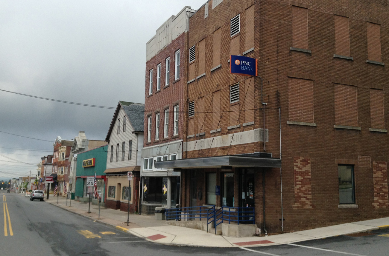
View at left: Centre and Front Streets, looking southeast. On the right, the First National Bank stands on the corner. I'm not sure, but I think that the tree on the right is in front of the Central Hotel, which is set back slightly and not visible in this view. Compare this view to the next one, which shows the Central Hotel and the Citizens Bank. Again, a number of these buildings are still there and still recognizable. Notice the trolley tracks.
View at left: Centre Street, looking southwest toward the Central Hotel and the Citizens Bank. Next to the Central Hotel might be Steven B. Dvorshak's grocery and meat market (it's a little hard to read the sign, but the location is about right). Again, recognizable biuldings and trolley tracks. The Central Hotel also contained a livery stable and a number of other businesses that rented office or shop space from the proprietor, M. H. Hunsicker.
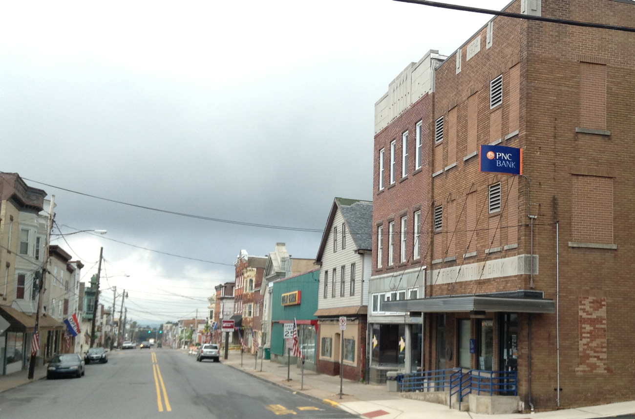
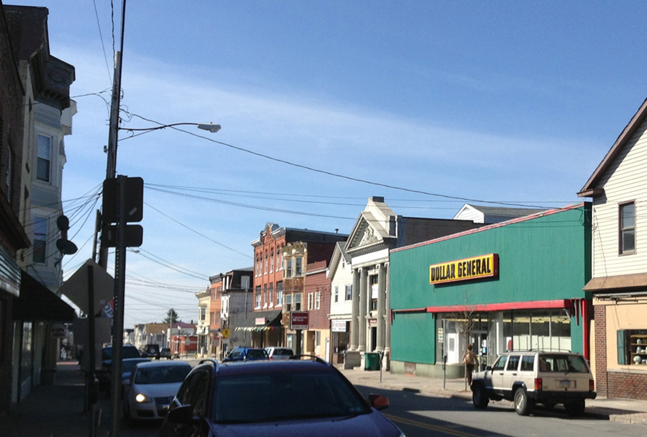
View at left: Two views looking southeast at Centre Street from Front Street. The First National Bank stands on the corner. No more Central Hotel, no more trees, no trolley tracks, and look at the cars and buses! Also notice the unusual street light on the left side of the picture, hanging out over the street. Compare this view to the one above of Centre and Front Streets, looking southeast. Similar perspective, but a very different time period.
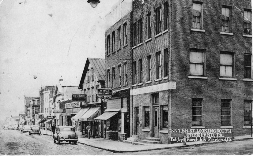
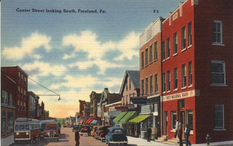
View at left: This view is similar to the one at above left, perhaps a bit later. If you look closely, you can see that Christmas lights are strung across the street. Also, at the very top of the image you see a street light of a type that hung out over the street, rather than sitting atop a pole. It looks like the same sort of streetlight as the one shown above left. You see Genetti's Food Center where the Central Hotel used to be. Next to that is a Frigidaire sign; was this already Feussner's Hardware Store? The next building up had a sign saying Fountain - Luncheonette - Dolly Madison Ice Cream. When did the Whitehead brothers take over this business? This postcard was published by Fairchild's.
See also the related page of views for east/west streets.
See also the related page of views of churches and other buildings.