
News & announcements
Saving your history
Early accounts
Maps
Nearby towns
People
Churches
Schools
Municipal
Organizations
Businesses
The mines
Transportation
Streets
Buildings
Entertainment
Celebrations
Sports
Ethnic groups
Freeland area maps
What's on this page about nearby towns, townships, Luzerne County:
- 1873 maps showing Freehold and the surrounding area
- 1884 geological map of Luzerne County
- Undated postal map,
possibly circa 1920?
- 1949 Foster
Township warrantee map
- 1873 more maps of Freeland area towns and townships
- Links to Hazleton maps, 1884-1918 - offsite, on the Pennsylvania State University Libraries' site
1873 Maps of the area around Freehold (later Freeland)
The maps shown
on this page (click on them for larger views) come from The Atlas
of Luzerne County, published in 1873. In the case of the township
maps I was only able to scan a portion
of each map, due to limitations having to do with the size and
condition
of the atlas. I've cropped the scans to show a few locales in the
immediate area of Freeland. The map at top left corner also comes from
this atlas.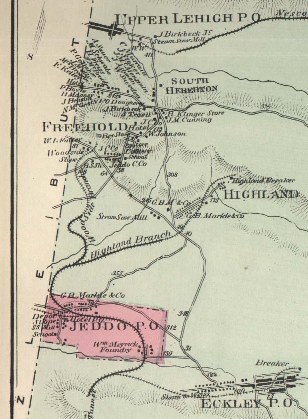
 This
is a part of a map of Foster Township, cropped to show a few locales
in the
immediate area of Freehold, later Freeland. It shows Upper Lehigh, South Heberton,
Freehold, Highland, Jeddo and
Eckley. The map shows buildings, roads, railroad tracks, breakers,
names
of major property owners, rivers and mountains. At the left of the map
are boundary lines that Foster Township shares with Butler and Hazle
Townships. The Butler/Foster line cuts right through Upper Lehigh,
although that's
not evident from this map. The road cutting across left to right above
the name Freehold is what would become Schwabe Street and was the
stagecoach route between Drums and Pond Creek and on to White Haven. In
the Freehold part you can actually see the
label pointing to Matthias Schwabe's house. At this time Freehold had
not yet been
renamed
Freeland, and South Heberton had not yet been annexed to Freeland.
This
is a part of a map of Foster Township, cropped to show a few locales
in the
immediate area of Freehold, later Freeland. It shows Upper Lehigh, South Heberton,
Freehold, Highland, Jeddo and
Eckley. The map shows buildings, roads, railroad tracks, breakers,
names
of major property owners, rivers and mountains. At the left of the map
are boundary lines that Foster Township shares with Butler and Hazle
Townships. The Butler/Foster line cuts right through Upper Lehigh,
although that's
not evident from this map. The road cutting across left to right above
the name Freehold is what would become Schwabe Street and was the
stagecoach route between Drums and Pond Creek and on to White Haven. In
the Freehold part you can actually see the
label pointing to Matthias Schwabe's house. At this time Freehold had
not yet been
renamed
Freeland, and South Heberton had not yet been annexed to Freeland.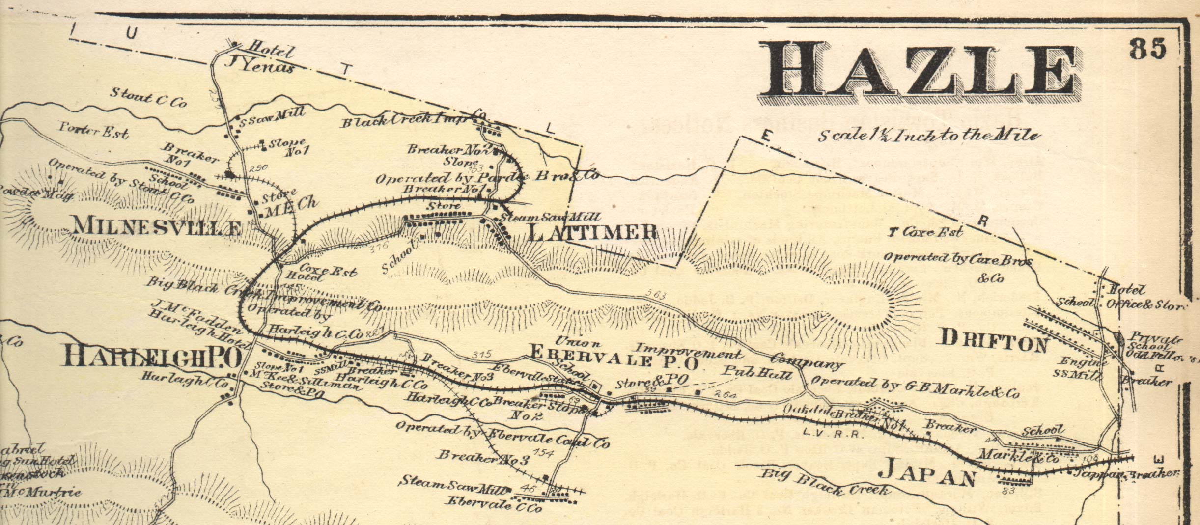 This piece of the 1873
map of Hazle Township at right shows a string of mining communities:
Lattimer, Milnesville, Harleigh,
Ebervale, Japan, Drifton, all within a few miles of Freehold. Part of
the boundary between Hazle and
Butler Townships can be seen along the top of the map. There are more
area maps from the 1873 Atlas on another
page.
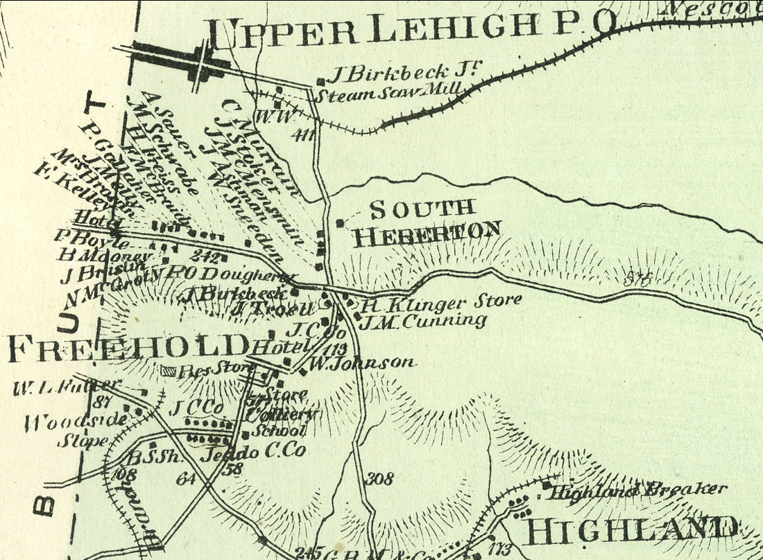
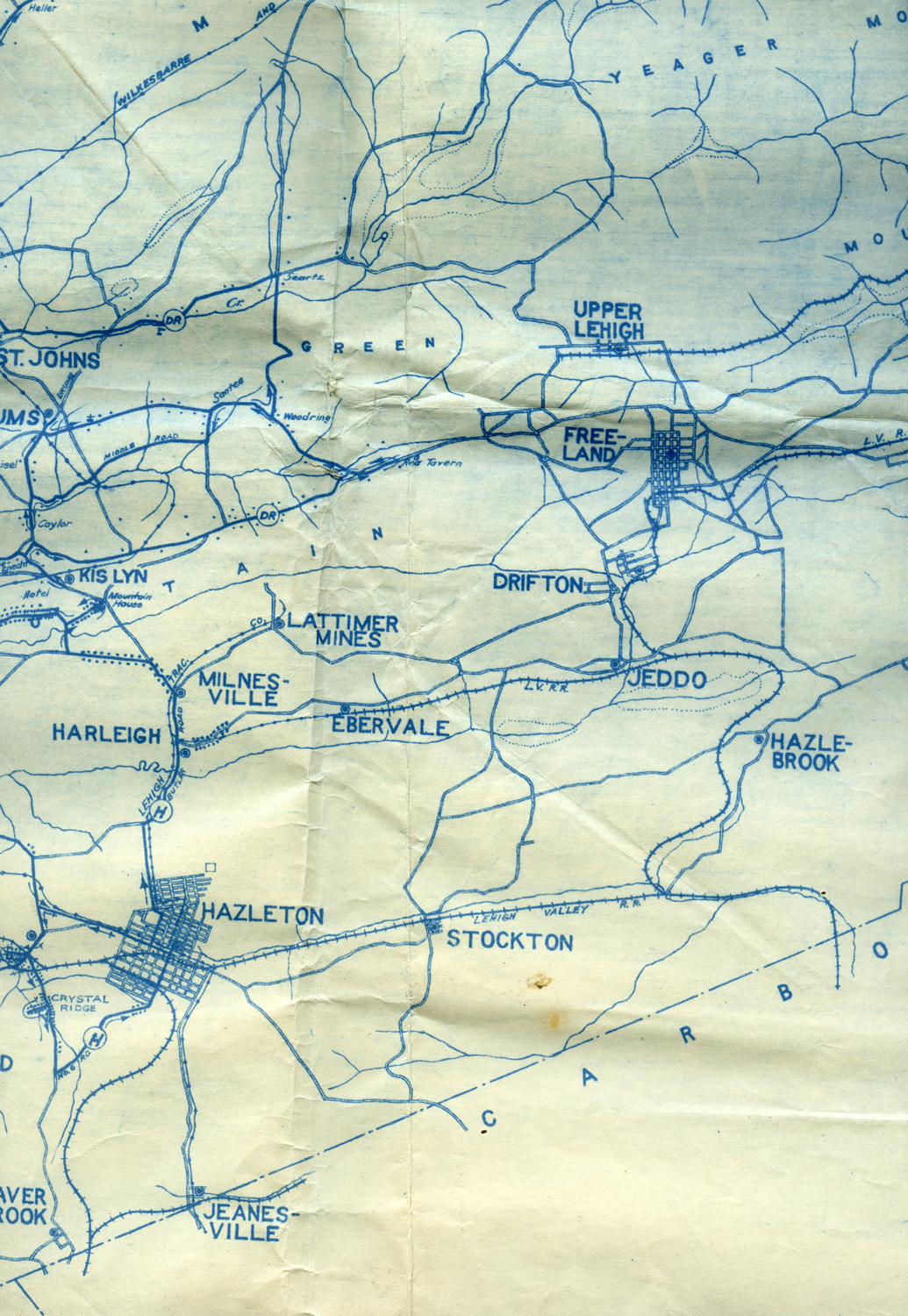
This piece of the 1873
map of Hazle Township at right shows a string of mining communities:
Lattimer, Milnesville, Harleigh,
Ebervale, Japan, Drifton, all within a few miles of Freehold. Part of
the boundary between Hazle and
Butler Townships can be seen along the top of the map. There are more
area maps from the 1873 Atlas on another
page.1884 Geological map of Luzerne County
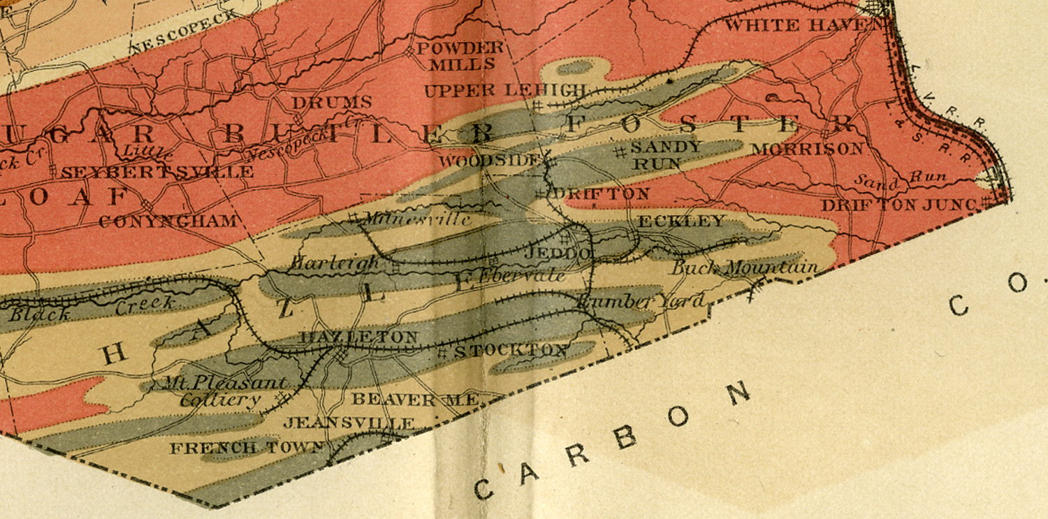
Here's an 1884 geological map of Luzerne County from the 2nd Geological Survey of Pennsylvania. The fact that it shows Woodside but not Freeland suggests that it might label mining locations rather than towns. On the right is a cropped section of the map highlighting our area of the county. This map makes it very clear why the mines were located where they were (and why there were no mines in certain other nearby areas). It also appears on my Mines page.
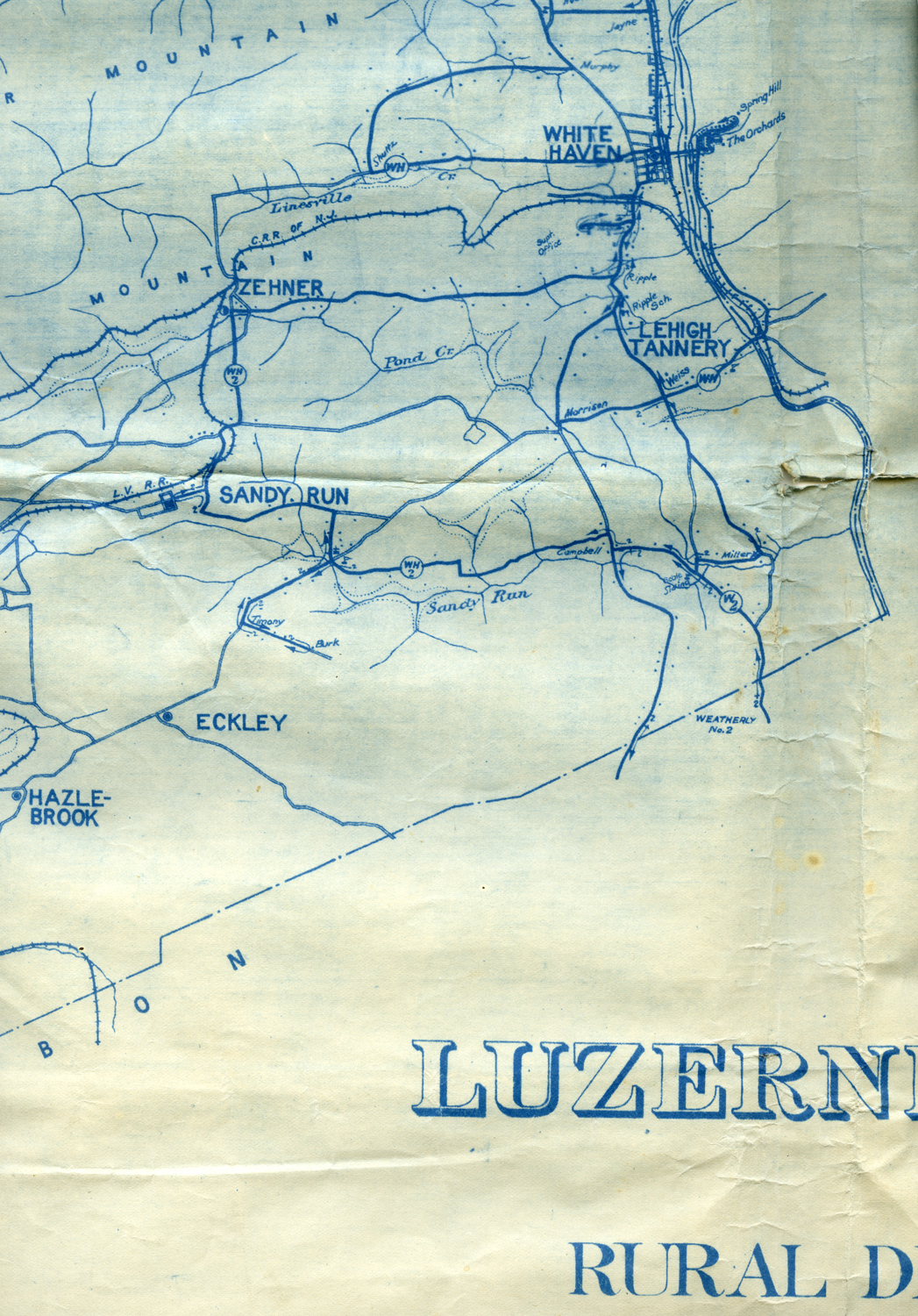
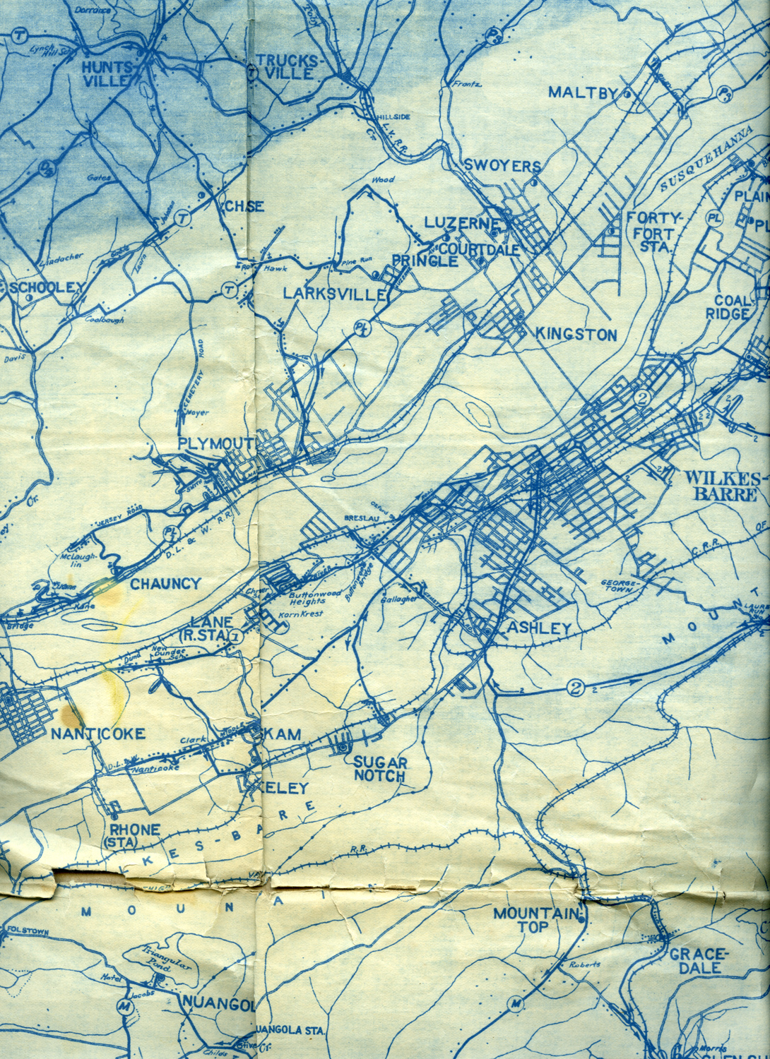
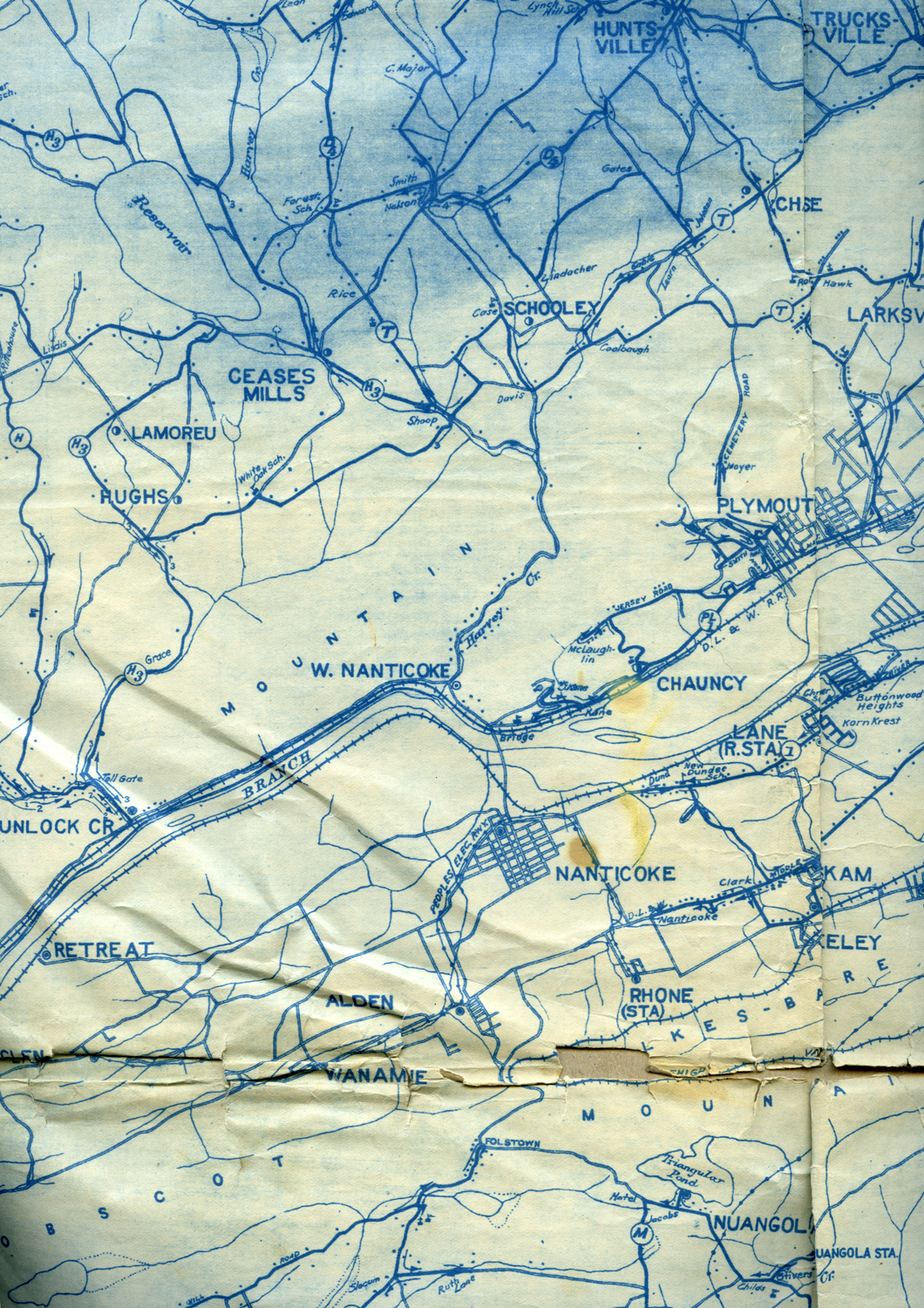
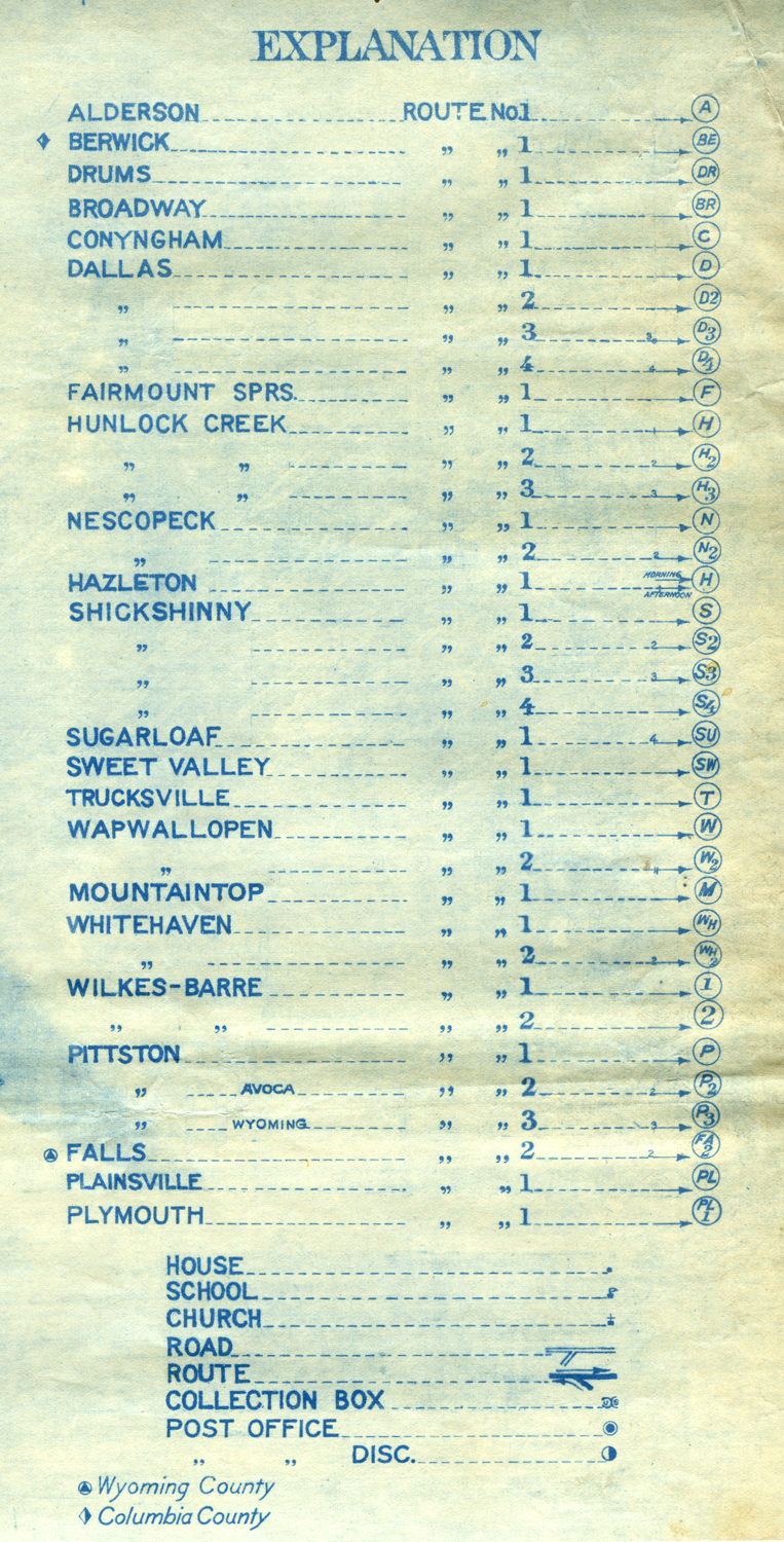
Postal rural delivery map for Luzerne County

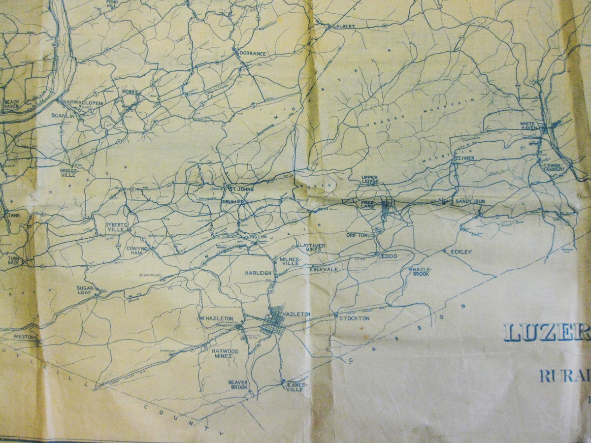
 I
bought this map on eBay, and it's
in poor condition. The title is "Map of Luzerne County, Pa. showing
Rural Delivery Service, Post Office Department." This map gives a great
view of roads, railroad tracks, rivers and creeks, with mountains
labeled. Larger communities are shown in outline, smaller ones with
post offices designated with a dot inside a circle. In the rural areas,
collection boxes are supposedly noted, routes are differentiated from
roads, and houses, schools and churches at least partially noted. See,
for example, the dots along the road from Zehner (Pond Creek) in the
direction of White Haven -- I assume that those are houses. I don't
have the whole map copied yet - its size and condition don't lend to
its being able to be scanned face down on a scanner. I'm going to try
to
get better photographs of it, but for now these will have to do.
I
bought this map on eBay, and it's
in poor condition. The title is "Map of Luzerne County, Pa. showing
Rural Delivery Service, Post Office Department." This map gives a great
view of roads, railroad tracks, rivers and creeks, with mountains
labeled. Larger communities are shown in outline, smaller ones with
post offices designated with a dot inside a circle. In the rural areas,
collection boxes are supposedly noted, routes are differentiated from
roads, and houses, schools and churches at least partially noted. See,
for example, the dots along the road from Zehner (Pond Creek) in the
direction of White Haven -- I assume that those are houses. I don't
have the whole map copied yet - its size and condition don't lend to
its being able to be scanned face down on a scanner. I'm going to try
to
get better photographs of it, but for now these will have to do.These 8 images show the index and various parts of the region around Freeland. From left to right:
(1) Eckley, Hazle Brook, Zehner, Sandy Run, White Haven, Lehigh Tannery
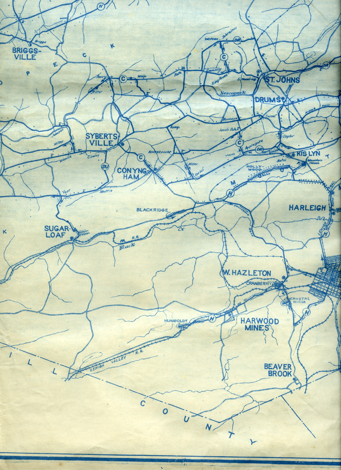
(2) Freeland, Upper Lehigh, Drifton, Jeddo, Hazle Brook, Stockton, Ebervale, Milnesville, Lattimer Mines, Harleigh, Hazleton, Jeanesville
(3) West Hazleton, Harwood Mines, Beaver Brook, KisLyn, Drums, St. Johns, Seybertsville, Conyngham, Sugarloaf, Briggsville
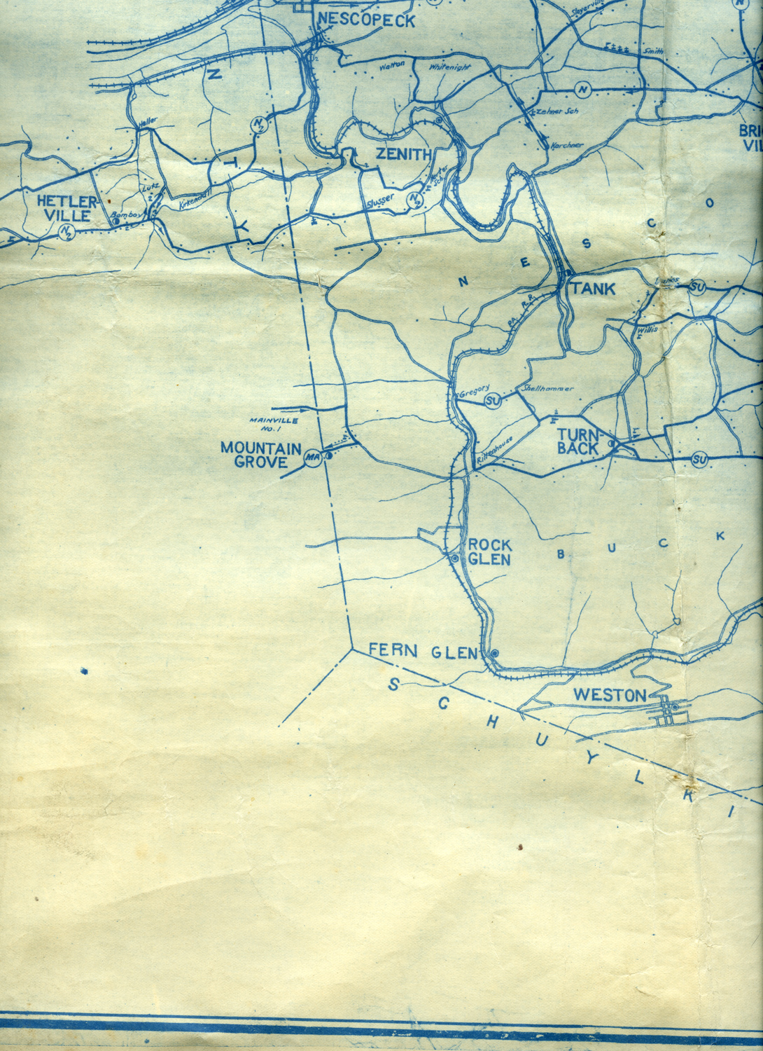
(4) Nescopeck, Zenith, Tank, Turnback, Rock Glen, Fern Glen, Weston, Mountain Grove, Hetlerville
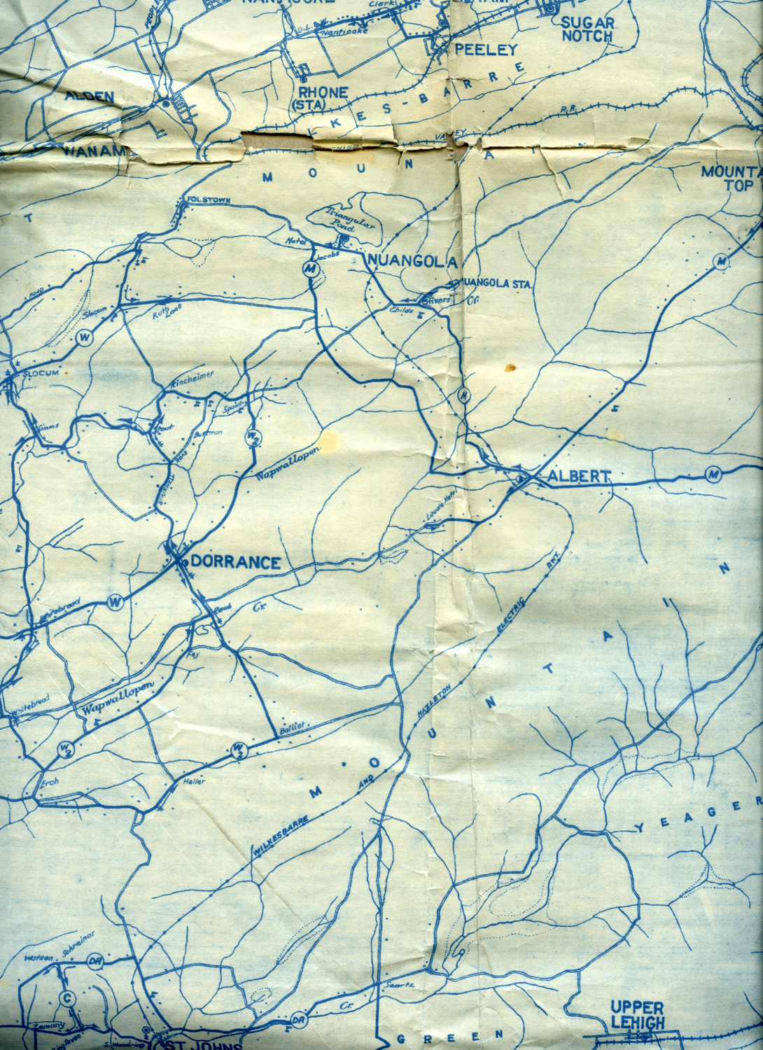
(5) Dorrance, Albert, Nuangola, Sugar Notch, Peeley, Rhone Station, Alden, Wanamie
(6) Gracedale, Mountaintop, Ashley, Wilkes-Barre, Nanticoke, Chauncy, Kingston, Coal Ridge, Forty Fort Station, Larksville, Pringle, Courtdale, Luzerne, Maltby, Trucksville, Huntsville, Schooley
(7) Plymouth, Ceases Mills, Lamoreu, Hughs, Lane Station
(8) Index
Warrantee township maps from the Pennsylvania State Archives
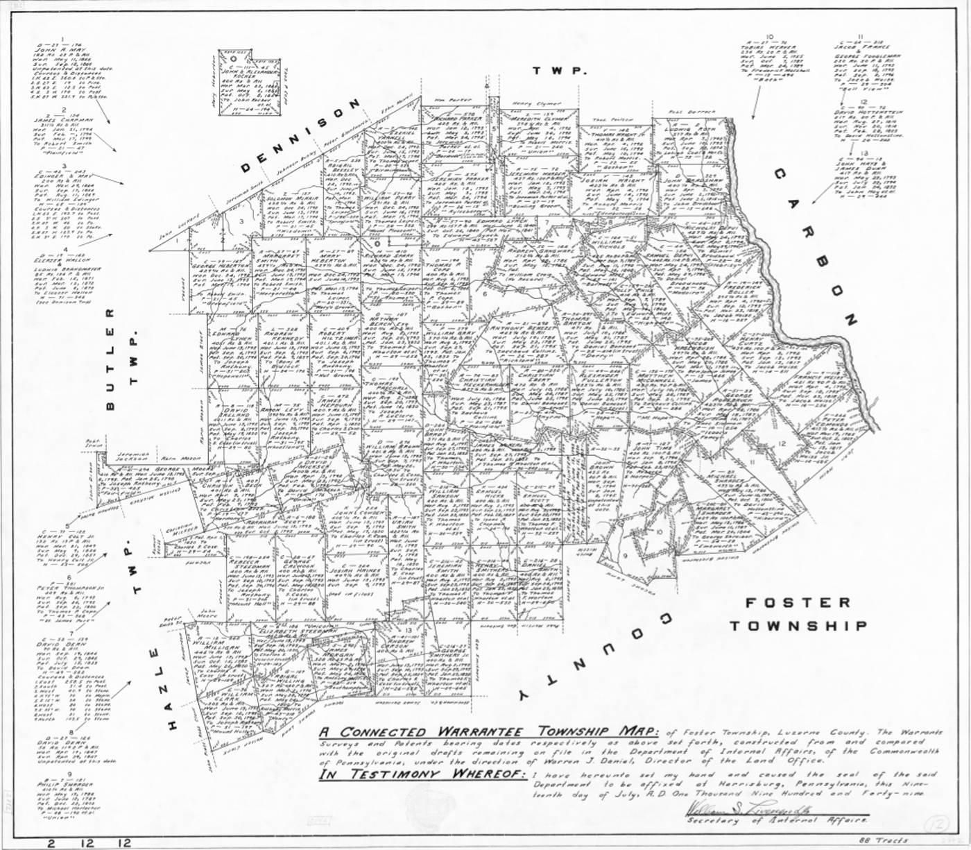 Charlie Gallagher
found this warrantee map for Foster Township online.
The map is
dated 1949. The larger version that clicking this thumbnail image gives
you isn't very readable, but you can download a good quality PDF of the
map from the Pennsylvania State Archives. Click
here for the page that has links to the various maps available by
county and
then township. Scroll down to Luzerne County, and then pick Foster, or
Hazle, Conyngham, Butler, etc.
Charlie Gallagher
found this warrantee map for Foster Township online.
The map is
dated 1949. The larger version that clicking this thumbnail image gives
you isn't very readable, but you can download a good quality PDF of the
map from the Pennsylvania State Archives. Click
here for the page that has links to the various maps available by
county and
then township. Scroll down to Luzerne County, and then pick Foster, or
Hazle, Conyngham, Butler, etc.According to an article in the October 2012 issue of The Pennsylvania Magazine of History and Biography, these maps were drawn in the 1940s from original drafts at the Pennsylvania Land Office. Information recorded on the maps includes "names of original applicants, acreage and location of tracts, dates of application, warrant, survey, and patent; and the names of patentees."
There is some general information about these maps on an introductory page at the Pennsylvania State Archives site. In part it says that the Archives "holds the following warrantee township maps, which show all original land purchases from the Proprietors or the Commonwealth made inside the boundaries of present-day townships. In essence, these maps serve as a summary and geographical index for the warrants, surveys and patents held by the State Archives. Information usually shown for each tract of land includes: name of warrantee, name of patentee, number of acres, name of tract, and dates of warrant, survey and patent. Survey and patent numbers also may be given."
Another offsite page shows the range of land records available at the Pennsylvania State Archives.