News & announcements
Saving your history
Early accounts
Maps
Nearby towns
People
Churches
Schools
Municipal
Organizations
Businesses
The mines
Transportation
Streets
Buildings
Entertainment
Celebrations
Sports
Ethnic groups
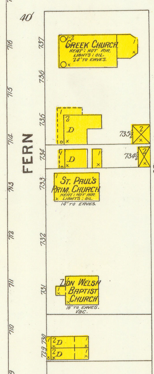
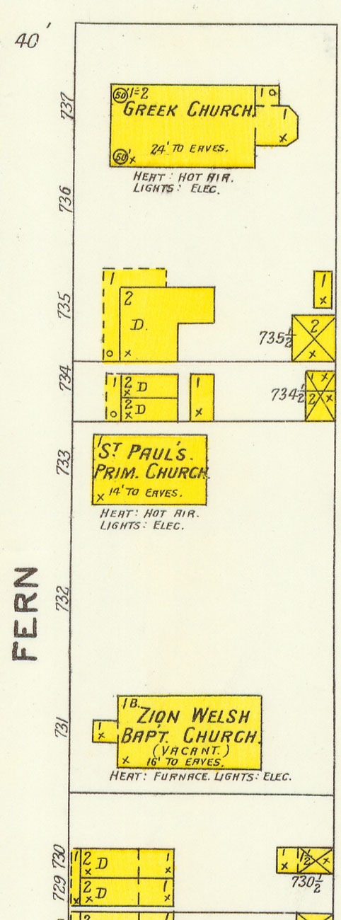
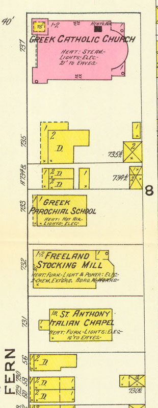
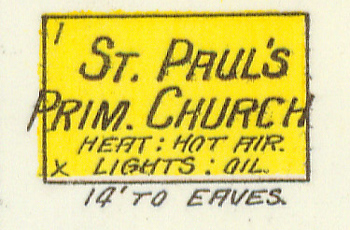
St. Paul's Primitive Methodist Church
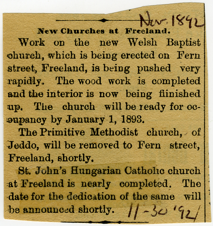 Apparently this church
was originally in Jeddo, and was moved to Fern St. in late
1892 or 1893, as noted in the 2nd paragraph of this newspaper clipping.
St. Paul's is not shown on the 1895 Sanborn map for some reason -- on
the 1895 Sanborn map, Fern St. was represented only by the upper
section of that block, showing St.
Mary's Church. I don't know why the 1895 map doesn't show St. Paul's,
which was listed
in the 1897 city directory this way: St. Paul's Primitive Methodist
Church, Fern street, Samuel
Cooper, pastor (home north Walnut). So it seems to have been
functioning as a church at the new location then, but at present I
don't have any more information except for this little newspaper
clipping and the depiction of the church
on two Sanborn maps, as shown below. I would welcome any additional
information about this church.
Apparently this church
was originally in Jeddo, and was moved to Fern St. in late
1892 or 1893, as noted in the 2nd paragraph of this newspaper clipping.
St. Paul's is not shown on the 1895 Sanborn map for some reason -- on
the 1895 Sanborn map, Fern St. was represented only by the upper
section of that block, showing St.
Mary's Church. I don't know why the 1895 map doesn't show St. Paul's,
which was listed
in the 1897 city directory this way: St. Paul's Primitive Methodist
Church, Fern street, Samuel
Cooper, pastor (home north Walnut). So it seems to have been
functioning as a church at the new location then, but at present I
don't have any more information except for this little newspaper
clipping and the depiction of the church
on two Sanborn maps, as shown below. I would welcome any additional
information about this church.Here are views from the 1900, 1905 and 1912 Sanborn maps showing the upper half of the northernmost block of Fern Street. "St. Paul's Prim. Church" is shown on the 1900 and 1905 maps. By the time they made the 1912 map, however, big changes had occurred. That "St. Paul's Prim. Church" building is replaced by the "Greek Parochial School." There's a factory building on the site next door to the south, and the "Zion Welsh Baptist Church" has been replaced by "St. Anthony Italian Chapel." Also, notice that by 1905 St. Paul's has switched from oil lamps to electric lights, as noted on the map.