News & announcements
Saving your history
Early accounts
Maps
Nearby towns
People
Churches
Schools
Municipal
Organizations
Businesses
The mines
Transportation
Streets
Buildings
Entertainment
Celebrations
Sports
Ethnic groups
Address numbering changes in Freeland
What's on this page:
- Map crops you can use to identify many old business
locations
- Overview of how buildings used to be numbered in Freeland
Sanborn map crops you can use to identify many old business addresses
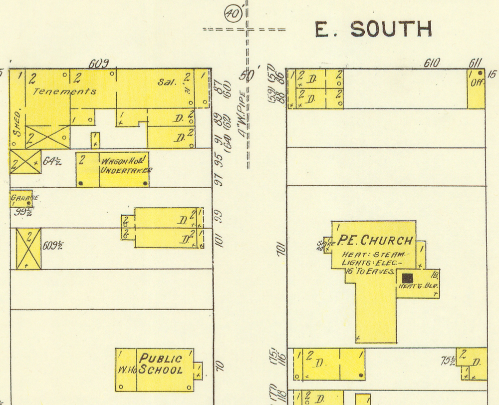
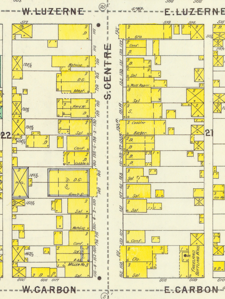
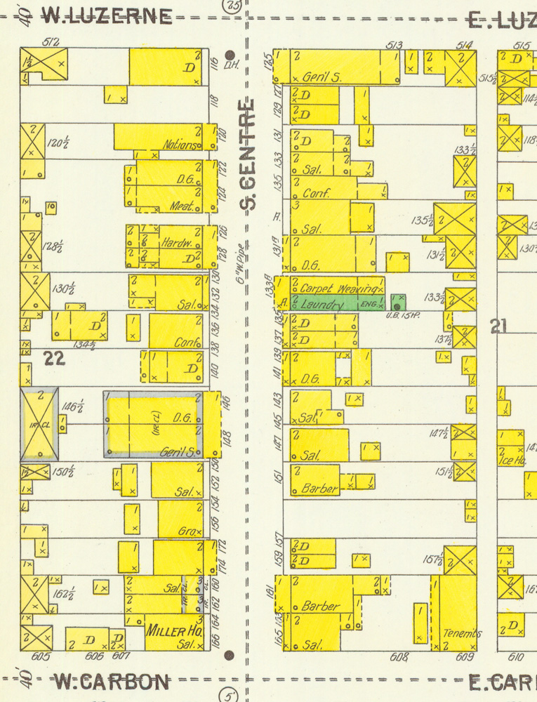
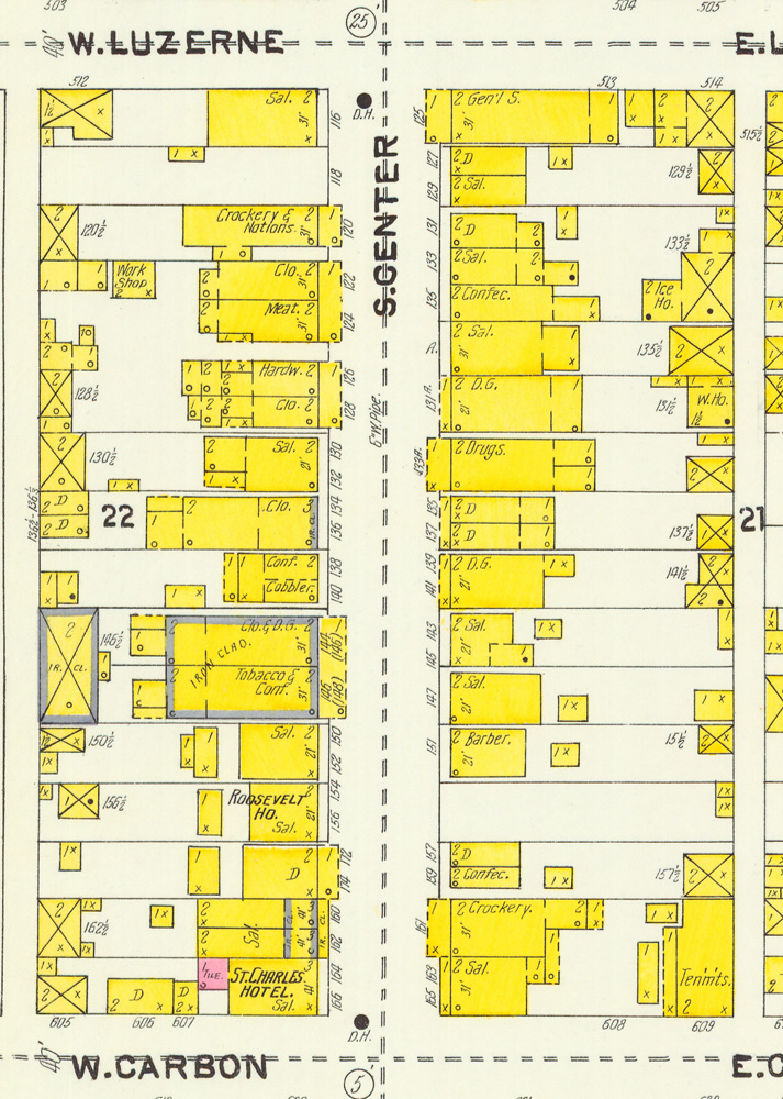
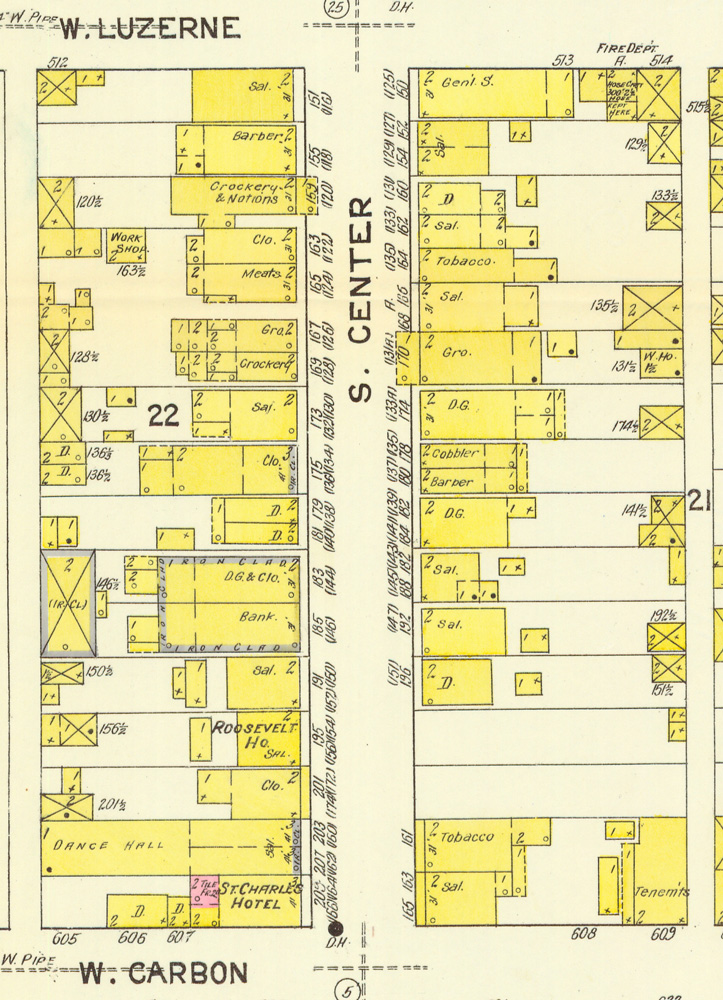
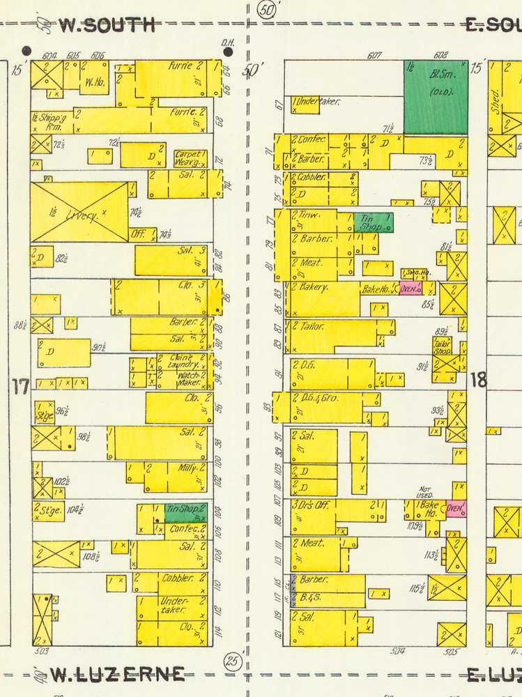
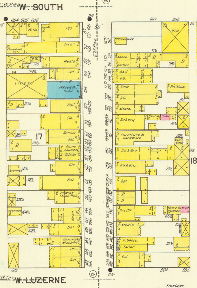
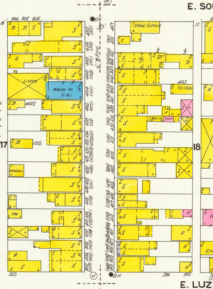
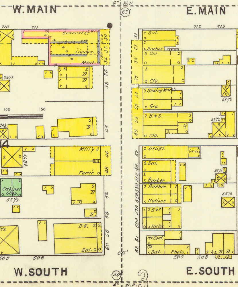
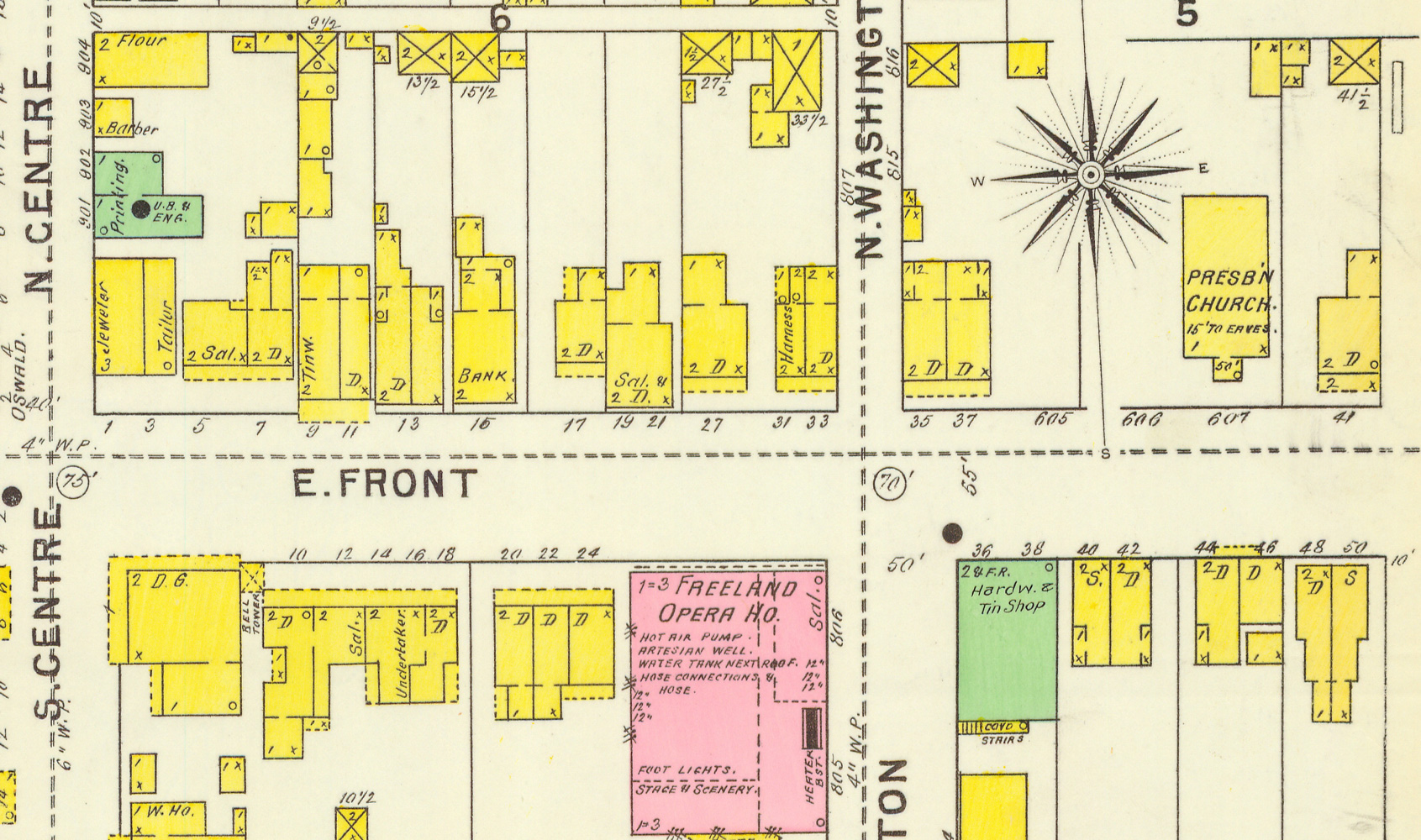
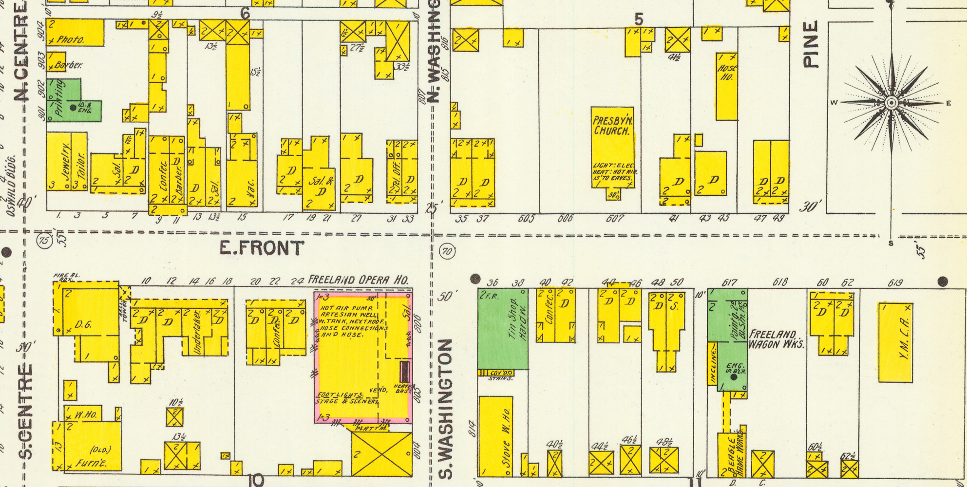
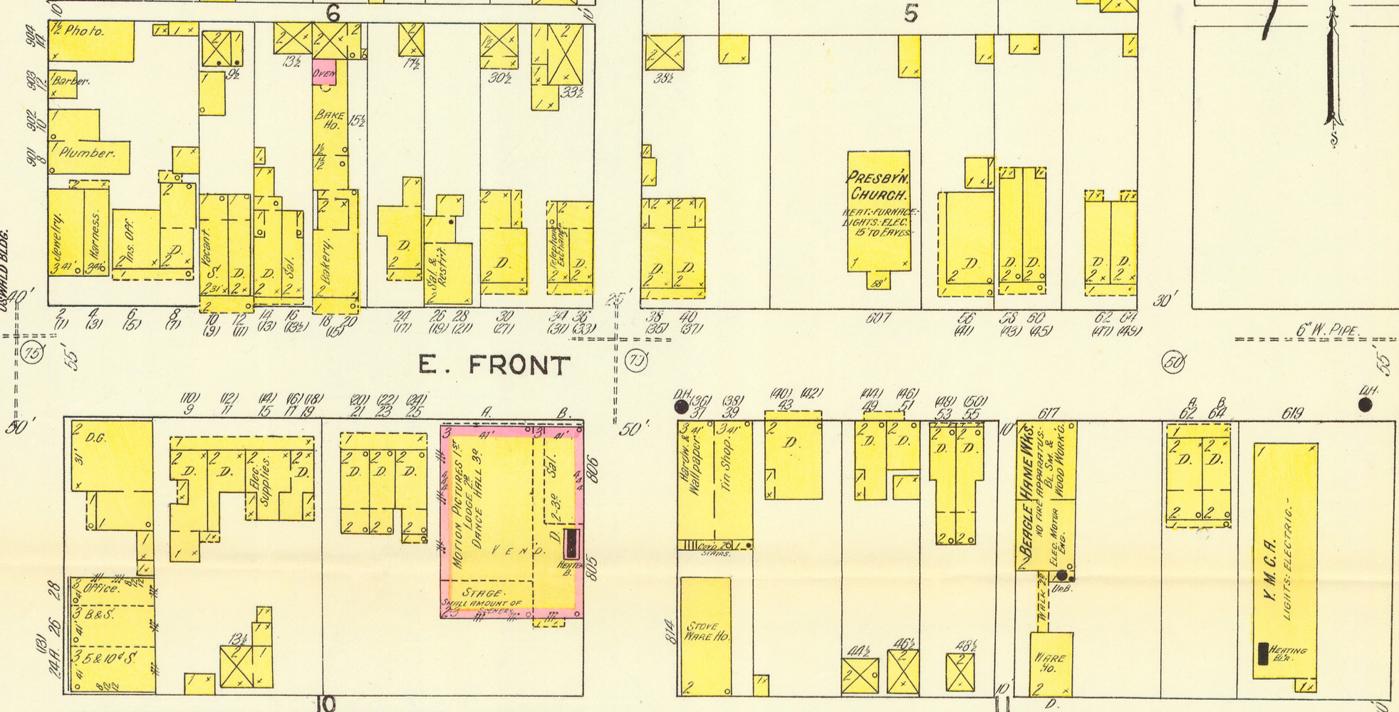
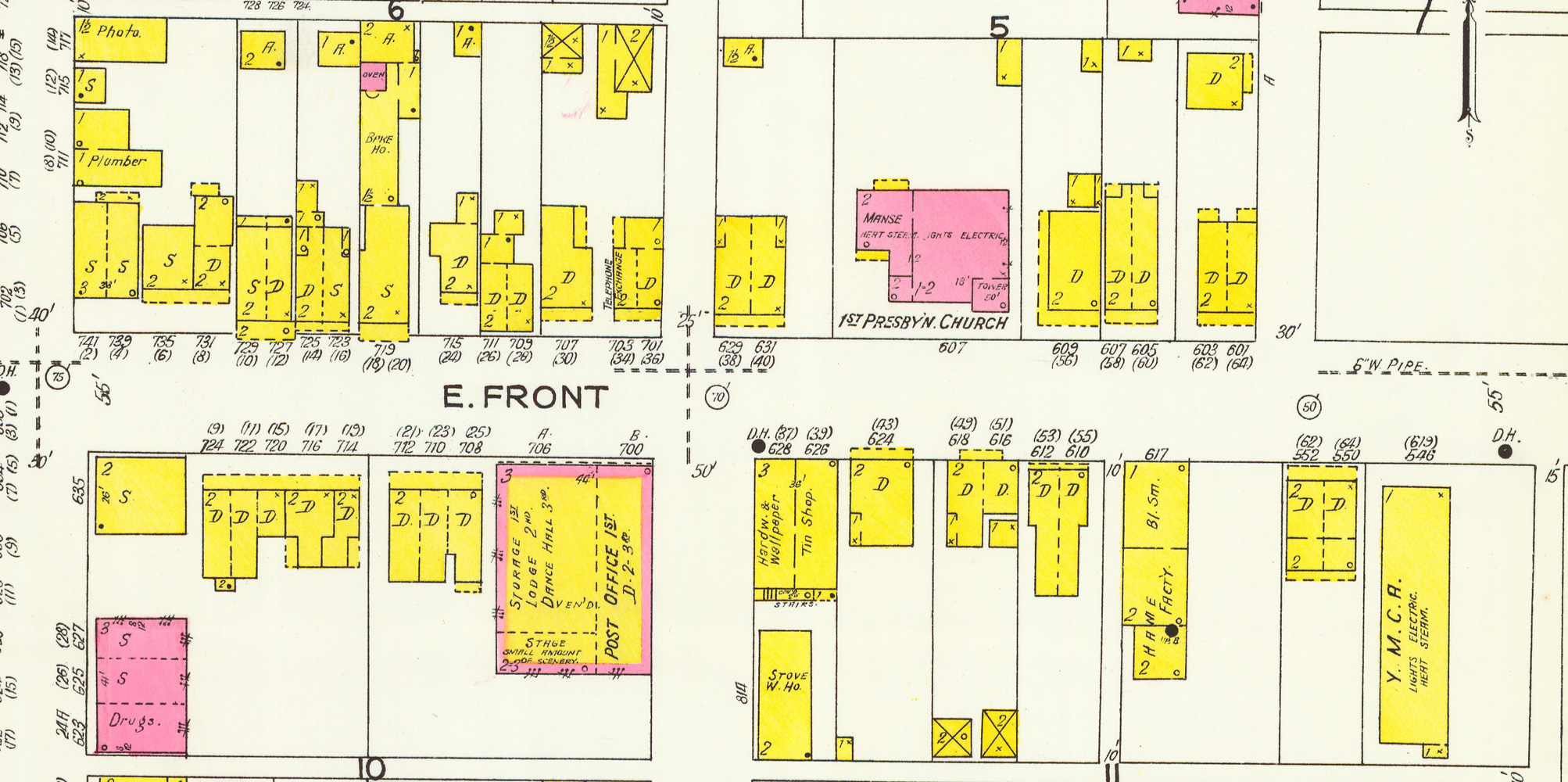
For each of these years -- 1895, 1900, 1905, 1912, 1923 -- here are 5 views of each block of the Centre Street business district from Carbon to Walnut, along with a view of Front Street from Centre Street to the beginning of the Public Park. The views are in the same order for each year. The 1923 views show pretty much the same address numbers we have in Freeland now. There was a major renumbering before 1912 and another before 1923; in each case, the old numbers are in parentheses above the new ones on the maps for those years. If you want to know more about that, see the bottom section of this page, but for just trying to see where an old business was, if you have an address from a directory or newspaper ad, pick the map view closest to the date you think your address is from, and then if you find it, also take a look at that building in the 1923 view to see what the address is now for that site. Thank you to Penn State for digitizing their copies and making them accessible.
Centre Street from Carbon to Luzerne: 1895, 1900, 1905, 1912, 1923
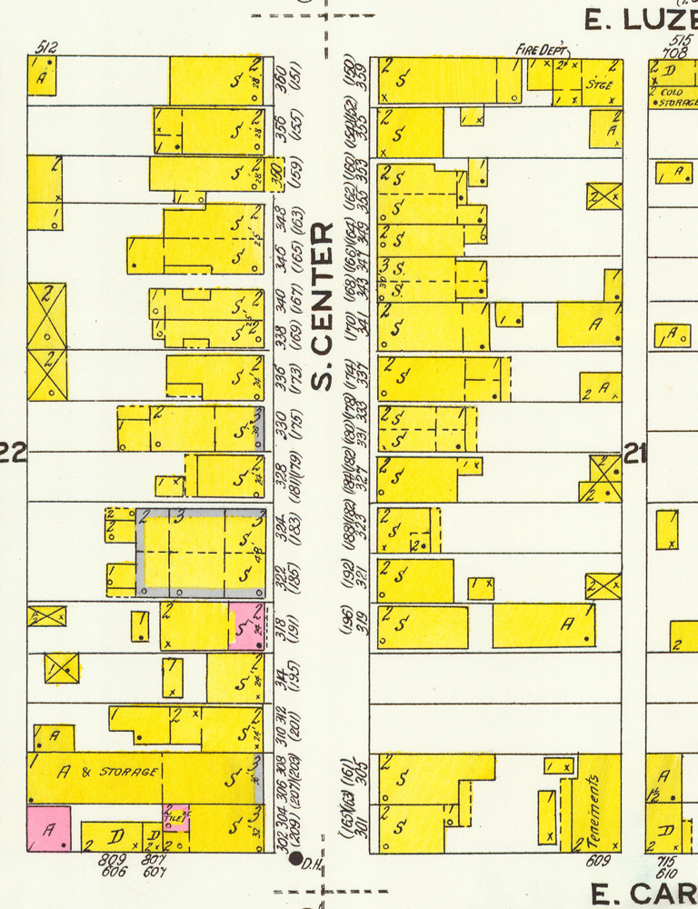
Centre Street from Luzerne to South: 1895, 1900, 1905, 1912, 1923
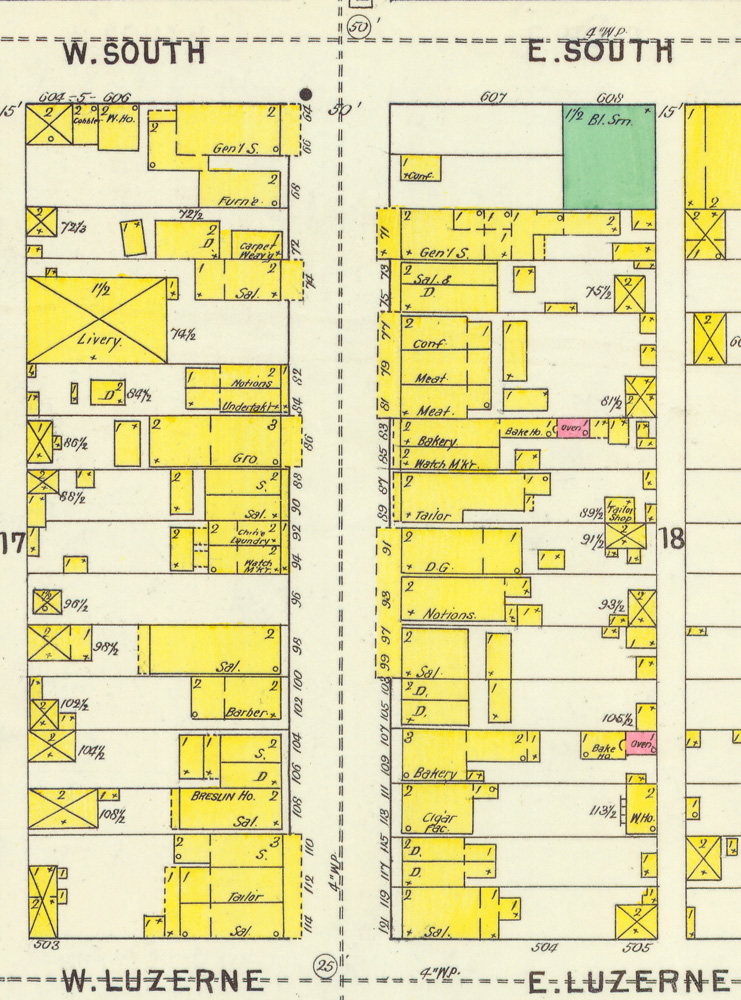
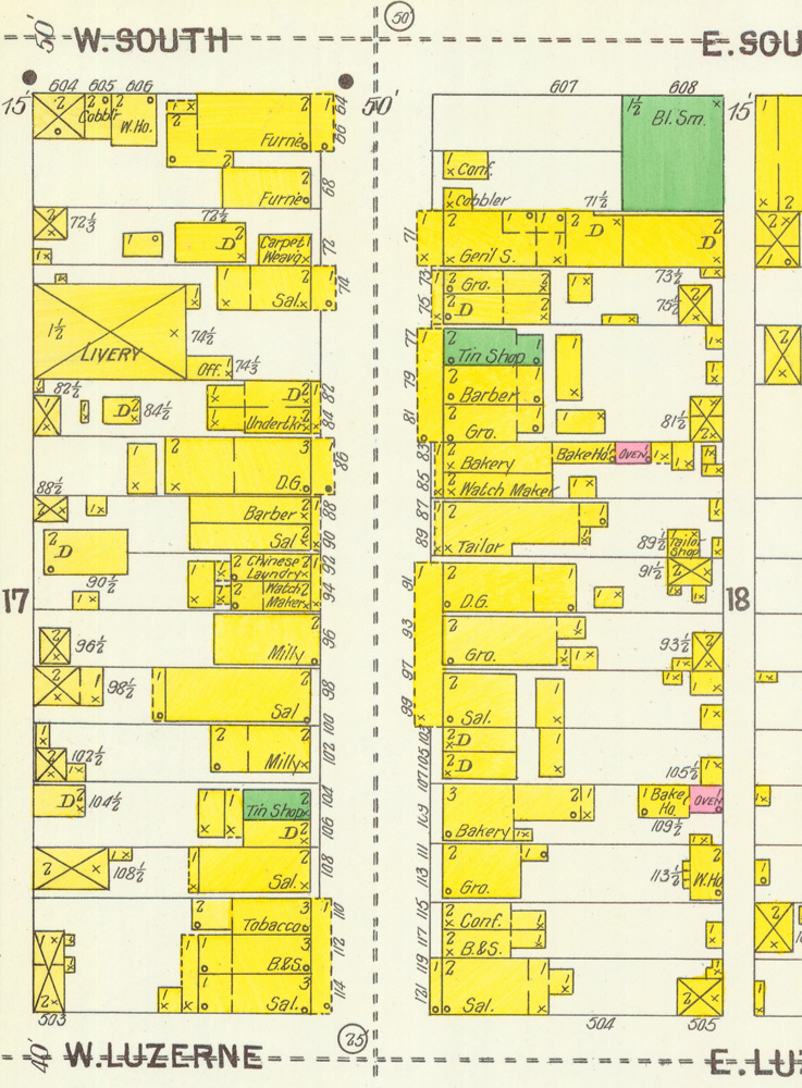
Centre Street from South to Main: 1895, 1900, 1905, 1912, 1923
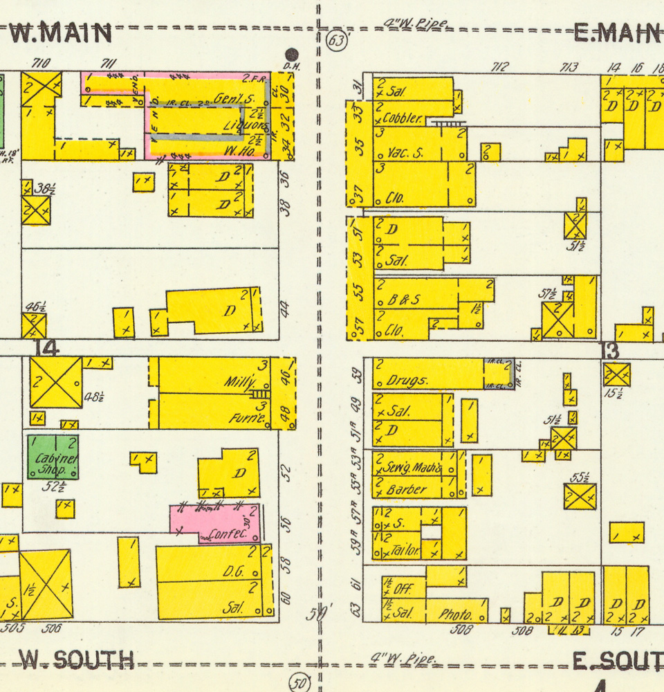
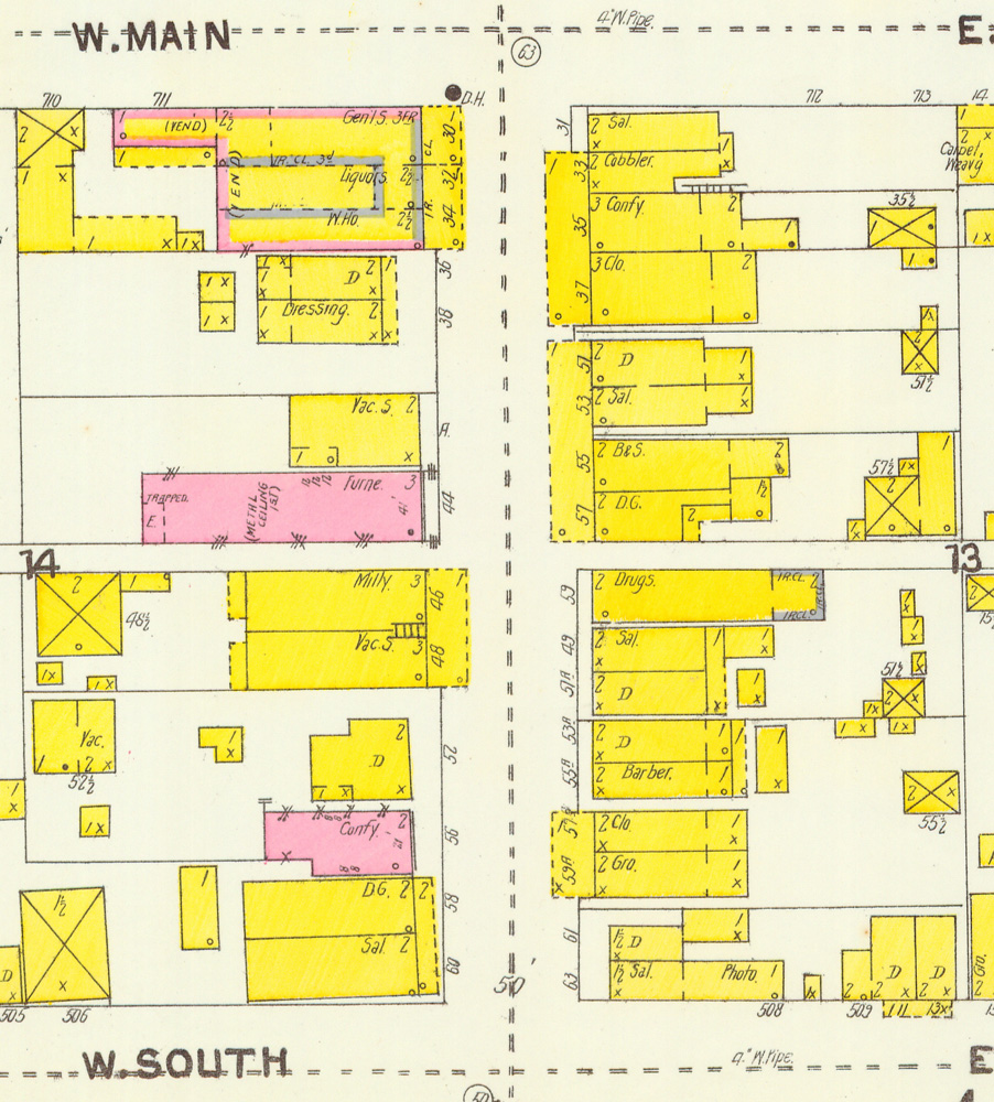
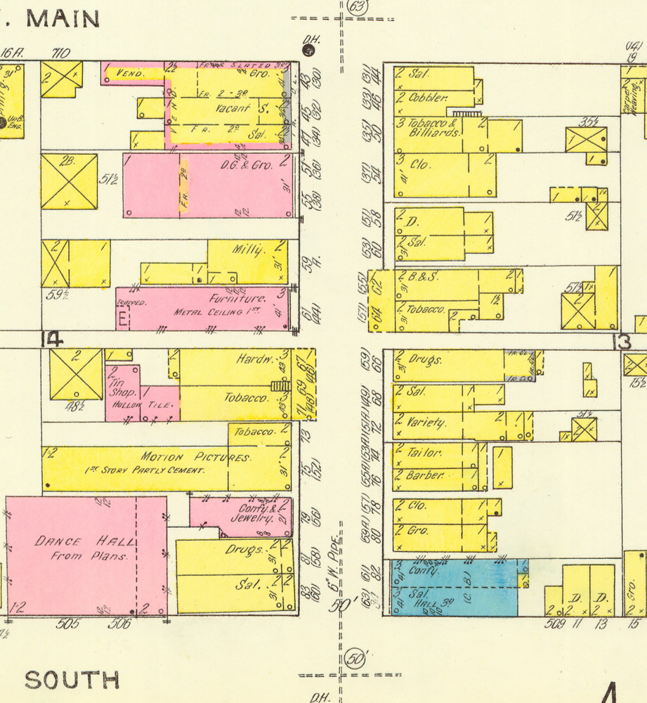
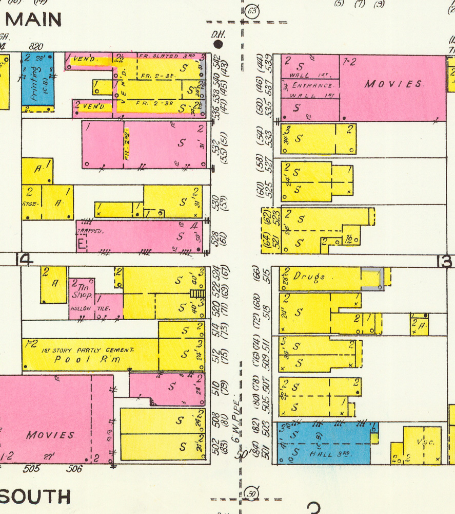
Centre Street from Main to Front: 1895, 1900, 1905, 1912, 1923
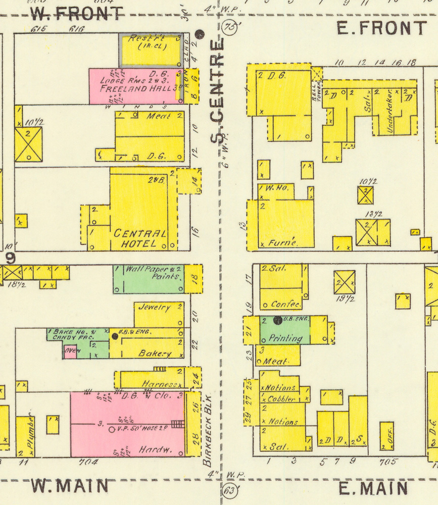

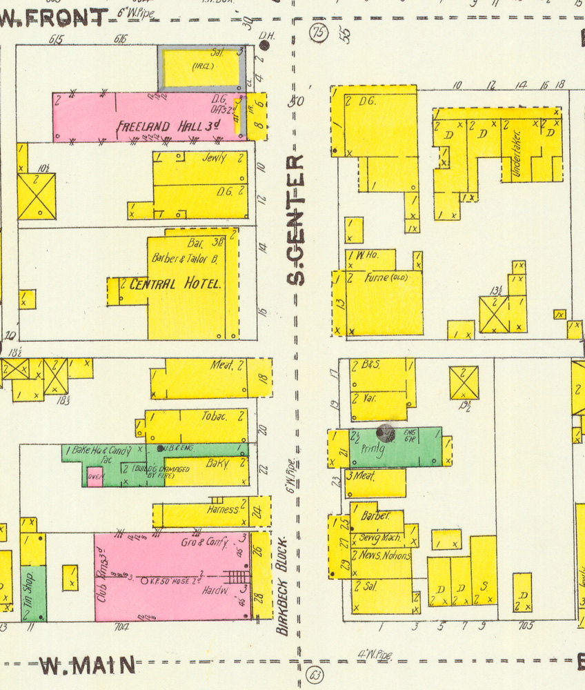
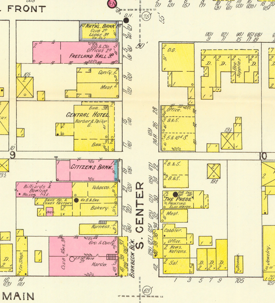
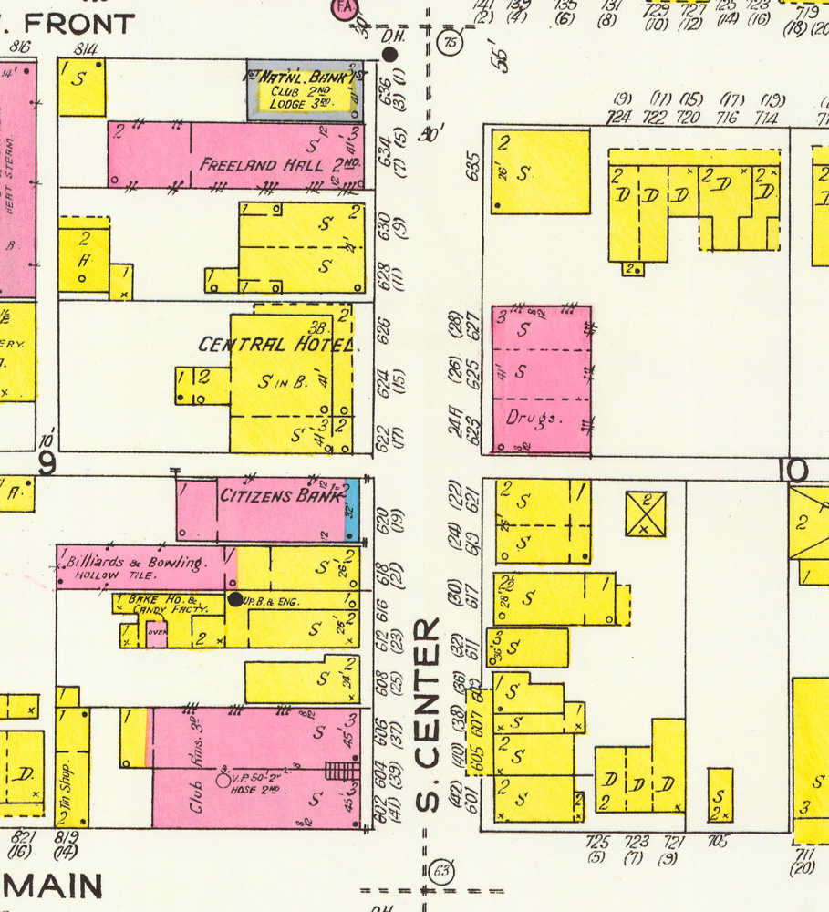
Centre Street from Front to Walnut: 1895, 1900, 1905, 1912, 1923
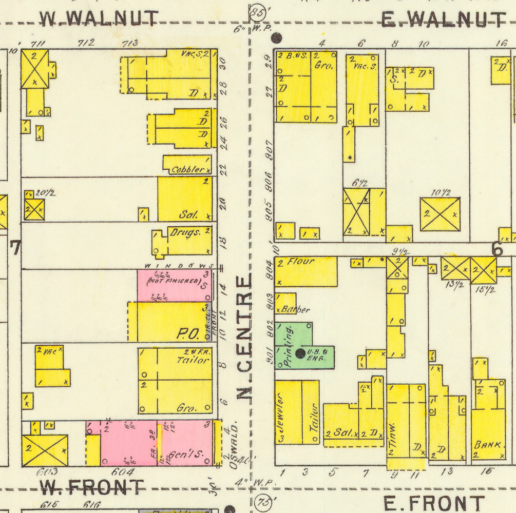
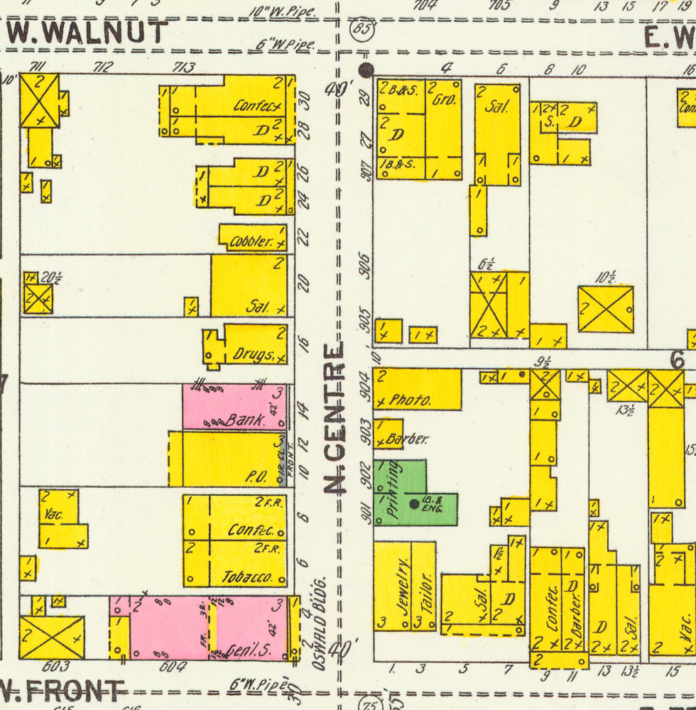
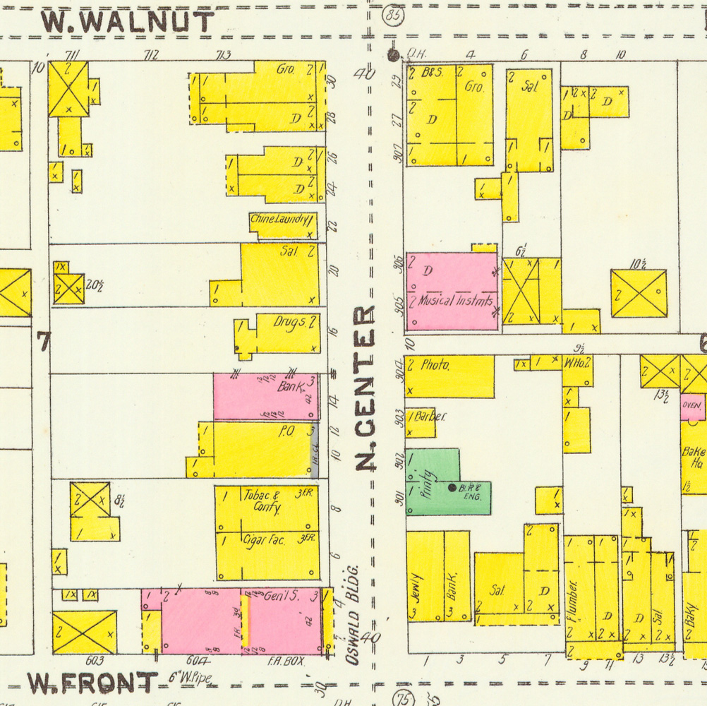
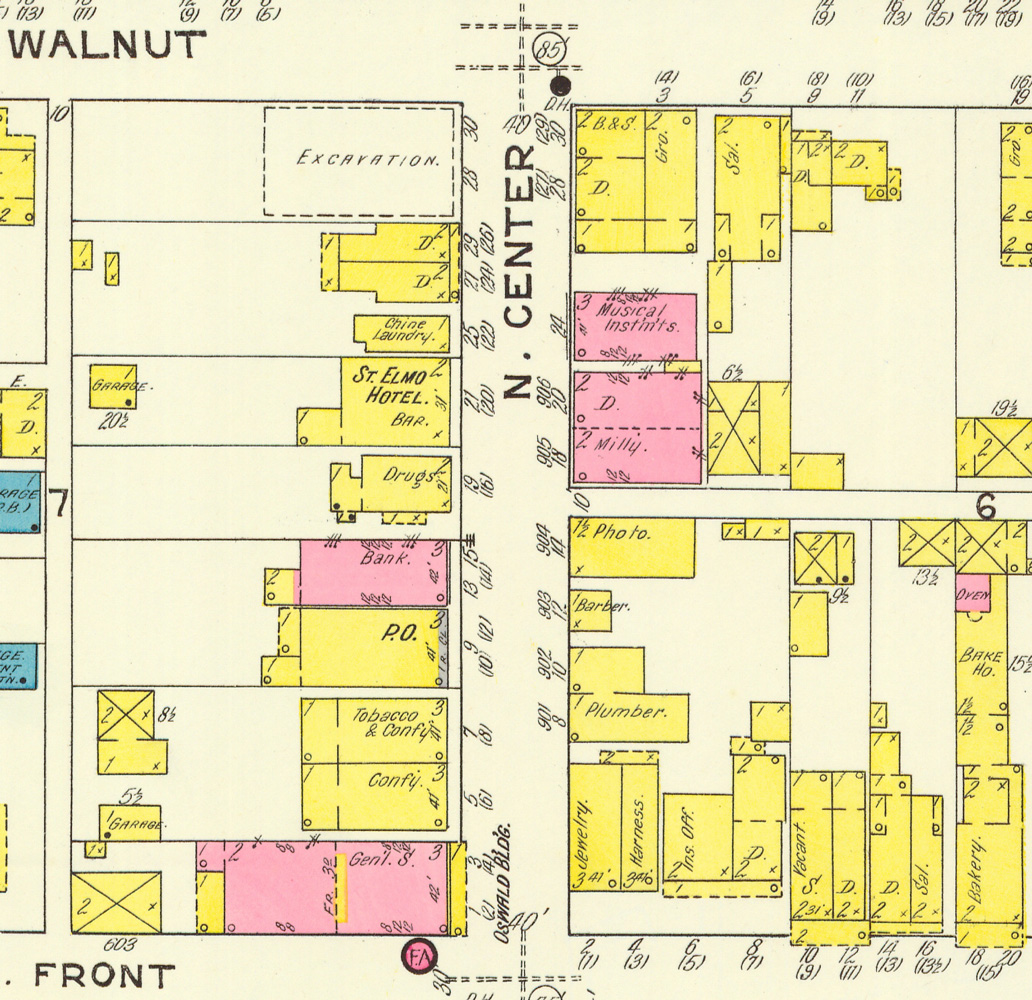
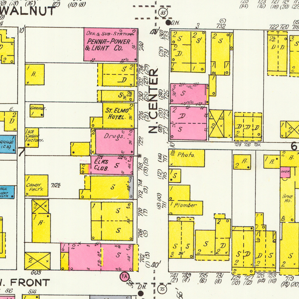
Front Street from Centre to the Public Park: 1895, 1900, 1905, 1912, 1923
How buildings used to be numbered in Freeland
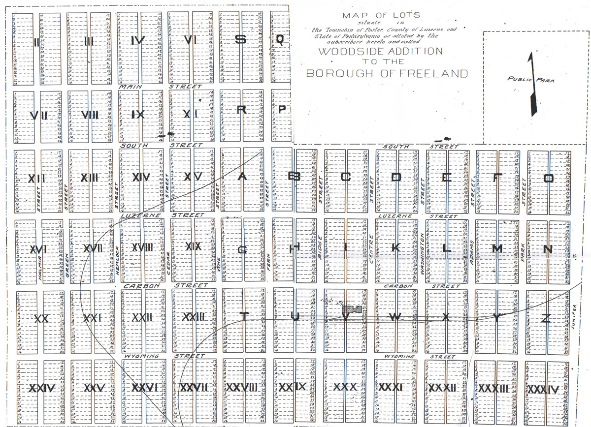
This is a page about Freeland’s address numbering. Click on the image on the top left corner of this page - it shows how unorganized Freeland's address numbering used to be. The reason I’m writing this is to help readers to understand why the addresses they might see in old ads or in directories or wherever don't seem to map onto current locations. Any location in town that had a building on it from the late 1880s or early 1900s went through at least 1 or 2 building address number changes before it got its current address. The clues to the changes can be found in the Sanborn Fire Insurance maps.
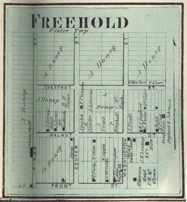
It begins in the 1870s with the town’s founding. Look at the maps on the Freeland maps page. The original map of Freehold (Freeland's original name) was drawn up in 1870. The first published map of Freehold is in the 1873 Atlas of Luzerne County. The town was laid out and developed between Front and what would later be North street, and between Ridge and what would later be Birkbeck street. That’s all there was in the town limits.
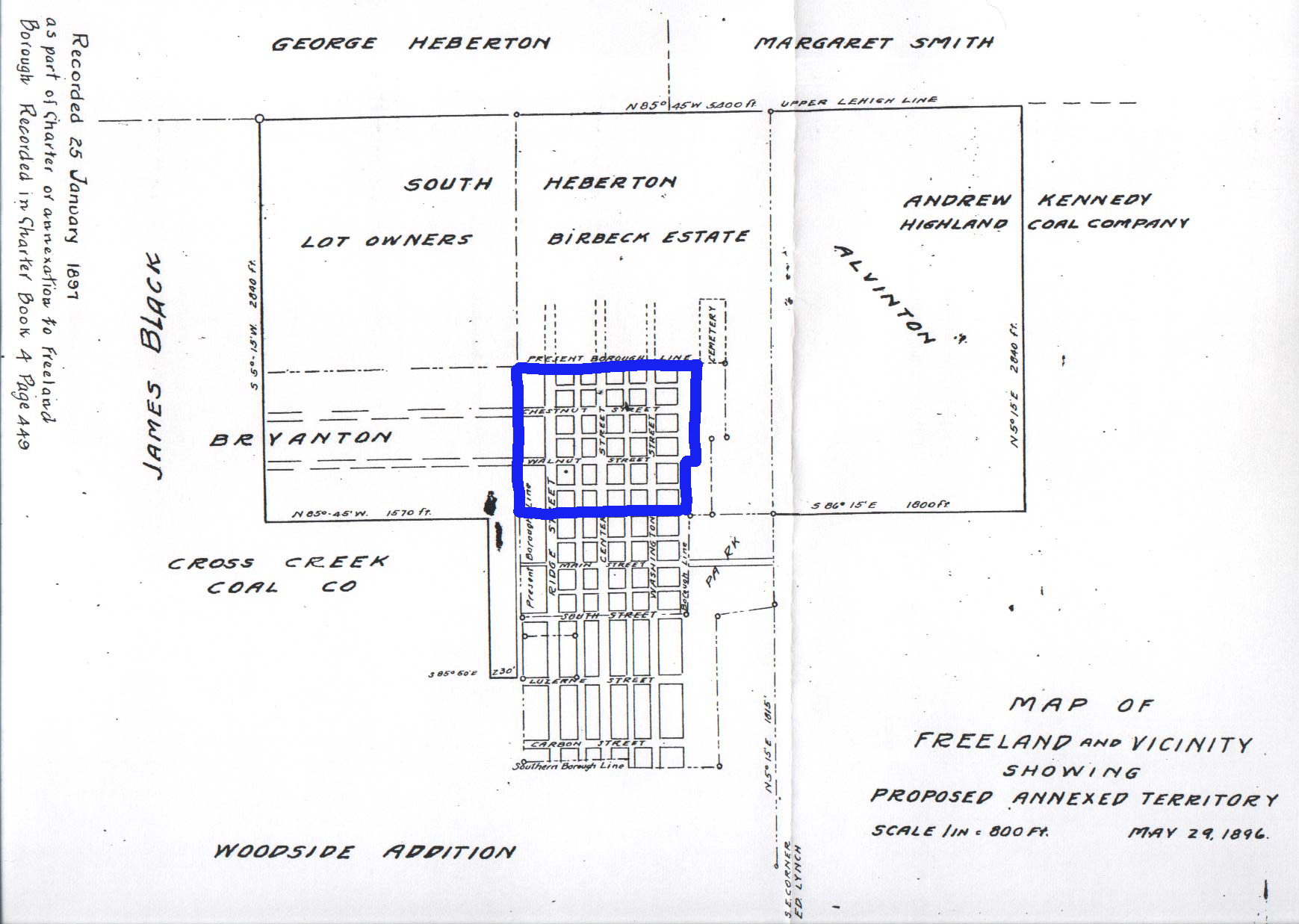
An 1896 map on which I digitally drew the original boundary in blue shows the ways that Freeland was expanding two decades later. It not only was expanding southward below Front, but South Heberton, Alvinton and “Birvanton” were about to be annexed to form a larger Freeland. Another map (undated)shows what was being referred to as the Coxe Addition or the Woodside Addition, which was another expansion of the town going southward from South Street and westward from Ridge Street.
I don’t know what the numbering was in the early days when the town didn’t extend below Front Street. My earliest information on addresses comes mostly from the Sanborn maps, from city directories, from the 1889 and 1892 Mercantile Directories, and from the old newspapers. I don’t have access to anything from the 1870s at present that lists people or businesses along with their actual addresses, or that shows addresses on a town map. In the 1880s and 1890s, while there were a number of businesses north of Front Street (most of them on Centre Street), many more were being established south of Front Street. Some of that area wasn’t officially part of Freeland yet. In the 1882-1884 directory, we see addresses like Centre corner Main, or Front near Centre, without numbers. A couple of years later in the 1884-1886 directory a numbering system shows up, with all numbering increasing in every direction from the intersection of Front and Centre, but some of the businesses still list addresses like “Centre below South” or “Centre near Main”, without a number. A decade later some say "Coxe addition."
In the mid-1880s numbering system, the intersection of Front and Centre streets was the center point. Address numbers began there and increased in each direction, with E. or W. or N. or S. added before the street name to show where the address was.
Looking at Centre Street as an example, numbers began from #1 at the corner of Front and Centre Streets and went “up” in every direction, north and south from Front and east and west from Centre -- so if an address was 24 Centre St., it would say N. or S. Centre to indicate whether it was 24 N. Centre Street (above Front Street) or 24 S. Centre Street (below Front Street). Ditto east and west of Centre Street, such as 12 W. Main Street and 12 E. Main Street.
The actual numbering was inconsistent and odd in the beginning. On the 1895 Sanborn map you can see that on Centre Street between Front and Walnut, addresses on the west side of Centre go from 2 to 30, and on the east side they were in the 900s along with a few in the 20s. By the 1912 map the numbering had been redone, and on the east side of that block they go from 8 to 30, and on the west side from 1 to 30 (!). Also there are some duplicate numbers on Centre up near Walnut on that map. Either those are mapmaker errors, or the numbering was still being ironed out. And the odd numbers were on the west side, opposite from today's numbers. But THE MAIN HELPFUL INFORMATION on the maps is that the previous numbers are written in parentheses above the new numbers on the 1912 and 1923 Sanborn maps.
The next renumbering happened between 1912 and 1923, and those numbers are mostly now the numbers we have today. Once again, the address numbers being replaced by the new numbering system are written on the map in parentheses above the new numbers on the 1923 Sanborn map. And with that new numbering, the odd numbers on Centre (for example) were now on the east side of the street and the even numbers on the west as they are now, AND the north-south numbering began with the 100s from Wyoming Street and progressed northward in a single, unbroken series of numbers. The same kind of thing happened going east-west. So with that renumbering, the numbers became more like what we see today.
So you can use the map crops above for most Centre and Front street business addresses, and for other locations in Freeland the links at the top of this page go to the full Sanborn maps and also to the Business section, where for many of the pages on particular kinds of businesses -- like, for example, grocery stores -- there are modern stores and then there is (or soon will be) also a page giving older lists of grocery stores from directories and maps 1873-1940. That's one of the places where you'll see the older addresses.
Sometimes on these web pages I’ll add a cropped detail from a Sanborn map that shows where a particular building was located, so that even without the current address you can see what its location was. If you are wondering where a 19th- or early 20th-century address was located and can't find it on the map crops in the top area of this page, please feel free to email me and I'll see if I can find it.