News & announcements
Saving your history
Early accounts
Maps
Nearby towns
People
Churches
Schools
Municipal
Organizations
Businesses
The mines
Transportation
Streets
Buildings
Entertainment
Celebrations
Sports
Ethnic groups
Railroads that serviced the Freeland area
- Introduction
- Maps of railroad routes
- Lehigh Valley RR
- Central RR of NJ
- Lehigh Traction
- Delaware Susquehanna & Schuylkill RR
- Delaware Susquehanna & Schuylkill RR locomotive photos
- Daniel Coxe and the D. S. and S.
- Freeland railroads - additional readings
- Transportation in the automotive age
- Transportation
companies
- Transportation by horse
- Haulers, drivers, express, movers, storage, junk dealers
Four railroads served the Freeland area in the late 1800s and for much of the 20th century. You can’t tell anymore, but at one time Freeland was a railroad town. This set of pages about Freeland's railroads comes from Charlie Gallagher.
Until the 1970’s the railroad supplied Berger Lumber on Birkbeck Street.
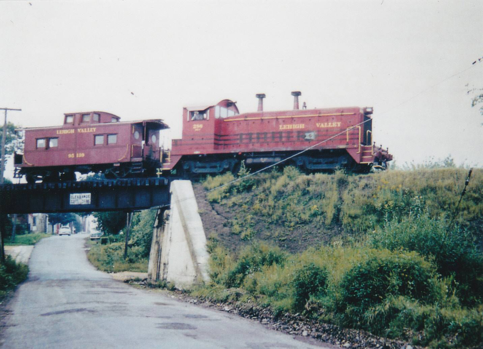
Lehigh Valley SW9 locomotive. Photograph courtesy Greg Gunshore.
Here is LV SW9 locomotive on the trestle that crossed Carbon Street in the late 1950’s or early 1960’s. The rail line made its way from the south end of town at the Freeland Freight Station (where the MMI Gymnasium is today), then Griffith’s Lumber, and ran north along Feussner Ford east of the Park and up to Ira Berger Lumber.
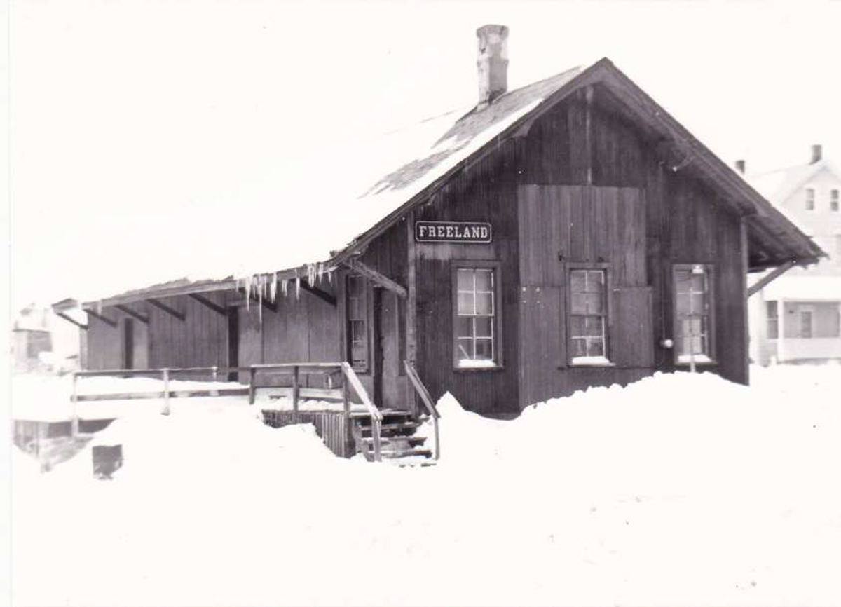
Lehigh Valley RR depot in winter. Photograph courtesy Greg Gunshore.
Google Earth historical view
Here is a Google Earth historical view of the railroads. Red lines represent the Lehigh Valley Railroad. Blue lines represent the Lehigh Traction Company (trolley line).
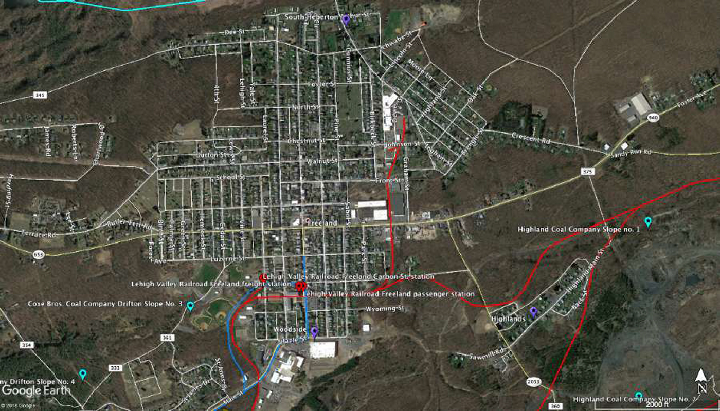
Google Earth Mapping courtesy Russell Heintzelman.
At one time there were as many as three tracks crossing Ridge St. and Centre St. and four tracks crossing Washington St.
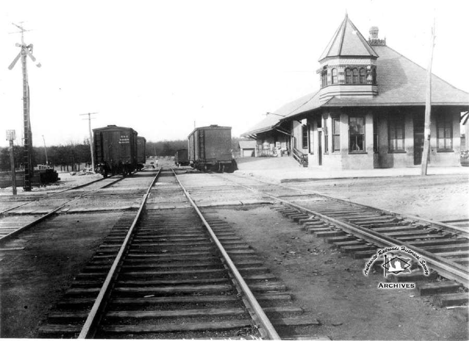
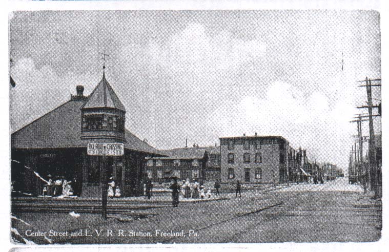
Freeland LVRR depot and tracks. This photo is the property of the ARHS, part of the Joe Zogby collection.
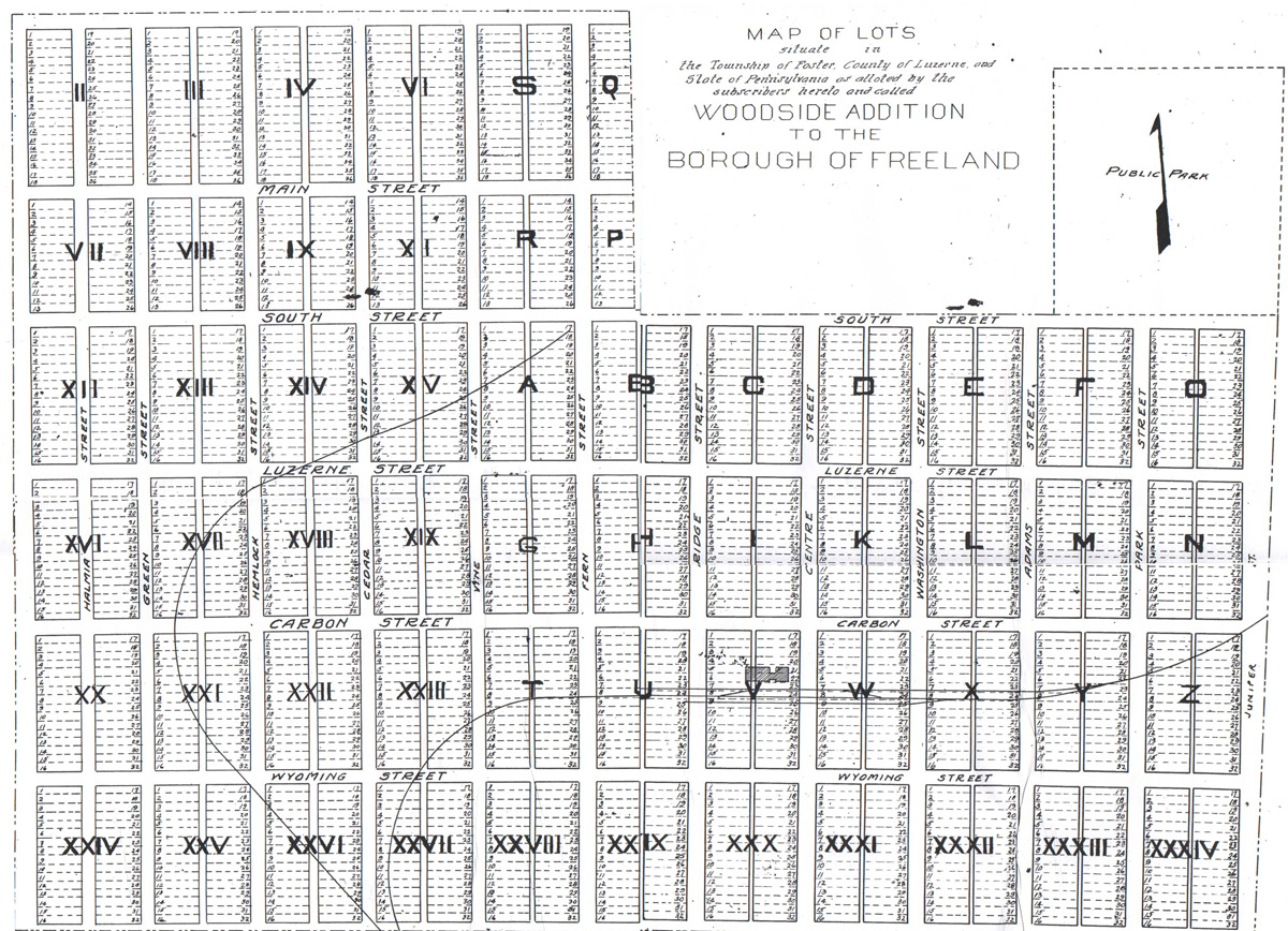
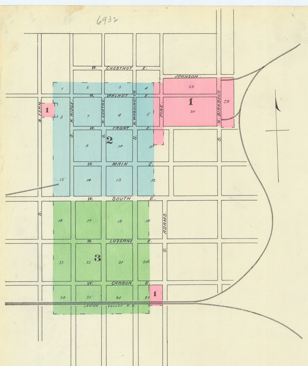
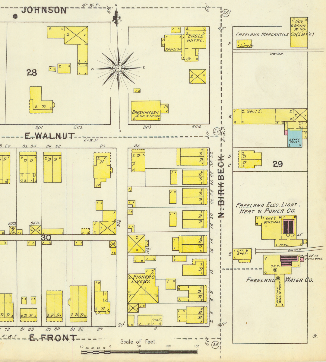
Before 1900 there was even a spur that ran from the area of the former Foster Township High School and ran to the corner of South & Fern Sts. to service the Freeland Brewery. You can see that on the circa 1890s Woodside Addition map that showed the proposed expansion of Freeland to the south and west, and also on the 1895 Sanborn Fire Insurance map overview. That Sanborn map also shows the spurs that connected with sites east of Birkbeck street between Front and Johnson streets. The Sanborn maps here are cropped from the copies held at Penn State.
Today we hardly think anything about travel to Hazleton, Humboldt or Wilkes Barre for that matter.
Today the majority of our students travel to Hazleton every morning.
But at the beginning of the 1900’s it was a very different thing.
Look at the railroad and trolley timetables on the next pages and see how different everything was. If you were to travel to Hazleton you could go by trolley (Lehigh Traction) or by the Lehigh Valley Railroad.
The trolley trip would take about 30 minutes as the trolley stopped in Drifton, Jeddo, Ebervale, Harleigh and then made its way to Wyoming Street in Hazleton.
The train (Lehigh Valley) would take longer just due to the route and stops as the train would go through Jeddo Boro, Foundryville, Hazlebrook, Stockton and then into Hazleton.
Any bus service would likely have been horse-drawn at this time.