Early
accounts
1873 Freehold map
More 1873 maps
Municipal
matters
Businesses
Places
of worship
People
Organizations
Schools
Entertainment
Transportation
Street names
Buildings
Newspapers
|
The maps shown
on this page (click on them for larger views) come from
The Atlas of Luzerne County, published in
1873. In the case of the township maps I was only able to scan a portion
of each map, due to limitations having to do with the size and condition
of the atlas. I've cropped the scans to show a few locales in the immediate
area of Freeland.
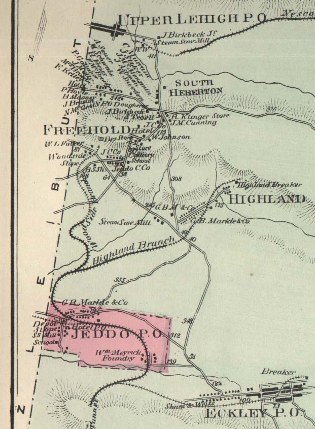
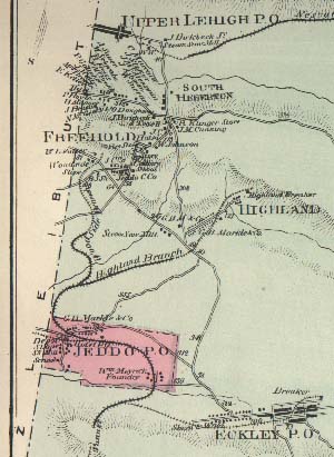 Here is a portion of the 1873 map of Foster Township,
showing Upper Lehigh, South Heberton, Freehold, Highland, Jeddo and
Eckley. The map shows buildings, roads, railroad tracks, breakers, names
of major property owners, rivers and mountains. At the left of the map
are boundary lines that Foster Township shares with Butler and Hazle Townships.
The Butler/Foster line cuts right through Upper Lehigh, although that's
not evident from this map. At this time Freehold had not yet been renamed
Freeland, and South Heberton had not yet been annexed to Freeland.
Here is a portion of the 1873 map of Foster Township,
showing Upper Lehigh, South Heberton, Freehold, Highland, Jeddo and
Eckley. The map shows buildings, roads, railroad tracks, breakers, names
of major property owners, rivers and mountains. At the left of the map
are boundary lines that Foster Township shares with Butler and Hazle Townships.
The Butler/Foster line cuts right through Upper Lehigh, although that's
not evident from this map. At this time Freehold had not yet been renamed
Freeland, and South Heberton had not yet been annexed to Freeland.
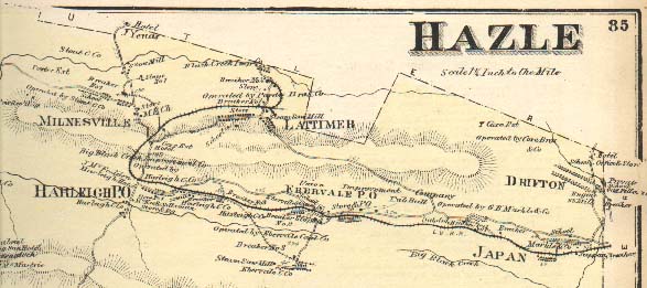 This piece of the 1873 map of Hazle Township at right shows
Lattimer, Milnesville, Harleigh, Ebervale, Japan and Drifton. Part of the
boundary between Hazle and Butler Townships can be seen along the top of
the map.
This piece of the 1873 map of Hazle Township at right shows
Lattimer, Milnesville, Harleigh, Ebervale, Japan and Drifton. Part of the
boundary between Hazle and Butler Townships can be seen along the top of
the map.
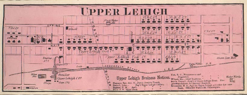 Here is a rare view of Upper Lehigh from 130 years ago, complete
with business notices. The fact that the entire town was
owned by the Upper Lehigh Coal Company is clearly shown. The breaker, the
saw mill, the water works and a reservoir are marked, as is the line between
Foster and Butler Townships.
Here is a rare view of Upper Lehigh from 130 years ago, complete
with business notices. The fact that the entire town was
owned by the Upper Lehigh Coal Company is clearly shown. The breaker, the
saw mill, the water works and a reservoir are marked, as is the line between
Foster and Butler Townships.
|
 [Larger view]
![[Larger view]](atlastitle150.jpg)